Directions to Sweathouz Chestnut Hill (Newton) with public transportation
The following transit lines have routes that pass near Sweathouz Chestnut Hill
How to get to Sweathouz Chestnut Hill by bus?
Click on the bus route to see step by step directions with maps, line arrival times and updated time schedules.
From Franklin Park, Boston
79 minFrom Hewlett Room 32-G882 (MIT Stata Center), Cambridge
50 minFrom Kenmore Square, Boston
31 minFrom Boston Marriott Copley Place, Boston
44 minFrom Consulate General of Italy, Boston
74 minFrom Bunker Hill Community College, Boston
73 minFrom Public Garden (Boston Public Garden), Boston
76 minFrom Citizenm Boston North Station, Boston
64 minFrom Sudbury, Boston
70 minFrom 240 Mount Vernon Street, Boston
78 min
How to get to Sweathouz Chestnut Hill by subway?
Click on the subway route to see step by step directions with maps, line arrival times and updated time schedules.
From Franklin Park, Boston
72 minFrom Hewlett Room 32-G882 (MIT Stata Center), Cambridge
58 minFrom Kenmore Square, Boston
35 minFrom Boston Marriott Copley Place, Boston
44 minFrom Consulate General of Italy, Boston
54 minFrom Bunker Hill Community College, Boston
65 minFrom Public Garden (Boston Public Garden), Boston
47 minFrom Citizenm Boston North Station, Boston
56 minFrom Sudbury, Boston
55 minFrom 240 Mount Vernon Street, Boston
66 min
Bus stop near Sweathouz Chestnut Hill in Newton
- Boylston St @ Hammond St, 2 min walk,VIEW
Subway stations near Sweathouz Chestnut Hill in Newton
Bus lines to Sweathouz Chestnut Hill in Newton
- 60, Kenmore - Chestnut Hill Mall,VIEW
- GREEN LINE D SHUTTLE, Riverside - Kenmore (Shuttle),VIEW
- GREEN LINE D SHUTTLE, Riverside - Reservoir,VIEW
- GREEN LINE D SHUTTLE, Newton Highlands - Kenmore,VIEW
- GREEN LINE D SHUTTLE, Riverside - Kenmore via Saint Mary's Street,VIEW
- GREEN LINE D SHUTTLE, Riverside - Brookline Hills,VIEW
- GREEN LINE D SHUTTLE, Newton Highlands - Brookline Hills,VIEW
- GREEN LINE D SHUTTLE, Newton Highlands - Fenway,VIEW
- GREEN LINE D SHUTTLE, Riverside - Fenway,VIEW
- GREEN LINE D SHUTTLE, Riverside - Brookline Village,VIEW
- GREEN LINE D SHUTTLE, Newton Highlands - Kenmore via Saint Mary's Street,VIEW
- GREEN LINE D SHUTTLE, Newton Highlands - Reservoir,VIEW
- GREEN LINE D SHUTTLE, Riverside - Kenmore,VIEW
What are the closest stations to Sweathouz Chestnut Hill?
The closest stations to Sweathouz Chestnut Hill are:
- Boylston St @ Hammond St is 124 yards away, 2 min walk.
- Chestnut Hill is 535 yards away, 7 min walk.
- South Street is 2653 yards away, 32 min walk.
Which bus line stops near Sweathouz Chestnut Hill?
60 (Chestnut Hill Mall)
Which subway line stops near Sweathouz Chestnut Hill?
GREEN LINE D (Riverside)
What’s the nearest subway station to Sweathouz Chestnut Hill in Newton?
The nearest subway station to Sweathouz Chestnut Hill in Newton is Chestnut Hill. It’s a 7 min walk away.
What’s the nearest bus station to Sweathouz Chestnut Hill in Newton?
The nearest bus station to Sweathouz Chestnut Hill in Newton is Boylston St @ Hammond St. It’s a 2 min walk away.
What time is the first subway to Sweathouz Chestnut Hill in Newton?
The GREEN LINE D is the first subway that goes to Sweathouz Chestnut Hill in Newton. It stops nearby at 4:45 AM.
What time is the last subway to Sweathouz Chestnut Hill in Newton?
The GREEN LINE B is the last subway that goes to Sweathouz Chestnut Hill in Newton. It stops nearby at 2:39 AM.
What time is the first bus to Sweathouz Chestnut Hill in Newton?
The 60 is the first bus that goes to Sweathouz Chestnut Hill in Newton. It stops nearby at 4:59 AM.
What time is the last bus to Sweathouz Chestnut Hill in Newton?
The 60 is the last bus that goes to Sweathouz Chestnut Hill in Newton. It stops nearby at 12:20 AM.
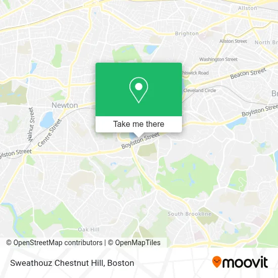
See Sweathouz Chestnut Hill, Newton, on the map
Public Transit to Sweathouz Chestnut Hill in Newton
Wondering how to get to Sweathouz Chestnut Hill in Newton? Moovit helps you find the best way to get to Sweathouz Chestnut Hill with step-by-step directions from the nearest public transit station.
Moovit provides free maps and live directions to help you navigate through your city. View schedules, routes, timetables, and find out how long does it take to get to Sweathouz Chestnut Hill in real time.
Looking for the nearest stop or station to Sweathouz Chestnut Hill? Check out this list of stops closest to your destination: Boylston St @ Hammond St; Chestnut Hill; South Street.
Bus: 60, GREEN LINE D SHUTTLE, GREEN LINE D SHUTTLE, GREEN LINE D SHUTTLE, GREEN LINE D SHUTTLE.Subway: GREEN LINE D, GREEN LINE B.
Want to see if there’s another route that gets you there at an earlier time? Moovit helps you find alternative routes or times. Get directions from and directions to Sweathouz Chestnut Hill easily from the Moovit App or Website.
We make riding to Sweathouz Chestnut Hill easy, which is why over 1.7 million users, including users in Newton, trust Moovit as the best app for public transit. You don’t need to download an individual bus app or train app, Moovit is your all-in-one transit app that helps you find the best bus time or train time available.
For information on prices of bus and subway, costs and ride fares to Sweathouz Chestnut Hill, please check the Moovit app.
Use the app to navigate to popular places including to the airport, hospital, stadium, grocery store, mall, coffee shop, school, college, and university.
Sweathouz Chestnut Hill Address: 33 Boylston St street in Newton
- Studs the Street, Chestnut Hill,
- Bond Vet,
- Limani,
- Roller Rabbit,
- Alo,
- Hummus V'Hummus,
- Dove and Donkey Pop-Up,
- Legit Activewear,
- NIKE,
- Dormify,
- SISLEY,
- Simon Pearce,
- EMPORIO ARMANI,
- Drain Cleaning,
- Legal Sea Food Marketplace,
- PNC Mortgage,
- Street,
- Casper,
- Reservoir Office Park,
- Showcase Superlux (SuperLux Cinema Chestnut Hill, MA)
Places Near Sweathouz Chestnut Hill (Newton)
- Massachusetts General Hospital, Boston,
- North End, Boston,
- House Of Blues, Boston,
- Quincy Market, Boston,
- Wilbur Theatre, Boston,
- Mgm Music Hall, Boston,
- Td Garden, Boston,
- Wang Theater, Boston,
- Isabella Stewart Gardner Museum, Boston,
- Prudential Center, Boston,
- Castle Island, Boston,
- Museum Of Science, Boston,
- Boston Convention & Exhibition Center, Boston,
- Cheers, Boston,
- Faneuil Hall, Boston,
- Seaport District, Boston,
- Boston Medical Center, Boston,
- Boston Common, Boston,
- Leader Bank Pavilion (Leader Bank Pavillion), Boston,
- Boston Children's Hospital, Boston
How to get to popular places in Boston with public transit
Get around Newton by public transit!
Traveling around Newton has never been so easy. See step by step directions as you travel to any attraction, street or major public transit station. View bus and train schedules, arrival times, service alerts and detailed routes on a map, so you know exactly how to get to anywhere in Newton.
When traveling to any destination around Newton use Moovit's Live Directions with Get Off Notifications to know exactly where and how far to walk, how long to wait for your line, and how many stops are left. Moovit will alert you when it's time to get off — no need to constantly re-check whether yours is the next stop.
Wondering how to use public transit in Newton or how to pay for public transit in Newton? Moovit public transit app can help you navigate your way with public transit easily, and at minimum cost. It includes public transit fees, ticket prices, and costs. Looking for a map of Newton public transit lines? Moovit public transit app shows all public transit maps in Newton with all Bus, Train, Subway and Ferry routes and stops on an interactive map.
Boston has 4 transit type(s), including: Bus, Train, Subway and Ferry, operated by several transit agencies, including MBTA, Southeastern Regional Transit Authority, MetroWest Regional Transit Authority, Rhode Island Public Transit Authority, WRTA, Lowell Regional Transit Authority, Merrimack Valley Transit, Montachusett Regional Transit Authority, Cape Cod Regional Transit Authority, Brockton Area Transit Authority, Martha's Vineyard Transit Authority, the WAVE - Nantucket Regional Transit Authority, GATRA, Cape Ann Transportation Authority and Massport