Directions to Sweetgreen (Watertown Town) with public transportation
The following transit lines have routes that pass near Sweetgreen
 Bus: 558, 70.
- Train: FRAMINGHAM/WORCESTER, FITCHBURG.
How to get to Sweetgreen by bus?
Click on the bus route to see step by step directions with maps, line arrival times and updated time schedules.
From Museum Of Fine Arts MBTA Station, Boston
38 minFrom West Roxbury, Boston
67 minFrom Boston Arts Academy, Boston
70 minFrom Eastern Standard Kitchen & Drinks, Boston
59 minFrom Terrace Room, Paige Hall, Medford
72 minFrom Brigham and Women's Faulkner Hospital, Boston
87 minFrom St. Elizabeth's Medical Center, Boston
30 minFrom MBTA-Museum of Fine Arts, Boston
38 minFrom Faulkner Hospital, Boston
88 minFrom Paradise Rock Club, Boston
40 min
How to get to Sweetgreen by train?
Click on the train route to see step by step directions with maps, line arrival times and updated time schedules.
From Museum Of Fine Arts MBTA Station, Boston
66 minFrom West Roxbury, Boston
161 minFrom Boston Arts Academy, Boston
56 minFrom Eastern Standard Kitchen & Drinks, Boston
50 minFrom Brigham and Women's Faulkner Hospital, Boston
162 minFrom St. Elizabeth's Medical Center, Boston
63 minFrom MBTA-Museum of Fine Arts, Boston
66 minFrom Faulkner Hospital, Boston
162 minFrom Paradise Rock Club, Boston
131 min
Bus stops near Sweetgreen in Watertown Town
Train stations near Sweetgreen in Watertown Town
What are the closest stations to Sweetgreen?
The closest stations to Sweetgreen are:
- California St @ Bridge St is 317 yards away, 4 min walk.
- Main St Opp Warren St - Watertown Line is 393 yards away, 5 min walk.
- Waltham is 1625 yards away, 20 min walk.
- West Newton is 4595 yards away, 54 min walk.
Which bus lines stop near Sweetgreen?
These bus lines stop near Sweetgreen: 558, 70.
Which train line stops near Sweetgreen?
FRAMINGHAM/WORCESTER (#521 | Worcester)
What’s the nearest train station to Sweetgreen in Watertown Town?
The nearest train station to Sweetgreen in Watertown Town is Waltham. It’s a 20 min walk away.
What’s the nearest bus station to Sweetgreen in Watertown Town?
The nearest bus station to Sweetgreen in Watertown Town is California St @ Bridge St. It’s a 4 min walk away.
What time is the first train to Sweetgreen in Watertown Town?
The FRAMINGHAM/WORCESTER is the first train that goes to Sweetgreen in Watertown Town. It stops nearby at 5:22 AM.
What time is the last train to Sweetgreen in Watertown Town?
The FRAMINGHAM/WORCESTER is the last train that goes to Sweetgreen in Watertown Town. It stops nearby at 12:20 AM.
What time is the first bus to Sweetgreen in Watertown Town?
The 70 is the first bus that goes to Sweetgreen in Watertown Town. It stops nearby at 4:44 AM.
What time is the last bus to Sweetgreen in Watertown Town?
The 70 is the last bus that goes to Sweetgreen in Watertown Town. It stops nearby at 12:45 AM.
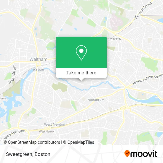
See Sweetgreen, Watertown Town, on the map
Public Transit to Sweetgreen in Watertown Town
Wondering how to get to Sweetgreen in Watertown Town? Moovit helps you find the best way to get to Sweetgreen with step-by-step directions from the nearest public transit station.
Moovit provides free maps and live directions to help you navigate through your city. View schedules, routes, timetables, and find out how long does it take to get to Sweetgreen in real time.
Looking for the nearest stop or station to Sweetgreen? Check out this list of stops closest to your destination: California St @ Bridge St; Main St Opp Warren St - Watertown Line; Waltham; West Newton.
Bus: 558, 70.Train: FRAMINGHAM/WORCESTER, FITCHBURG.
Want to see if there’s another route that gets you there at an earlier time? Moovit helps you find alternative routes or times. Get directions from and directions to Sweetgreen easily from the Moovit App or Website.
We make riding to Sweetgreen easy, which is why over 1.7 million users, including users in Watertown Town, trust Moovit as the best app for public transit. You don’t need to download an individual bus app or train app, Moovit is your all-in-one transit app that helps you find the best bus time or train time available.
For information on prices of bus, train and subway, costs and ride fares to Sweetgreen, please check the Moovit app.
Use the app to navigate to popular places including to the airport, hospital, stadium, grocery store, mall, coffee shop, school, college, and university.
Sweetgreen Address: 1 Repton Pl street in Watertown Town
- Commonwealth Cabinetry,
- Repton Place Condominium Trust,
- Elemental Beverage Company,
- Benjamin Construction,
- Willis JG,
- Arranta Bio,
- Watertown Sons & D,
- EV Connect,
- Victory Family Church,
- AmpUp,
- International Colliers,
- UPS,
- Normatec Industries,
- Clinlab Life Science Staffing & Recruiting,
- AT&T,
- Bj's Wholesale Club,
- Pegas Appliance Repair,
- Ct Pizzeria,
- Charchaflian PI,
- Italian Design
Places Near Sweetgreen (Watertown Town)
- Boston Children's Hospital, Boston,
- Museum Of Science, Boston,
- Faneuil Hall, Boston,
- Leader Bank Pavilion (Leader Bank Pavillion), Boston,
- Mgm Music Hall, Boston,
- Isabella Stewart Gardner Museum, Boston,
- Wang Theater, Boston,
- Castle Island, Boston,
- Boston Common, Boston,
- Cheers, Boston,
- Wilbur Theatre, Boston,
- Td Garden, Boston,
- House Of Blues, Boston,
- Seaport District, Boston,
- Boston Medical Center, Boston,
- Quincy Market, Boston,
- North End, Boston,
- Massachusetts General Hospital, Boston,
- Boston Convention & Exhibition Center, Boston,
- Prudential Center, Boston
How to get to popular places in Boston with public transit
Get around Watertown Town by public transit!
Traveling around Watertown Town has never been so easy. See step by step directions as you travel to any attraction, street or major public transit station. View bus and train schedules, arrival times, service alerts and detailed routes on a map, so you know exactly how to get to anywhere in Watertown Town.
When traveling to any destination around Watertown Town use Moovit's Live Directions with Get Off Notifications to know exactly where and how far to walk, how long to wait for your line, and how many stops are left. Moovit will alert you when it's time to get off — no need to constantly re-check whether yours is the next stop.
Wondering how to use public transit in Watertown Town or how to pay for public transit in Watertown Town? Moovit public transit app can help you navigate your way with public transit easily, and at minimum cost. It includes public transit fees, ticket prices, and costs. Looking for a map of Watertown Town public transit lines? Moovit public transit app shows all public transit maps in Watertown Town with all Bus, Train, Subway and Ferry routes and stops on an interactive map.
Boston has 4 transit type(s), including: Bus, Train, Subway and Ferry, operated by several transit agencies, including MBTA, Southeastern Regional Transit Authority, MetroWest Regional Transit Authority, Rhode Island Public Transit Authority, WRTA, Lowell Regional Transit Authority, Merrimack Valley Transit, Montachusett Regional Transit Authority, Cape Cod Regional Transit Authority, Brockton Area Transit Authority, Martha's Vineyard Transit Authority, the WAVE - Nantucket Regional Transit Authority, GATRA, Cape Ann Transportation Authority and Massport