Directions to Sweets by Cella (Boston) with public transportation
The following transit lines have routes that pass near Sweets by Cella
 Bus: 354, 4, 7, SL2, SL3.
- Train: FRAMINGHAM/WORCESTER, NEEDHAM, NEWBURYPORT/ROCKPORT, COMMUTER RAIL SHUTTLE, FAIRMOUNT LINE SHUTTLE.
- Subway: RED LINE.
- Ferry: HINGHAM FERRY, FAST FERRY.
How to get to Sweets by Cella by bus?
Click on the bus route to see step by step directions with maps, line arrival times and updated time schedules.
From Chelsea, MA, Chelsea
31 minFrom La Quinta Inn & Suites Boston Somerville, Somerville
54 minFrom New Balance, Boston
74 minFrom Conte Forum, Boston
76 minFrom Boston College (BC), Boston
75 minFrom Boston College, Boston
74 minFrom Staybridge Suites Boston-Quincy, Quincy
113 minFrom Roslindale, Boston
70 minFrom AC Hotel Boston Cambridge, Cambridge
81 minFrom Chestnut Hill, Boston
76 min
How to get to Sweets by Cella by train?
Click on the train route to see step by step directions with maps, line arrival times and updated time schedules.
How to get to Sweets by Cella by subway?
Click on the subway route to see step by step directions with maps, line arrival times and updated time schedules.
From La Quinta Inn & Suites Boston Somerville, Somerville
37 minFrom New Balance, Boston
74 minFrom Conte Forum, Boston
75 minFrom Boston College (BC), Boston
73 minFrom Boston College, Boston
72 minFrom Staybridge Suites Boston-Quincy, Quincy
33 minFrom Roslindale, Boston
56 minFrom AC Hotel Boston Cambridge, Cambridge
50 minFrom Chestnut Hill, Boston
74 min
Bus stops near Sweets by Cella in Boston
Train station near Sweets by Cella in Boston
- South Station, 4 min walk,VIEW
Ferry stations near Sweets by Cella in Boston
Bus lines to Sweets by Cella in Boston
What are the closest stations to Sweets by Cella?
The closest stations to Sweets by Cella are:
- Seaport Blvd @ Pier 4 Blvd is 103 yards away, 2 min walk.
- Summer St @ D St is 195 yards away, 3 min walk.
- South Station is 288 yards away, 4 min walk.
- Rowes Wharf is 529 yards away, 7 min walk.
- A St @ Mt Washington Ave is 736 yards away, 9 min walk.
- World Trade Center Pier, Boston, MA is 924 yards away, 12 min walk.
- Seaport (Fan Pier) is 1403 yards away, 17 min walk.
Which bus lines stop near Sweets by Cella?
These bus lines stop near Sweets by Cella: 354, 4, 7, SL2, SL3, SL4.
Which train lines stop near Sweets by Cella?
These train lines stop near Sweets by Cella: FRAMINGHAM/WORCESTER, NEEDHAM, NEWBURYPORT/ROCKPORT.
Which subway line stops near Sweets by Cella?
RED LINE (Ashmont/Braintree)
What’s the nearest train station to Sweets by Cella in Boston?
The nearest train station to Sweets by Cella in Boston is South Station. It’s a 4 min walk away.
What’s the nearest bus station to Sweets by Cella in Boston?
The nearest bus station to Sweets by Cella in Boston is Seaport Blvd @ Pier 4 Blvd. It’s a 2 min walk away.
What’s the nearest ferry station to Sweets by Cella in Boston?
The nearest ferry station to Sweets by Cella in Boston is Rowes Wharf. It’s a 7 min walk away.
What time is the first subway to Sweets by Cella in Boston?
The RED LINE is the first subway that goes to Sweets by Cella in Boston. It stops nearby at 5:30 AM.
What time is the last subway to Sweets by Cella in Boston?
The RED LINE is the last subway that goes to Sweets by Cella in Boston. It stops nearby at 1:49 AM.
What time is the first train to Sweets by Cella in Boston?
The PROVIDENCE/STOUGHTON is the first train that goes to Sweets by Cella in Boston. It stops nearby at 4:20 AM.
What time is the last train to Sweets by Cella in Boston?
The LAKE SHORE LIMITED is the last train that goes to Sweets by Cella in Boston. It stops nearby at 8:32 PM.
What time is the first bus to Sweets by Cella in Boston?
The SLW is the first bus that goes to Sweets by Cella in Boston. It stops nearby at 4:14 AM.
What time is the last bus to Sweets by Cella in Boston?
The SL1 is the last bus that goes to Sweets by Cella in Boston. It stops nearby at 1:26 AM.
What time is the first ferry to Sweets by Cella in Boston?
The EAST is the first ferry that goes to Sweets by Cella in Boston. It stops nearby at 6:01 AM.
What time is the last ferry to Sweets by Cella in Boston?
The FAST FERRY is the last ferry that goes to Sweets by Cella in Boston. It stops nearby at 9:05 PM.
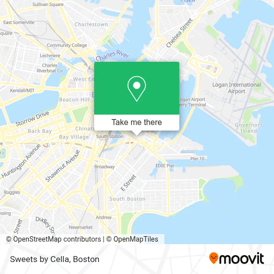
See Sweets by Cella, Boston, on the map
Public Transit to Sweets by Cella in Boston
Wondering how to get to Sweets by Cella in Boston? Moovit helps you find the best way to get to Sweets by Cella with step-by-step directions from the nearest public transit station.
Moovit provides free maps and live directions to help you navigate through your city. View schedules, routes, timetables, and find out how long does it take to get to Sweets by Cella in real time.
Looking for the nearest stop or station to Sweets by Cella? Check out this list of stops closest to your destination: Seaport Blvd @ Pier 4 Blvd; Summer St @ D St; South Station; Rowes Wharf; A St @ Mt Washington Ave; World Trade Center Pier; Seaport (Fan Pier).
Bus: 354, 4, 7, SL2, SL3, SL4, 11.Train: FRAMINGHAM/WORCESTER, NEEDHAM, NEWBURYPORT/ROCKPORT, COMMUTER RAIL SHUTTLE, FAIRMOUNT LINE SHUTTLE, FRANKLIN LINE SHUTTLE, KINGSTON LINE SHUTTLE, SL1.Subway: RED LINE.Ferry: HINGHAM FERRY, FAST FERRY.
Want to see if there’s another route that gets you there at an earlier time? Moovit helps you find alternative routes or times. Get directions from and directions to Sweets by Cella easily from the Moovit App or Website.
We make riding to Sweets by Cella easy, which is why over 1.7 million users, including users in Boston, trust Moovit as the best app for public transit. You don’t need to download an individual bus app or train app, Moovit is your all-in-one transit app that helps you find the best bus time or train time available.
For information on prices of bus, subway and train, costs and ride fares to Sweets by Cella, please check the Moovit app.
Use the app to navigate to popular places including to the airport, hospital, stadium, grocery store, mall, coffee shop, school, college, and university.
Sweets by Cella Address: 501 Congress St street in Boston
- Gables Seaport,
- Eddie Merlot's Boston,
- Seaport Medspa,
- Congress St / Boston Wharf Rd,
- Row 34,
- Nema Boston,
- Sheraton,
- Pink Taco Boston,
- Amazon Boston,
- Sweetgreen (Sweet Green),
- Residence Inn-Boston Seaport,
- Bos21 - Amazon,
- JSGD,
- Blue Bottle Coffee,
- bank of america pavilion,
- USPS C Lot,
- Greentown Labs,
- Sonja Haviland Design (Lewis Lighting Design),
- Trillium Brewing Company,
- Residence Inn by Marriott Boston Downtown Seaport
Places Near Sweets by Cella (Boston)
- House Of Blues, Boston,
- Boston Medical Center, Boston,
- Wilbur Theatre, Boston,
- Museum Of Science, Boston,
- Wang Theater, Boston,
- Cheers, Boston,
- Td Garden, Boston,
- Faneuil Hall, Boston,
- Castle Island, Boston,
- Mgm Music Hall, Boston,
- North End, Boston,
- Seaport District, Boston,
- Isabella Stewart Gardner Museum, Boston,
- Boston Common, Boston,
- Boston Convention & Exhibition Center, Boston,
- Quincy Market, Boston,
- Leader Bank Pavilion (Leader Bank Pavillion), Boston,
- Massachusetts General Hospital, Boston,
- Prudential Center, Boston,
- Boston Children's Hospital, Boston
How to get to popular places in Boston with public transit
Get around Boston by public transit!
Traveling around Boston has never been so easy. See step by step directions as you travel to any attraction, street or major public transit station. View bus and train schedules, arrival times, service alerts and detailed routes on a map, so you know exactly how to get to anywhere in Boston.
When traveling to any destination around Boston use Moovit's Live Directions with Get Off Notifications to know exactly where and how far to walk, how long to wait for your line, and how many stops are left. Moovit will alert you when it's time to get off — no need to constantly re-check whether yours is the next stop.
Wondering how to use public transit in Boston or how to pay for public transit in Boston? Moovit public transit app can help you navigate your way with public transit easily, and at minimum cost. It includes public transit fees, ticket prices, and costs. Looking for a map of Boston public transit lines? Moovit public transit app shows all public transit maps in Boston with all Bus, Train, Subway and Ferry routes and stops on an interactive map.
Boston has 4 transit type(s), including: Bus, Train, Subway and Ferry, operated by several transit agencies, including MBTA, Southeastern Regional Transit Authority, MetroWest Regional Transit Authority, Rhode Island Public Transit Authority, WRTA, Lowell Regional Transit Authority, Merrimack Valley Transit, Montachusett Regional Transit Authority, Cape Cod Regional Transit Authority, Brockton Area Transit Authority, Martha's Vineyard Transit Authority, the WAVE - Nantucket Regional Transit Authority, GATRA, Cape Ann Transportation Authority and Massport