Directions to Swiss World Cargo (Boston) with public transportation
The following transit lines have routes that pass near Swiss World Cargo
 Bus: 88, BB, SL1, 11, 22.
- Subway: BLUE LINE.
- Ferry: HINGHAM/HULL FERRY, QUINCY FERRY, WINTHROP FERRY, WINTHROP/QUINCY FERRY.
How to get to Swiss World Cargo by bus?
Click on the bus route to see step by step directions with maps, line arrival times and updated time schedules.
From Gateway Center, Everett
54 minFrom Encore Boston Harbor, Everett
60 minFrom Saugus, MA, Saugus
97 minFrom Spaulding Rehabilitation Center, Boston
74 minFrom COURTYARD-Boston Cambridge (Cambridge Marriott), Cambridge
77 minFrom MBTA Kenmore Station, Boston
34 minFrom New Balance, Boston
74 minFrom Fresh Pond Mall, Cambridge
87 minFrom Huntington Theatre, Boston
41 min
How to get to Swiss World Cargo by subway?
Click on the subway route to see step by step directions with maps, line arrival times and updated time schedules.
From Gateway Center, Everett
63 minFrom Encore Boston Harbor, Everett
67 minFrom Spaulding Rehabilitation Center, Boston
94 minFrom COURTYARD-Boston Cambridge (Cambridge Marriott), Cambridge
67 minFrom Huntington Theatre, Boston
54 minFrom Qea, Quincy
67 minFrom MBTA Kenmore Station, Boston
53 minFrom Fresh Pond Mall, Cambridge
75 minFrom New Balance, Boston
94 min
Bus stops near Swiss World Cargo in Boston
Ferry stations near Swiss World Cargo in Boston
Subway station near Swiss World Cargo in Boston
- Maverick, 30 min walk,VIEW
Bus lines to Swiss World Cargo in Boston
- 11, Terminal E - Arrivals - Terminal E - Arrivals,VIEW
- 22, Conrac Rental Car Center, Drop Off - Conrac Rental Car Center, Pick Up,VIEW
- 55, Conrac Rental Car Center, Drop Off - Conrac Rental Car Center, Pick Up,VIEW
- 66, Water Transportation Dock - Water Transportation Dock,VIEW
- 88, Economy Parking - Economy Parking,VIEW
- 221, 221,VIEW
- 551, 551,VIEW
- 552, 552,VIEW
- 771, 270 Central Ave - Chelsea Garage - 270 Central Ave - Chelsea Garage,VIEW
- 772, 270 Central Ave - Chelsea Garage - 270 Central Ave - Chelsea Garage,VIEW
- PETER PAN, BOSTON - WORCESTER - SPRINGFIELD - NORTHAMPTON - AMHERST,VIEW
- PETER PAN, BOSTON LOGAN AIRPORT - NEWARK,VIEW
- PETER PAN, BOSTON LOGAN AIRPORT - BOSTON - PROVIDENCE,VIEW
- PETER PAN, NEWARK - BOSTON LOGAN AIRPORT,VIEW
- PETER PAN, BOSTON LOGAN AIRPORT - BOSTON - FALMOUTH - WOODS HOLE,VIEW
- PETER PAN, HYANNIS - BOSTON - BOSTON LOGAN AIRPORT,VIEW
- PETER PAN, PROVIDENCE - BOSTON - BOSTON LOGAN AIRPORT,VIEW
- PETER PAN, BOSTON LOGAN AIRPORT - BOSTON - HYANNIS,VIEW
- PETER PAN, AMHERST - NORTHAMPTON - BOSTON College Express,VIEW
- PETER PAN, AMHERST - NORTHAMPTON - SPRINGFIELD - WORCESTER - BOSTON,VIEW
What are the closest stations to Swiss World Cargo?
The closest stations to Swiss World Cargo are:
- Terminal B - Arrivals Stop 1 is 5 yards away, 1 min walk.
- Boston (Logan Airport) is 225 yards away, 3 min walk.
- Terminal A is 225 yards away, 3 min walk.
- Terminal A - Arrivals is 225 yards away, 3 min walk.
- Now Entering Terminal B is 225 yards away, 3 min walk.
- Harborside Dr - Stop 2 is 241 yards away, 3 min walk.
- Logan Office Center is 375 yards away, 5 min walk.
- Logan Airport Ferry Terminal is 1701 yards away, 20 min walk.
- Maverick is 2508 yards away, 30 min walk.
- Lewis Mall Wharf is 2854 yards away, 34 min walk.
Which bus lines stop near Swiss World Cargo?
These bus lines stop near Swiss World Cargo: 88, BB, SL1.
Which subway line stops near Swiss World Cargo?
BLUE LINE (Wonderland)
What’s the nearest subway station to Swiss World Cargo in Boston?
The nearest subway station to Swiss World Cargo in Boston is Maverick. It’s a 30 min walk away.
What’s the nearest bus station to Swiss World Cargo in Boston?
The nearest bus station to Swiss World Cargo in Boston is Terminal B - Arrivals Stop 1. It’s a 1 min walk away.
What’s the nearest ferry station to Swiss World Cargo in Boston?
The nearest ferry station to Swiss World Cargo in Boston is Logan Airport Ferry Terminal. It’s a 20 min walk away.
What time is the first subway to Swiss World Cargo in Boston?
The BLUE LINE is the first subway that goes to Swiss World Cargo in Boston. It stops nearby at 5:12 AM.
What time is the last subway to Swiss World Cargo in Boston?
The BLUE LINE is the last subway that goes to Swiss World Cargo in Boston. It stops nearby at 1:59 AM.
What time is the first bus to Swiss World Cargo in Boston?
The 771 is the first bus that goes to Swiss World Cargo in Boston. It stops nearby at 3:01 AM.
What time is the last bus to Swiss World Cargo in Boston?
The 771 is the last bus that goes to Swiss World Cargo in Boston. It stops nearby at 3:06 AM.
What time is the first ferry to Swiss World Cargo in Boston?
The EAST is the first ferry that goes to Swiss World Cargo in Boston. It stops nearby at 5:55 AM.
What time is the last ferry to Swiss World Cargo in Boston?
The HINGHAM/HULL FERRY is the last ferry that goes to Swiss World Cargo in Boston. It stops nearby at 10:05 PM.
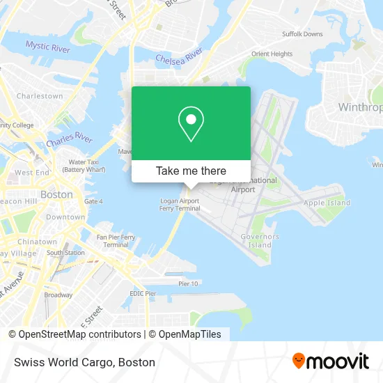
See Swiss World Cargo, Boston, on the map
Public Transit to Swiss World Cargo in Boston
Wondering how to get to Swiss World Cargo in Boston? Moovit helps you find the best way to get to Swiss World Cargo with step-by-step directions from the nearest public transit station.
Moovit provides free maps and live directions to help you navigate through your city. View schedules, routes, timetables, and find out how long does it take to get to Swiss World Cargo in real time.
Looking for the nearest stop or station to Swiss World Cargo? Check out this list of stops closest to your destination: Terminal B - Arrivals Stop 1; Boston (Logan Airport); Terminal A; Terminal A - Arrivals; Now Entering Terminal B; Harborside Dr - Stop 2; Logan Office Center; Logan Airport Ferry Terminal; Maverick; Lewis Mall Wharf.
Bus: 88, BB, SL1, 11, 22, 55, 66, PETER PAN, PETER PAN, PETER PAN, PETER PAN, PETER PAN, BT, DV, FH, WO, MANSFIELD TO LOGAN AIRPORT.Subway: BLUE LINE.Ferry: HINGHAM/HULL FERRY, QUINCY FERRY, WINTHROP FERRY, WINTHROP/QUINCY FERRY.
Want to see if there’s another route that gets you there at an earlier time? Moovit helps you find alternative routes or times. Get directions from and directions to Swiss World Cargo easily from the Moovit App or Website.
We make riding to Swiss World Cargo easy, which is why over 1.7 million users, including users in Boston, trust Moovit as the best app for public transit. You don’t need to download an individual bus app or train app, Moovit is your all-in-one transit app that helps you find the best bus time or train time available.
For information on prices of bus, subway and train, costs and ride fares to Swiss World Cargo, please check the Moovit app.
Use the app to navigate to popular places including to the airport, hospital, stadium, grocery store, mall, coffee shop, school, college, and university.
Swiss World Cargo Address: 112 Harborside Dr street in Boston
- Southwest Airlines,
- Southwest Airlines Cargo,
- Hyatt Regency-Boston Harbor,
- Aer Lingus,
- Taxi Pool,
- Taxi Pool Cafeteria,
- Lufthansa,
- American Airlines Cargo Facility,
- Hawaiian Airlines Airlines,
- Swissport Cargo Services,
- Gate A16,
- Building 58,
- Yale Car,
- Lex Etix Logan Termina,
- Berkshire Farms Market,
- Logan Airport,
- Boston Water Taxi,
- Hyatt Regency-Boston Harbor (Hyatt Harborside At Boston's Logan International Airport Hotel Boston),
- Spirit Flight,
- Noah & Sons Chimneys
Places Near Swiss World Cargo (Boston)
- Seaport District, Boston,
- Museum Of Science, Boston,
- Boston Convention & Exhibition Center, Boston,
- Boston Children's Hospital, Boston,
- Quincy Market, Boston,
- Cheers, Boston,
- Castle Island, Boston,
- Boston Medical Center, Boston,
- Faneuil Hall, Boston,
- North End, Boston,
- Wang Theater, Boston,
- Boston Common, Boston,
- Massachusetts General Hospital, Boston,
- Prudential Center, Boston,
- Mgm Music Hall, Boston,
- Isabella Stewart Gardner Museum, Boston,
- Leader Bank Pavilion (Leader Bank Pavillion), Boston,
- Wilbur Theatre, Boston,
- Td Garden, Boston,
- House Of Blues, Boston
How to get to popular places in Boston with public transit
Get around Boston by public transit!
Traveling around Boston has never been so easy. See step by step directions as you travel to any attraction, street or major public transit station. View bus and train schedules, arrival times, service alerts and detailed routes on a map, so you know exactly how to get to anywhere in Boston.
When traveling to any destination around Boston use Moovit's Live Directions with Get Off Notifications to know exactly where and how far to walk, how long to wait for your line, and how many stops are left. Moovit will alert you when it's time to get off — no need to constantly re-check whether yours is the next stop.
Wondering how to use public transit in Boston or how to pay for public transit in Boston? Moovit public transit app can help you navigate your way with public transit easily, and at minimum cost. It includes public transit fees, ticket prices, and costs. Looking for a map of Boston public transit lines? Moovit public transit app shows all public transit maps in Boston with all Bus, Train, Subway and Ferry routes and stops on an interactive map.
Boston has 4 transit type(s), including: Bus, Train, Subway and Ferry, operated by several transit agencies, including MBTA, Southeastern Regional Transit Authority, MetroWest Regional Transit Authority, Rhode Island Public Transit Authority, WRTA, Lowell Regional Transit Authority, Merrimack Valley Transit, Montachusett Regional Transit Authority, Cape Cod Regional Transit Authority, Brockton Area Transit Authority, Martha's Vineyard Transit Authority, the WAVE - Nantucket Regional Transit Authority, GATRA, Cape Ann Transportation Authority and Massport