Directions to Swissport (Winthrop Town) with public transportation
The following transit lines have routes that pass near Swissport
 Bus: 119, 712.
- Subway: BLUE LINE.
- Ferry: WINTHROP FERRY, WINTHROP/QUINCY FERRY.
How to get to Swissport by bus?
Click on the bus route to see step by step directions with maps, line arrival times and updated time schedules.
From Hotel Aka Back Bay (Hotel Back Bay), Boston
67 minFrom Christian Science Plaza, Boston
100 minFrom Mapparium, Boston
118 minFrom Fogo De Chão, Boston
67 minFrom Fire + Ice, Boston
64 minFrom Eliot Hotel, Boston
120 minFrom Inman Square, Cambridge
118 minFrom Carson Beach, Boston
96 minFrom Intercontinental Boston, Boston
54 minFrom The Mapparium, Boston
118 min
How to get to Swissport by subway?
Click on the subway route to see step by step directions with maps, line arrival times and updated time schedules.
From Hotel Aka Back Bay (Hotel Back Bay), Boston
53 minFrom Christian Science Plaza, Boston
63 minFrom Mapparium, Boston
58 minFrom Fogo De Chão, Boston
52 minFrom Fire + Ice, Boston
55 minFrom Eliot Hotel, Boston
60 minFrom Inman Square, Cambridge
69 minFrom Carson Beach, Boston
76 minFrom Intercontinental Boston, Boston
50 minFrom The Mapparium, Boston
62 min
Bus stop near Swissport in Winthrop Town
- Revere St @ Hutchinson St, 3 min walk,VIEW
Ferry station near Swissport in Winthrop Town
- Winthrop Landing, 21 min walk,VIEW
Subway station near Swissport in Winthrop Town
- Revere Beach, 27 min walk,VIEW
Bus lines to Swissport in Winthrop Town
- 712, Winthrop Beach,VIEW
What are the closest stations to Swissport?
The closest stations to Swissport are:
- Revere St @ Hutchinson St is 191 yards away, 3 min walk.
- Winthrop Landing is 1785 yards away, 21 min walk.
- Revere Beach is 2258 yards away, 27 min walk.
Which bus lines stop near Swissport?
These bus lines stop near Swissport: 119, 712.
Which subway line stops near Swissport?
BLUE LINE (Wonderland)
What’s the nearest subway station to Swissport in Winthrop Town?
The nearest subway station to Swissport in Winthrop Town is Revere Beach. It’s a 27 min walk away.
What’s the nearest bus station to Swissport in Winthrop Town?
The nearest bus station to Swissport in Winthrop Town is Revere St @ Hutchinson St. It’s a 3 min walk away.
What’s the nearest ferry station to Swissport in Winthrop Town?
The nearest ferry station to Swissport in Winthrop Town is Winthrop Landing. It’s a 21 min walk away.
What time is the first subway to Swissport in Winthrop Town?
The BLUE LINE is the first subway that goes to Swissport in Winthrop Town. It stops nearby at 5:08 AM.
What time is the last subway to Swissport in Winthrop Town?
The BLUE LINE is the last subway that goes to Swissport in Winthrop Town. It stops nearby at 2:08 AM.
What time is the first bus to Swissport in Winthrop Town?
The 712 is the first bus that goes to Swissport in Winthrop Town. It stops nearby at 4:41 AM.
What time is the last bus to Swissport in Winthrop Town?
The 712 is the last bus that goes to Swissport in Winthrop Town. It stops nearby at 12:39 AM.
What time is the first ferry to Swissport in Winthrop Town?
The WINTHROP FERRY is the first ferry that goes to Swissport in Winthrop Town. It stops nearby at 6:40 AM.
What time is the last ferry to Swissport in Winthrop Town?
The WINTHROP FERRY is the last ferry that goes to Swissport in Winthrop Town. It stops nearby at 9:00 PM.
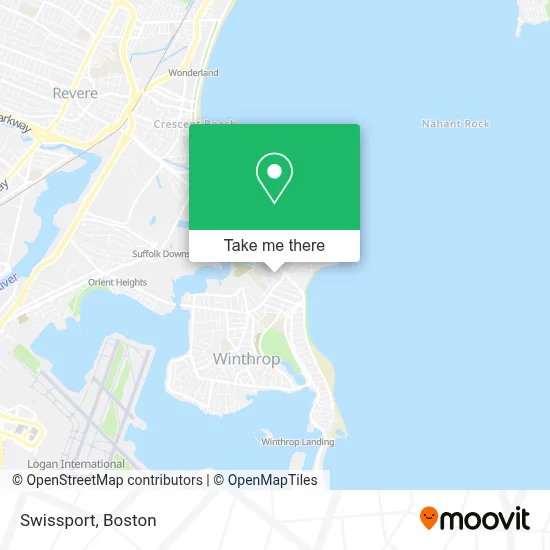
See Swissport, Winthrop Town, on the map
Public Transit to Swissport in Winthrop Town
Wondering how to get to Swissport in Winthrop Town? Moovit helps you find the best way to get to Swissport with step-by-step directions from the nearest public transit station.
Moovit provides free maps and live directions to help you navigate through your city. View schedules, routes, timetables, and find out how long does it take to get to Swissport in real time.
Looking for the nearest stop or station to Swissport? Check out this list of stops closest to your destination: Revere St @ Hutchinson St; Winthrop Landing; Revere Beach.
Bus: 119, 712.Subway: BLUE LINE.Ferry: WINTHROP FERRY, WINTHROP/QUINCY FERRY.
Want to see if there’s another route that gets you there at an earlier time? Moovit helps you find alternative routes or times. Get directions from and directions to Swissport easily from the Moovit App or Website.
We make riding to Swissport easy, which is why over 1.7 million users, including users in Winthrop Town, trust Moovit as the best app for public transit. You don’t need to download an individual bus app or train app, Moovit is your all-in-one transit app that helps you find the best bus time or train time available.
For information on prices of subway and bus, costs and ride fares to Swissport, please check the Moovit app.
Use the app to navigate to popular places including to the airport, hospital, stadium, grocery store, mall, coffee shop, school, college, and university.
Swissport Address: 32 Argyle St street in Winthrop Town
- Esthetics And Makeup by Meda,
- Roof Repair Corp.,
- Essentially Well Bodywork + Cryotherapy,
- Epidermis And Co,
- Chrissy In the City Creations,
- Citizens Bank,
- Cinco Mexican Kitchen,
- Jan Stevens - Realtor,
- Antique Table Restaurant - Winthrop,
- La Esquina Del Sabor,
- 19 Crest Avenue Food Services,
- Those Who Can, For Those In Need,
- Tradewinds Fitness,
- Fort Banks Pto,
- Top Quality Barbershop,
- Tmccc Primary Care - Winthrop,
- Aecd Foundation,
- Winthrop Town Of, Cemetery Department,
- M Studio Pilates And Fitness,
- Lou Tattoo Studio
Places Near Swissport (Winthrop Town)
- Prudential Center, Boston,
- Cheers, Boston,
- Mgm Music Hall, Boston,
- Massachusetts General Hospital, Boston,
- Boston Medical Center, Boston,
- Isabella Stewart Gardner Museum, Boston,
- House Of Blues, Boston,
- Wang Theater, Boston,
- Seaport District, Boston,
- Boston Convention & Exhibition Center, Boston,
- North End, Boston,
- Leader Bank Pavilion (Leader Bank Pavillion), Boston,
- Boston Children's Hospital, Boston,
- Quincy Market, Boston,
- Boston Common, Boston,
- Td Garden, Boston,
- Wilbur Theatre, Boston,
- Castle Island, Boston,
- Museum Of Science, Boston,
- Faneuil Hall, Boston
How to get to popular places in Boston with public transit
Get around Winthrop Town by public transit!
Traveling around Winthrop Town has never been so easy. See step by step directions as you travel to any attraction, street or major public transit station. View bus and train schedules, arrival times, service alerts and detailed routes on a map, so you know exactly how to get to anywhere in Winthrop Town.
When traveling to any destination around Winthrop Town use Moovit's Live Directions with Get Off Notifications to know exactly where and how far to walk, how long to wait for your line, and how many stops are left. Moovit will alert you when it's time to get off — no need to constantly re-check whether yours is the next stop.
Wondering how to use public transit in Winthrop Town or how to pay for public transit in Winthrop Town? Moovit public transit app can help you navigate your way with public transit easily, and at minimum cost. It includes public transit fees, ticket prices, and costs. Looking for a map of Winthrop Town public transit lines? Moovit public transit app shows all public transit maps in Winthrop Town with all Bus, Train, Subway and Ferry routes and stops on an interactive map.
Boston has 4 transit type(s), including: Bus, Train, Subway and Ferry, operated by several transit agencies, including MBTA, Southeastern Regional Transit Authority, MetroWest Regional Transit Authority, Rhode Island Public Transit Authority, WRTA, Lowell Regional Transit Authority, Merrimack Valley Transit, Montachusett Regional Transit Authority, Cape Cod Regional Transit Authority, Brockton Area Transit Authority, Martha's Vineyard Transit Authority, the WAVE - Nantucket Regional Transit Authority, GATRA, Cape Ann Transportation Authority and Massport