Directions to T-Mobile Authorized Retailer (Boston) with public transportation
The following transit lines have routes that pass near T-Mobile Authorized Retailer
 Bus: 10, 11, 9.
- Train: FAIRMOUNT, FRAMINGHAM/WORCESTER, KINGSTON, FALL RIVER/NEW BEDFORD, GREENBUSH.
- Subway: RED LINE.
- Ferry: FAST FERRY.
How to get to T-Mobile Authorized Retailer by bus?
Click on the bus route to see step by step directions with maps, line arrival times and updated time schedules.
From Quincy Market, Quincy
102 minFrom Winter Hill, Somerville
82 minFrom Boston College, Boston
80 minFrom Hampton Inn Boston Logan Airport, Revere
65 minFrom Washington St, Boston
70 minFrom Malden, MA, Malden
86 minFrom Chestnut Hill, Boston
82 minFrom Alumni Stadium, Newton
84 minFrom Warren St, Boston
61 minFrom Costco Wholesale, Everett
88 min
How to get to T-Mobile Authorized Retailer by train?
Click on the train route to see step by step directions with maps, line arrival times and updated time schedules.
How to get to T-Mobile Authorized Retailer by subway?
Click on the subway route to see step by step directions with maps, line arrival times and updated time schedules.
From Quincy Market, Quincy
37 minFrom Winter Hill, Somerville
61 minFrom Boston College, Boston
77 minFrom Hampton Inn Boston Logan Airport, Revere
64 minFrom Washington St, Boston
40 minFrom Malden, MA, Malden
48 minFrom Chestnut Hill, Boston
79 minFrom Alumni Stadium, Newton
81 minFrom Warren St, Boston
64 minFrom Costco Wholesale, Everett
55 min
Bus stops near T-Mobile Authorized Retailer in Boston
Subway station near T-Mobile Authorized Retailer in Boston
- Broadway, 16 min walk,VIEW
Train station near T-Mobile Authorized Retailer in Boston
- Jfk/Umass, 18 min walk,VIEW
Ferry station near T-Mobile Authorized Retailer in Boston
- World Trade Center Pier, Boston, MA, 31 min walk,VIEW
Bus lines to T-Mobile Authorized Retailer in Boston
What are the closest stations to T-Mobile Authorized Retailer?
The closest stations to T-Mobile Authorized Retailer are:
- W Broadway @ Dorchester St is 13 yards away, 1 min walk.
- Dorchester St @ Broadway is 26 yards away, 1 min walk.
- W 6th S @ Dorchester St is 305 yards away, 4 min walk.
- Broadway is 1292 yards away, 16 min walk.
- Jfk/Umass is 1452 yards away, 18 min walk.
- World Trade Center Pier, Boston, MA is 2577 yards away, 31 min walk.
Which bus lines stop near T-Mobile Authorized Retailer?
These bus lines stop near T-Mobile Authorized Retailer: 10, 11, 9.
Which train lines stop near T-Mobile Authorized Retailer?
These train lines stop near T-Mobile Authorized Retailer: FAIRMOUNT, FRAMINGHAM/WORCESTER, KINGSTON.
Which subway line stops near T-Mobile Authorized Retailer?
RED LINE (Alewife)
What’s the nearest subway station to T-Mobile Authorized Retailer in Boston?
The nearest subway station to T-Mobile Authorized Retailer in Boston is Broadway. It’s a 16 min walk away.
What’s the nearest train station to T-Mobile Authorized Retailer in Boston?
The nearest train station to T-Mobile Authorized Retailer in Boston is Jfk/Umass. It’s a 18 min walk away.
What’s the nearest bus station to T-Mobile Authorized Retailer in Boston?
The nearest bus stations to T-Mobile Authorized Retailer in Boston are W Broadway @ Dorchester St and Dorchester St @ Broadway. The closest one is a 1 min walk away.
What time is the first subway to T-Mobile Authorized Retailer in Boston?
The RED LINE is the first subway that goes to T-Mobile Authorized Retailer in Boston. It stops nearby at 5:23 AM.
What time is the last subway to T-Mobile Authorized Retailer in Boston?
The RED LINE is the last subway that goes to T-Mobile Authorized Retailer in Boston. It stops nearby at 1:55 AM.
What time is the first train to T-Mobile Authorized Retailer in Boston?
The KINGSTON is the first train that goes to T-Mobile Authorized Retailer in Boston. It stops nearby at 5:50 AM.
What time is the last train to T-Mobile Authorized Retailer in Boston?
The KINGSTON is the last train that goes to T-Mobile Authorized Retailer in Boston. It stops nearby at 8:02 PM.
What time is the first bus to T-Mobile Authorized Retailer in Boston?
The 10 is the first bus that goes to T-Mobile Authorized Retailer in Boston. It stops nearby at 4:54 AM.
What time is the last bus to T-Mobile Authorized Retailer in Boston?
The 10 is the last bus that goes to T-Mobile Authorized Retailer in Boston. It stops nearby at 1:36 AM.
What time is the first ferry to T-Mobile Authorized Retailer in Boston?
The FAST FERRY is the first ferry that goes to T-Mobile Authorized Retailer in Boston. It stops nearby at 8:30 AM.
What time is the last ferry to T-Mobile Authorized Retailer in Boston?
The FAST FERRY is the last ferry that goes to T-Mobile Authorized Retailer in Boston. It stops nearby at 9:05 PM.
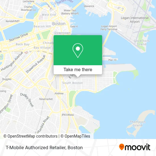
See T-Mobile Authorized Retailer, Boston, on the map
Public Transit to T-Mobile Authorized Retailer in Boston
Wondering how to get to T-Mobile Authorized Retailer in Boston? Moovit helps you find the best way to get to T-Mobile Authorized Retailer with step-by-step directions from the nearest public transit station.
Moovit provides free maps and live directions to help you navigate through your city. View schedules, routes, timetables, and find out how long does it take to get to T-Mobile Authorized Retailer in real time.
Looking for the nearest stop or station to T-Mobile Authorized Retailer? Check out this list of stops closest to your destination: W Broadway @ Dorchester St; Dorchester St @ Broadway; W 6th S @ Dorchester St; Broadway; Jfk/Umass; World Trade Center Pier.
Bus: 10, 11, 9.Train: FAIRMOUNT, FRAMINGHAM/WORCESTER, KINGSTON, FALL RIVER/NEW BEDFORD, GREENBUSH.Subway: RED LINE.Ferry: FAST FERRY.
Want to see if there’s another route that gets you there at an earlier time? Moovit helps you find alternative routes or times. Get directions from and directions to T-Mobile Authorized Retailer easily from the Moovit App or Website.
We make riding to T-Mobile Authorized Retailer easy, which is why over 1.7 million users, including users in Boston, trust Moovit as the best app for public transit. You don’t need to download an individual bus app or train app, Moovit is your all-in-one transit app that helps you find the best bus time or train time available.
For information on prices of bus, subway and train, costs and ride fares to T-Mobile Authorized Retailer, please check the Moovit app.
Use the app to navigate to popular places including to the airport, hospital, stadium, grocery store, mall, coffee shop, school, college, and university.
T-Mobile Authorized Retailer Address: 471 W Broadway street in Boston
- Navy Federal Credit Union,
- P.S. Gourmet Coffee,
- The Goodwill Store,
- B3 Fitness,
- Hunter's Kitchen & Bar,
- Precious M Cleaners & Laundromat,
- Fat Baby,
- Capo,
- Capo Restaurant & Supper Club,
- Supper Club at Capo,
- Marion Manor,
- Sherwin-Williams,
- The Luxury Box,
- Lincoln Tavern & Restaurant,
- Lincoln,
- Publico Street Bistro (Publico Boston),
- South Boston Municipal Court (Boston Southpaws),
- Dorchester Heights Monument,
- Dorchester Heights,
- McDonough Gym/ Walsh Community Center
Places Near T-Mobile Authorized Retailer (Boston)
- Seaport District, Boston,
- Museum Of Science, Boston,
- Faneuil Hall, Boston,
- Boston Common, Boston,
- Boston Convention & Exhibition Center, Boston,
- Boston Children's Hospital, Boston,
- Leader Bank Pavilion (Leader Bank Pavillion), Boston,
- Td Garden, Boston,
- Wilbur Theatre, Boston,
- House Of Blues, Boston,
- Isabella Stewart Gardner Museum, Boston,
- Wang Theater, Boston,
- Massachusetts General Hospital, Boston,
- Castle Island, Boston,
- Cheers, Boston,
- Boston Medical Center, Boston,
- Prudential Center, Boston,
- Quincy Market, Boston,
- North End, Boston,
- Mgm Music Hall, Boston
How to get to popular places in Boston with public transit
Get around Boston by public transit!
Traveling around Boston has never been so easy. See step by step directions as you travel to any attraction, street or major public transit station. View bus and train schedules, arrival times, service alerts and detailed routes on a map, so you know exactly how to get to anywhere in Boston.
When traveling to any destination around Boston use Moovit's Live Directions with Get Off Notifications to know exactly where and how far to walk, how long to wait for your line, and how many stops are left. Moovit will alert you when it's time to get off — no need to constantly re-check whether yours is the next stop.
Wondering how to use public transit in Boston or how to pay for public transit in Boston? Moovit public transit app can help you navigate your way with public transit easily, and at minimum cost. It includes public transit fees, ticket prices, and costs. Looking for a map of Boston public transit lines? Moovit public transit app shows all public transit maps in Boston with all Bus, Train, Subway and Ferry routes and stops on an interactive map.
Boston has 4 transit type(s), including: Bus, Train, Subway and Ferry, operated by several transit agencies, including MBTA, Southeastern Regional Transit Authority, MetroWest Regional Transit Authority, Rhode Island Public Transit Authority, WRTA, Lowell Regional Transit Authority, Merrimack Valley Transit, Montachusett Regional Transit Authority, Cape Cod Regional Transit Authority, Brockton Area Transit Authority, Martha's Vineyard Transit Authority, the WAVE - Nantucket Regional Transit Authority, GATRA, Cape Ann Transportation Authority and Massport