How to get to Taisdeoliveira by bus?
Click on the bus route to see step by step directions with maps, line arrival times and updated time schedules.
From Mesquita, Mesquita
69 minFrom Nilópolis, Nilópolis
56 minFrom Rua Oscar Soares, Nova Iguaçu
48 minFrom Avenida Nilo Peçanha, Nova Iguaçu
37 minFrom Madureira 1, Nova Iguaçu
49 minFrom Cabuçu, Nova Iguaçu
75 minFrom Hospital Estadual Da Mãe, Mesquita
65 minFrom Universidade Estácio de Sá, Nova Iguaçu
52 minFrom Shopping Da Multidão, Nova Iguaçu
39 minFrom Vilar Dos Teles, São João De Meriti
68 min
Bus stops near Taisdeoliveira in Nova Iguaçu
Bus lines to Taisdeoliveira in Nova Iguaçu
- 123, Vila De Cava,VIEW
- 131, A. T. A.,VIEW
- 492B, Vila De Cava (Parador),VIEW
- 503B, Praça Mauá,VIEW
- 585I, Jaceruba,VIEW
- 901, Tinguá,VIEW
- 2492B (EXECUTIVO), Central,VIEW
- 124, Santa Rita,VIEW
- 716L, Pavuna,VIEW
- 561I, Pavuna,VIEW
- 126, Nova Iguaçu - Vila de Cava (Via Luiz de Lemos),VIEW
- 137, Nova Iguaçu - Vila de Cava (Via Ambaí),VIEW
- 423I, Tinguá - Pavuna,VIEW
- 424I, Vila de Cava - Pavuna (via Belford Roxo),VIEW
- 525I, Belford Roxo - Santa Rita (Via Vila de Cava),VIEW
- 625, Nova Iguaçu - Vila de Cava (Via Estrada do Iguaçu),VIEW
What are the closest stations to Taisdeoliveira?
The closest stations to Taisdeoliveira are:
- Rua Coronel Alberto De Melo, 2-54 is 41 meters away, 1 min walk.
- Rua João Manhães, 59 is 873 meters away, 12 min walk.
- Rua Jurandir Lima, 380-518 is 887 meters away, 12 min walk.
- Estrada Velha De Iguaçu, 751 is 1055 meters away, 14 min walk.
Which bus lines stop near Taisdeoliveira?
These bus lines stop near Taisdeoliveira: 131, 585I, 901.
What’s the nearest bus station to Taisdeoliveira in Nova Iguaçu?
The nearest bus station to Taisdeoliveira in Nova Iguaçu is Rua Coronel Alberto De Melo, 2-54. It’s a 1 min walk away.
What time is the first bus to Taisdeoliveira in Nova Iguaçu?
The 901 is the first bus that goes to Taisdeoliveira in Nova Iguaçu. It stops nearby at 4:00 AM.
What time is the last bus to Taisdeoliveira in Nova Iguaçu?
The 901 is the last bus that goes to Taisdeoliveira in Nova Iguaçu. It stops nearby at 1:36 AM.
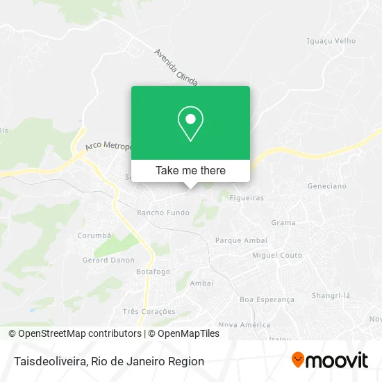
See Taisdeoliveira, Nova Iguaçu, on the map
Public Transit to Taisdeoliveira in Nova Iguaçu
Wondering how to get to Taisdeoliveira in Nova Iguaçu? Moovit helps you find the best way to get to Taisdeoliveira with step-by-step directions from the nearest public transit station.
Moovit provides free maps and live directions to help you navigate through your city. View schedules, routes, timetables, and find out how long does it take to get to Taisdeoliveira in real time.
Looking for the nearest stop or station to Taisdeoliveira? Check out this list of stops closest to your destination: Rua Coronel Alberto De Melo; Rua João Manhães; Rua Jurandir Lima; Estrada Velha De Iguaçu.
Bus: 131, 585I, 901, 123, 492B, 503B, 124, 716L, 561I, 126, 137, 423I, 424I, 525I.
Want to see if there’s another route that gets you there at an earlier time? Moovit helps you find alternative routes or times. Get directions from and directions to Taisdeoliveira easily from the Moovit App or Website.
We make riding to Taisdeoliveira easy, which is why over 1.5 million users, including users in Nova Iguaçu, trust Moovit as the best app for public transit. You don’t need to download an individual bus app or train app, Moovit is your all-in-one transit app that helps you find the best bus time or train time available.
For information on prices of bus, costs and ride fares to Taisdeoliveira, please check the Moovit app.
Use the app to navigate to popular places including to the airport, hospital, stadium, grocery store, mall, coffee shop, school, college, and university.
Taisdeoliveira Address: Estrada Carro Quebrado, 44 Rancho Fundo Nova Iguaçu-RJ 26051-680 street in Nova Iguaçu
- Segunda Igreja Batista Em Figueira,
- Estrada Carro Quebrado, 31,
- Igreja Assembleia de Deus Ministério Vale a Pena Ser Crente,
- Salão de Beleza Stylo da Moda,
- Rancho Fundo,
- Cabana Tinguá,
- Rua Carlinda Próximo ao 124,
- Michelle Reis,
- Rua Carro Quebrado / Estrada Quebra Carro,
- Malungo Decor,
- Cantinho de Pai Cipriano e Ile Xangô Aira,
- Rua Maria Tereza,
- Estrada Quebra Carro,
- Sitio Sol da Justiça,
- Rua Coronel Alberto de Melo,
- Sítio Marina & Dias,
- Igreja Católica Comunidade São Pedro,
- Rua Sacadura Cabral,
- Varandão do Samba,
- Rua Ajuru, 108
Places Near Taisdeoliveira (Nova Iguaçu)
- Hospital Pedro Ernesto, Vila Isabel,
- Avenida Venezuela 134, Saúde,
- Hospital Municipal Ronaldo Gazolla, Acari,
- Niterói, Niterói,
- Rua Licínio Cardoso, São Francisco Xavier,
- Museu Do Amanhã, Centro,
- Praia do Arpoador, Ipanema,
- Rodoviária Novo Rio (Rodoviária do Rio de Janeiro), Santo Cristo,
- Feirão De Malhas, Duque De Caxias,
- Hospital Federal Do Andaraí, Andaraí,
- Avenida Rio Branco, Centro,
- Rua Ulysses Guimarães 16, Cidade Nova,
- Hospital Federal Cardoso Fontes, Jacarepaguá,
- Shopping Rio Sul, Botafogo,
- Shopping RioSul, Botafogo,
- Norte Shopping, Cachambi,
- Feira Livre da Gloria, Glória,
- Shopping Downtown, Barra Da Tijuca,
- Shopping Nova América, Del Castilho,
- Rio De Janeiro
How to get to popular places in Rio de Janeiro Region with public transit
Get around Nova Iguaçu by public transit!
Traveling around Nova Iguaçu has never been so easy. See step by step directions as you travel to any attraction, street or major public transit station. View bus and train schedules, arrival times, service alerts and detailed routes on a map, so you know exactly how to get to anywhere in Nova Iguaçu.
When traveling to any destination around Nova Iguaçu use Moovit's Live Directions with Get Off Notifications to know exactly where and how far to walk, how long to wait for your line, and how many stops are left. Moovit will alert you when it's time to get off — no need to constantly re-check whether yours is the next stop.
Wondering how to use public transit in Nova Iguaçu or how to pay for public transit in Nova Iguaçu? Moovit public transit app can help you navigate your way with public transit easily, and at minimum cost. It includes public transit fees, ticket prices, and costs. Looking for a map of Nova Iguaçu public transit lines? Moovit public transit app shows all public transit maps in Nova Iguaçu with all Bus, Train, Metro, Light Rail, Ferry, Cable Car, Gondola and Funicular routes and stops on an interactive map.
Rio de Janeiro Region has 8 transit type(s), including: Bus, Train, Metro, Light Rail, Ferry, Cable Car, Gondola and Funicular, operated by several transit agencies, including TrensRJ, Metrô Rio, VLT Carioca, Barcas Rio, BRT MOBI-Rio, Auto Viação Alpha, Auto Viação Tijuca, Gire Transportes, Transurb, Viação Nossa Senhora das Graças, Consórcio INTERSUL, Braso Lisboa (Municipal), Caprichosa Auto Ônibus, Auto Viação Três Amigos and Rodoviária Âncora Matias