Directions to Take Five Inc (Boston) with public transportation
The following transit lines have routes that pass near Take Five Inc
 Bus: R14.
How to get to Take Five Inc by bus?
Click on the bus route to see step by step directions with maps, line arrival times and updated time schedules.
From Palladium, Worcester
154 minFrom Registry Of Motor Vehicles (Rmv) Branch Office, Worcester
153 minFrom Polar Park, Worcester
150 minFrom Walmart Supercenter, Worcester
208 minFrom Foxwoods, Worcester
178 minFrom Worcester, MA, Worcester
149 minFrom South High Community School, Worcester
246 minFrom Dcu Center, Worcester
151 min
Bus stop near Take Five Inc in Boston
- 704 Springfield St, 12 min walk,VIEW
Bus lines to Take Five Inc in Boston
- R14, Union Station Via Maple,VIEW
What are the closest stations to Take Five Inc?
The closest stations to Take Five Inc are:
- 704 Springfield St is 944 yards away, 12 min walk.
Which bus line stops near Take Five Inc?
R14 (Pheasant Hill)
What’s the nearest bus station to Take Five Inc in Boston?
The nearest bus station to Take Five Inc in Boston is 704 Springfield St. It’s a 12 min walk away.
What time is the first bus to Take Five Inc in Boston?
The R14 is the first bus that goes to Take Five Inc in Boston. It stops nearby at 6:29 AM.
What time is the last bus to Take Five Inc in Boston?
The R14 is the last bus that goes to Take Five Inc in Boston. It stops nearby at 7:42 PM.
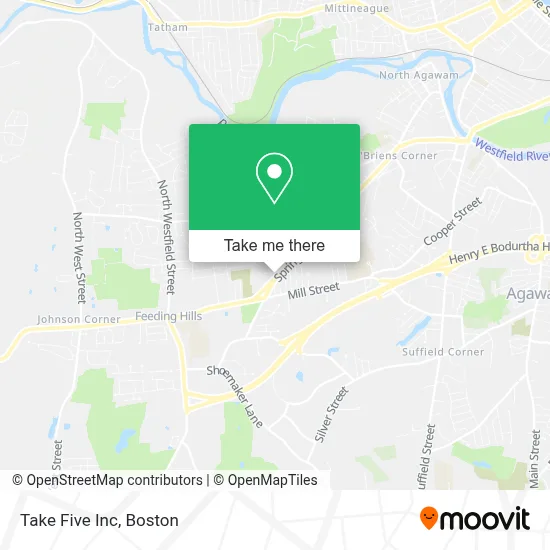
See Take Five Inc, Boston, on the map
Public Transit to Take Five Inc in Boston
Wondering how to get to Take Five Inc in Boston? Moovit helps you find the best way to get to Take Five Inc with step-by-step directions from the nearest public transit station.
Moovit provides free maps and live directions to help you navigate through your city. View schedules, routes, timetables, and find out how long does it take to get to Take Five Inc in real time.
Looking for the nearest stop or station to Take Five Inc? Check out this list of stops closest to your destination: 704 Springfield St.
Bus: R14.
Want to see if there’s another route that gets you there at an earlier time? Moovit helps you find alternative routes or times. Get directions from and directions to Take Five Inc easily from the Moovit App or Website.
We make riding to Take Five Inc easy, which is why over 1.7 million users, including users in Boston, trust Moovit as the best app for public transit. You don’t need to download an individual bus app or train app, Moovit is your all-in-one transit app that helps you find the best bus time or train time available.
For information on prices of bus, costs and ride fares to Take Five Inc, please check the Moovit app.
Use the app to navigate to popular places including to the airport, hospital, stadium, grocery store, mall, coffee shop, school, college, and university.
Take Five Inc Address: 944 Springfield St street in Boston
- Western Ma Constable Service,
- Hra Realty,
- Smith Wayne Used Car Sales,
- Bay State Family Podiatry,
- Robert Tatoian,
- Ann Marie Lak, LMT,
- Avantu Factory Certified Appliance Repair,
- Optimum Logistics Solutions,
- Optimum Staffing,
- Hair-Loft,
- Sacred Heart Parish Center,
- Saint Davids Episcopal Church,
- Vandl Tattoo,
- Coin Cloud Bitcoin ATM,
- Cichetti Teamwork at Sears Real Estate,
- Grace Goddard Realtor,
- Smoke Vape & Things,
- Nikolai Home Improvements,
- Lavalley Construction,
- Wade Park
Places Near Take Five Inc (Boston)
- Wang Theater, Boston,
- Isabella Stewart Gardner Museum, Boston,
- Td Garden, Boston,
- Faneuil Hall, Boston,
- Seaport District, Boston,
- Boston Medical Center, Boston,
- North End, Boston,
- Wilbur Theatre, Boston,
- Mgm Music Hall, Boston,
- Castle Island, Boston,
- Quincy Market, Boston,
- Boston Children's Hospital, Boston,
- House Of Blues, Boston,
- Prudential Center, Boston,
- Boston Common, Boston,
- Boston Convention & Exhibition Center, Boston,
- Leader Bank Pavilion (Leader Bank Pavillion), Boston,
- Massachusetts General Hospital, Boston,
- Cheers, Boston,
- Museum Of Science, Boston
How to get to popular places in Boston with public transit
Get around Boston by public transit!
Traveling around Boston has never been so easy. See step by step directions as you travel to any attraction, street or major public transit station. View bus and train schedules, arrival times, service alerts and detailed routes on a map, so you know exactly how to get to anywhere in Boston.
When traveling to any destination around Boston use Moovit's Live Directions with Get Off Notifications to know exactly where and how far to walk, how long to wait for your line, and how many stops are left. Moovit will alert you when it's time to get off — no need to constantly re-check whether yours is the next stop.
Wondering how to use public transit in Boston or how to pay for public transit in Boston? Moovit public transit app can help you navigate your way with public transit easily, and at minimum cost. It includes public transit fees, ticket prices, and costs. Looking for a map of Boston public transit lines? Moovit public transit app shows all public transit maps in Boston with all Bus, Train, Subway and Ferry routes and stops on an interactive map.
Boston has 4 transit type(s), including: Bus, Train, Subway and Ferry, operated by several transit agencies, including MBTA, Southeastern Regional Transit Authority, MetroWest Regional Transit Authority, Rhode Island Public Transit Authority, WRTA, Lowell Regional Transit Authority, Merrimack Valley Transit, Montachusett Regional Transit Authority, Cape Cod Regional Transit Authority, Brockton Area Transit Authority, Martha's Vineyard Transit Authority, the WAVE - Nantucket Regional Transit Authority, GATRA, Cape Ann Transportation Authority and Massport