Directions to Take It Slow Massage (Belmont) with public transportation
The following transit lines have routes that pass near Take It Slow Massage
 Bus: 73.
- Train: FITCHBURG, FRAMINGHAM/WORCESTER.
- Subway: RED LINE.
How to get to Take It Slow Massage by bus?
Click on the bus route to see step by step directions with maps, line arrival times and updated time schedules.
From Paul Revere House, Boston
85 minFrom 300 Longwood Ave, Boston
79 minFrom Quincy Market, Boston
84 minFrom Bostonia Public House, Boston
73 minFrom La Famiglia Giorgio's, Boston
80 minFrom MIT Lincoln Laboratory, Lexington
75 minFrom Cambridgeside, Cambridge
56 minFrom 75 / 101 Federal Street, Boston
58 minFrom US Coast Guard Base Boston, Boston
89 minFrom Residence Inn by Marriott Boston Harbor on Tudor Wharf, Boston
75 min
How to get to Take It Slow Massage by train?
Click on the train route to see step by step directions with maps, line arrival times and updated time schedules.
From Paul Revere House, Boston
56 minFrom 300 Longwood Ave, Boston
56 minFrom Quincy Market, Boston
59 minFrom Bostonia Public House, Boston
61 minFrom La Famiglia Giorgio's, Boston
54 minFrom Cambridgeside, Cambridge
64 minFrom 75 / 101 Federal Street, Boston
64 minFrom US Coast Guard Base Boston, Boston
57 minFrom Residence Inn by Marriott Boston Harbor on Tudor Wharf, Boston
56 min
Bus stop near Take It Slow Massage in Belmont
- Belmont St Opp Payson Rd, 7 min walk,VIEW
Train stations near Take It Slow Massage in Belmont
Subway station near Take It Slow Massage in Belmont
- Alewife, 64 min walk,VIEW
Bus lines to Take It Slow Massage in Belmont
- 73, Waverley,VIEW
What are the closest stations to Take It Slow Massage?
The closest stations to Take It Slow Massage are:
- Belmont St Opp Payson Rd is 592 yards away, 7 min walk.
- Newtonville is 2934 yards away, 35 min walk.
- Belmont is 3333 yards away, 39 min walk.
- Alewife is 5439 yards away, 64 min walk.
Which bus line stops near Take It Slow Massage?
73 (Waverley)
Which train line stops near Take It Slow Massage?
FITCHBURG (#409 | Wachusett)
What’s the nearest bus station to Take It Slow Massage in Belmont?
The nearest bus station to Take It Slow Massage in Belmont is Belmont St Opp Payson Rd. It’s a 7 min walk away.
What time is the first subway to Take It Slow Massage in Belmont?
The RED LINE is the first subway that goes to Take It Slow Massage in Belmont. It stops nearby at 5:15 AM.
What time is the last subway to Take It Slow Massage in Belmont?
The RED LINE is the last subway that goes to Take It Slow Massage in Belmont. It stops nearby at 2:06 AM.
What time is the first train to Take It Slow Massage in Belmont?
The FRAMINGHAM/WORCESTER is the first train that goes to Take It Slow Massage in Belmont. It stops nearby at 5:25 AM.
What time is the last train to Take It Slow Massage in Belmont?
The FRAMINGHAM/WORCESTER is the last train that goes to Take It Slow Massage in Belmont. It stops nearby at 12:17 AM.
What time is the first bus to Take It Slow Massage in Belmont?
The 73 is the first bus that goes to Take It Slow Massage in Belmont. It stops nearby at 4:55 AM.
What time is the last bus to Take It Slow Massage in Belmont?
The 73 is the last bus that goes to Take It Slow Massage in Belmont. It stops nearby at 1:20 AM.
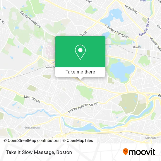
See Take It Slow Massage, Belmont, on the map
Public Transit to Take It Slow Massage in Belmont
Wondering how to get to Take It Slow Massage in Belmont? Moovit helps you find the best way to get to Take It Slow Massage with step-by-step directions from the nearest public transit station.
Moovit provides free maps and live directions to help you navigate through your city. View schedules, routes, timetables, and find out how long does it take to get to Take It Slow Massage in real time.
Looking for the nearest stop or station to Take It Slow Massage? Check out this list of stops closest to your destination: Belmont St Opp Payson Rd; Newtonville; Belmont; Alewife.
Bus: 73.Train: FITCHBURG, FRAMINGHAM/WORCESTER.Subway: RED LINE.
Want to see if there’s another route that gets you there at an earlier time? Moovit helps you find alternative routes or times. Get directions from and directions to Take It Slow Massage easily from the Moovit App or Website.
We make riding to Take It Slow Massage easy, which is why over 1.7 million users, including users in Belmont, trust Moovit as the best app for public transit. You don’t need to download an individual bus app or train app, Moovit is your all-in-one transit app that helps you find the best bus time or train time available.
For information on prices of bus, subway and train, costs and ride fares to Take It Slow Massage, please check the Moovit app.
Use the app to navigate to popular places including to the airport, hospital, stadium, grocery store, mall, coffee shop, school, college, and university.
Take It Slow Massage Address: 79 Trapelo Rd street in Belmont
- Physical Therapy Orthopedic Surgery,
- Hanami Sushi Bar and Grill,
- O'Connor Peter,
- Pequossette Playground,
- The Locksmith Shop,
- Kirwan Jessica,
- Pazienski-Davin Joan,
- Shred Nations,
- The Toland Team,
- New England Golf Guide,
- Cameron Building & Design,
- Belmont Auto Exchange,
- Brown & Hickey Funeral Home & Cremation Service,
- Ovenbird Cafe,
- Big Picture Framing,
- Donata Barber, Realtor,
- Want List Records,
- Stretchmed Belmont,
- 24 Hour Emergency Locksmith,
- Simply the Best Dogs
Places Near Take It Slow Massage (Belmont)
- Td Garden, Boston,
- House Of Blues, Boston,
- Museum Of Science, Boston,
- Castle Island, Boston,
- Boston Children's Hospital, Boston,
- Quincy Market, Boston,
- Faneuil Hall, Boston,
- Mgm Music Hall, Boston,
- Boston Common, Boston,
- Seaport District, Boston,
- Wilbur Theatre, Boston,
- North End, Boston,
- Boston Medical Center, Boston,
- Leader Bank Pavilion (Leader Bank Pavillion), Boston,
- Massachusetts General Hospital, Boston,
- Cheers, Boston,
- Wang Theater, Boston,
- Prudential Center, Boston,
- Boston Convention & Exhibition Center, Boston,
- Isabella Stewart Gardner Museum, Boston
How to get to popular places in Boston with public transit
Get around Belmont by public transit!
Traveling around Belmont has never been so easy. See step by step directions as you travel to any attraction, street or major public transit station. View bus and train schedules, arrival times, service alerts and detailed routes on a map, so you know exactly how to get to anywhere in Belmont.
When traveling to any destination around Belmont use Moovit's Live Directions with Get Off Notifications to know exactly where and how far to walk, how long to wait for your line, and how many stops are left. Moovit will alert you when it's time to get off — no need to constantly re-check whether yours is the next stop.
Wondering how to use public transit in Belmont or how to pay for public transit in Belmont? Moovit public transit app can help you navigate your way with public transit easily, and at minimum cost. It includes public transit fees, ticket prices, and costs. Looking for a map of Belmont public transit lines? Moovit public transit app shows all public transit maps in Belmont with all Bus, Train, Subway and Ferry routes and stops on an interactive map.
Boston has 4 transit type(s), including: Bus, Train, Subway and Ferry, operated by several transit agencies, including MBTA, Southeastern Regional Transit Authority, MetroWest Regional Transit Authority, Rhode Island Public Transit Authority, WRTA, Lowell Regional Transit Authority, Merrimack Valley Transit, Montachusett Regional Transit Authority, Cape Cod Regional Transit Authority, Brockton Area Transit Authority, Martha's Vineyard Transit Authority, the WAVE - Nantucket Regional Transit Authority, GATRA, Cape Ann Transportation Authority and Massport