Directions to Talya R. Benoff, Md (Boston) with public transportation
The following transit lines have routes that pass near Talya R. Benoff, Md
 Bus: 1, 54, 58, 72, 51.
- Train: PROVIDENCE/STOUGHTON, ACELA, NORTHEAST REGIONAL, PROVIDENCE LINE SHUTTLE, PROVIDENCE LINE SHUTTLE.
How to get to Talya R. Benoff, Md by bus?
Click on the bus route to see step by step directions with maps, line arrival times and updated time schedules.
How to get to Talya R. Benoff, Md by train?
Click on the train route to see step by step directions with maps, line arrival times and updated time schedules.
Bus stops near Talya R. Benoff, Md in Boston
Train stations near Talya R. Benoff, Md in Boston
- Providence, 21 min walk,VIEW
Bus lines to Talya R. Benoff, Md in Boston
What are the closest stations to Talya R. Benoff, Md?
The closest stations to Talya R. Benoff, Md are:
- Charles After Silver Spring is 355 yards away, 5 min walk.
- Walmart (Providence) is 362 yards away, 5 min walk.
- Admiral & Charles (Opposite Admiral) is 370 yards away, 5 min walk.
- Corliss Before Barbara Leonard is 575 yards away, 7 min walk.
- Providence is 1760 yards away, 21 min walk.
Which bus lines stop near Talya R. Benoff, Md?
These bus lines stop near Talya R. Benoff, Md: 1, 54, 58, 72.
Which train line stops near Talya R. Benoff, Md?
PROVIDENCE/STOUGHTON (#827 | Wickford Junction)
What’s the nearest train station to Talya R. Benoff, Md in Boston?
The nearest train station to Talya R. Benoff, Md in Boston is Providence. It’s a 21 min walk away.
What’s the nearest bus station to Talya R. Benoff, Md in Boston?
The nearest bus stations to Talya R. Benoff, Md in Boston are Charles After Silver Spring, Walmart (Providence) and Admiral & Charles (Opposite Admiral). The closest one is a 5 min walk away.
What time is the first train to Talya R. Benoff, Md in Boston?
The PROVIDENCE/STOUGHTON is the first train that goes to Talya R. Benoff, Md in Boston. It stops nearby at 4:10 AM.
What time is the last train to Talya R. Benoff, Md in Boston?
The NORTHEAST REGIONAL is the last train that goes to Talya R. Benoff, Md in Boston. It stops nearby at 9:17 AM.
What time is the first bus to Talya R. Benoff, Md in Boston?
The 54 is the first bus that goes to Talya R. Benoff, Md in Boston. It stops nearby at 5:19 AM.
What time is the last bus to Talya R. Benoff, Md in Boston?
The 54 is the last bus that goes to Talya R. Benoff, Md in Boston. It stops nearby at 12:04 AM.
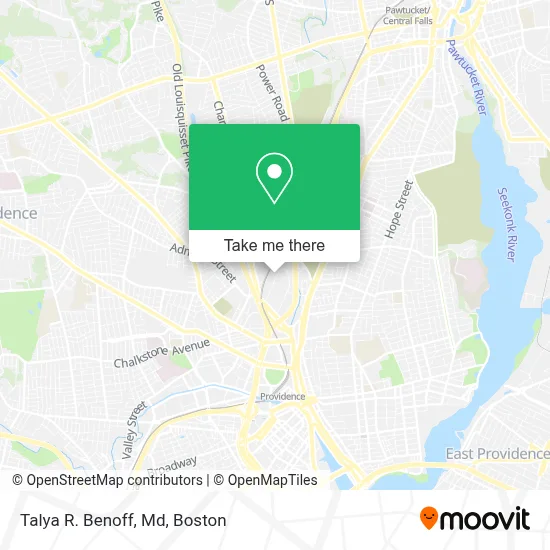
See Talya R. Benoff, Md, Boston, on the map
Public Transit to Talya R. Benoff, Md in Boston
Wondering how to get to Talya R. Benoff, Md in Boston? Moovit helps you find the best way to get to Talya R. Benoff, Md with step-by-step directions from the nearest public transit station.
Moovit provides free maps and live directions to help you navigate through your city. View schedules, routes, timetables, and find out how long does it take to get to Talya R. Benoff, Md in real time.
Looking for the nearest stop or station to Talya R. Benoff, Md? Check out this list of stops closest to your destination: Charles After Silver Spring; Walmart (Providence); Admiral & Charles (Opposite Admiral); Corliss Before Barbara Leonard; Providence.
Bus: 1, 54, 58, 72, 51.Train: PROVIDENCE/STOUGHTON, ACELA, NORTHEAST REGIONAL, PROVIDENCE LINE SHUTTLE, PROVIDENCE LINE SHUTTLE, PROVIDENCE LINE SHUTTLE, FOXBORO EVENT SERVICE.
Want to see if there’s another route that gets you there at an earlier time? Moovit helps you find alternative routes or times. Get directions from and directions to Talya R. Benoff, Md easily from the Moovit App or Website.
We make riding to Talya R. Benoff, Md easy, which is why over 1.7 million users, including users in Boston, trust Moovit as the best app for public transit. You don’t need to download an individual bus app or train app, Moovit is your all-in-one transit app that helps you find the best bus time or train time available.
For information on prices of bus and train, costs and ride fares to Talya R. Benoff, Md, please check the Moovit app.
Use the app to navigate to popular places including to the airport, hospital, stadium, grocery store, mall, coffee shop, school, college, and university.
Talya R. Benoff, Md Address: 146 W River St Ste 11B street in Boston
- Hearing Centers of Ri,
- Boston Ivf,
- Andrew Phillip MC A MD,
- Secretary STT/Corporations Div,
- Living Essence Physical Therapy & Herbal Pharmacy,
- Extended Stay America,
- Depot,
- Minute Key,
- RVS Associates,
- Medicare Health Plans,
- Minute Key,
- Mountain of Fire & Miracles Ministries PPP,
- Coinstar,
- Fresenius Kidney Care,
- Walmart Pharmacy,
- USPS Collection Box - Blue Box,
- Pillar To Post Home Inspectors- Rafael Cordero,
- Cse*Wilkinson Fuels,
- Je Liquors,
- U-Haul
Places Near Talya R. Benoff, Md (Boston)
- Wang Theater, Boston,
- Leader Bank Pavilion (Leader Bank Pavillion), Boston,
- Boston Children's Hospital, Boston,
- Mgm Music Hall, Boston,
- Isabella Stewart Gardner Museum, Boston,
- Quincy Market, Boston,
- Boston Medical Center, Boston,
- Massachusetts General Hospital, Boston,
- Seaport District, Boston,
- Prudential Center, Boston,
- Faneuil Hall, Boston,
- Castle Island, Boston,
- Boston Convention & Exhibition Center, Boston,
- Wilbur Theatre, Boston,
- Boston Common, Boston,
- Td Garden, Boston,
- Cheers, Boston,
- North End, Boston,
- Museum Of Science, Boston,
- House Of Blues, Boston
How to get to popular places in Boston with public transit
Get around Boston by public transit!
Traveling around Boston has never been so easy. See step by step directions as you travel to any attraction, street or major public transit station. View bus and train schedules, arrival times, service alerts and detailed routes on a map, so you know exactly how to get to anywhere in Boston.
When traveling to any destination around Boston use Moovit's Live Directions with Get Off Notifications to know exactly where and how far to walk, how long to wait for your line, and how many stops are left. Moovit will alert you when it's time to get off — no need to constantly re-check whether yours is the next stop.
Wondering how to use public transit in Boston or how to pay for public transit in Boston? Moovit public transit app can help you navigate your way with public transit easily, and at minimum cost. It includes public transit fees, ticket prices, and costs. Looking for a map of Boston public transit lines? Moovit public transit app shows all public transit maps in Boston with all Bus, Train, Subway and Ferry routes and stops on an interactive map.
Boston has 4 transit type(s), including: Bus, Train, Subway and Ferry, operated by several transit agencies, including MBTA, Southeastern Regional Transit Authority, MetroWest Regional Transit Authority, Rhode Island Public Transit Authority, WRTA, Lowell Regional Transit Authority, Merrimack Valley Transit, Montachusett Regional Transit Authority, Cape Cod Regional Transit Authority, Brockton Area Transit Authority, Martha's Vineyard Transit Authority, the WAVE - Nantucket Regional Transit Authority, GATRA, Cape Ann Transportation Authority and Massport