Directions to Tappen Park (Staten Island) with public transportation
The following transit lines have routes that pass near Tappen Park
How to get to Tappen Park by bus?
Click on the bus route to see step by step directions with maps, line arrival times and updated time schedules.
Bus stops near Tappen Park in Staten Island
- Canal St/Canal St, 2 min walk,
- Slosson Ter/Bay St, 22 min walk,
- Castleton Av/Brighton Av, 31 min walk,
Bus lines to Tappen Park in Staten Island
- SIM30, Midtown Via 42 St Via Madison Av,
- S52, St George Ferry,
- S74, St George Ferry,
- S78, St George Ferry Via Hylan,
- S42, St George Ferry,
- S46, St George Ferry Via Teleport,
- S96, Limited St George Via Castleton,
What are the closest stations to Tappen Park?
The closest stations to Tappen Park are:
- Canal St/Canal St is 116 yards away, 2 min walk.
- Slosson Ter/Bay St is 1664 yards away, 22 min walk.
- Castleton Av/Brighton Av is 2548 yards away, 31 min walk.
Which bus lines stop near Tappen Park?
These bus lines stop near Tappen Park: S52, S74, S76, S78, S93.
What’s the nearest bus stop to Tappen Park in Staten Island?
The nearest bus stop to Tappen Park in Staten Island is Canal St/Canal St. It’s a 2 min walk away.
See Tappen Park, Staten Island, on the map
Public Transit to Tappen Park in Staten Island
Wondering how to get to Tappen Park in Staten Island, United States? Moovit helps you find the best way to get to Tappen Park with step-by-step directions from the nearest public transit station.
Moovit provides free maps and live directions to help you navigate through your city. View schedules, routes, timetables, and find out how long does it take to get to Tappen Park in real time.
Looking for the nearest stop or station to Tappen Park? Check out this list of stops closest to your destination: Canal St/Canal St; Slosson Ter/Bay St; Castleton Av/Brighton Av.
Bus: S52, S74, S76, S78, S93, SIM30, S42, S46, S96.
Want to see if there’s another route that gets you there at an earlier time? Moovit helps you find alternative routes or times. Get directions from and directions to Tappen Park easily from the Moovit App or Website.
We make riding to Tappen Park easy, which is why over 1.5 million users, including users in Staten Island, trust Moovit as the best app for public transit. You don’t need to download an individual bus app or train app, Moovit is your all-in-one transit app that helps you find the best bus time or train time available.
For information on prices of bus and subway, costs and ride fares to Tappen Park, please check the Moovit app.
Use the app to navigate to popular places including to the airport, hospital, stadium, grocery store, mall, coffee shop, school, college, and university.
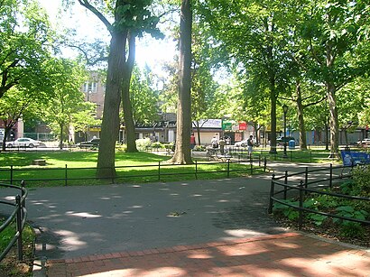
Tappen Park Address: Canal Street street in Staten Island
Attractions near Tappen Park
A Beautiful Nails,103 Canal St,Beach St / Water St,Beach Water,Water St Beach St,Tappen Park Associates 105 Water,25 Beach St,Homeport Liquors & Fine Wine,Canal St St St Wright St St,More Than Beauty Products,Stapleton,Take Ur Pic Make-Up & Photography Studio,Bay & Water,Water Bay St,Water St / Bay St,Bay St / Water,Key Plus Locks,MTA Bus - Bay St & Water St (S51 / S76),German House,Margret Ultra Home CareHow to get to popular attractions in Staten Island with public transit
125, Manhattan,Intrepid Museum, Manhattan,New York City Police Academy, Queens,Color Factory, Manhattan,Spring Valley TRANSIT Center, Spring Valley, Ny,Kings County Hospital Center,Elmhurst, NY, Queens,Governors Ball Music Festival, Manhattan,Orange, NJ, City Of Orange, Nj,Columbia University, Manhattan,Jacobi Medical Center, Bronx,Cape Liberty Cruise Terminal, Bayonne, Nj,Upper East Side, Manhattan,Roosevelt Field (Roosevelt Feild Shopping Mall), East Garden City, Ny,2nd Ave (59th st and 2nd ave), Manhattan,Brooklyn Bridge, Manhattan,125 Worth Street, Manhattan,Ground Zero / Zona Cero. New York, Manhattan,Florham Park, NJ, Florham Park, Nj,Brooklyn Public Library (Central Library)Get around New York - New Jersey by public transit!
Traveling around New York - New Jersey has never been so easy. See step by step directions as you travel to any attraction, street or major public transit station. View bus and train schedules, arrival times, service alerts and detailed routes on a map, so you know exactly how to get to anywhere in New York - New Jersey.
When traveling to any destination around New York - New Jersey use Moovit's Live Directions with Get Off Notifications to know exactly where and how far to walk, how long to wait for your line, and how many stops are left. Moovit will alert you when it's time to get off — no need to constantly re-check whether yours is the next stop.
Wondering how to use public transit in New York - New Jersey or how to pay for public transit in New York - New Jersey? Moovit public transit app can help you navigate your way with public transit easily, and at minimum cost. It includes public transit fees, ticket prices, and costs. Looking for a map of New York - New Jersey public transit lines? Moovit public transit app shows all public transit maps in New York - New Jersey with all Bus, Train, Subway, Light Rail, Ferry and Cable Car routes and stops on an interactive map.
New York - New Jersey has 6 transit type(s), including: Bus, Train, Subway, Light Rail, Ferry and Cable Car, operated by several transit agencies, including MTA Subway, Metro-North Railroad, LIRR, PATH, Shore Line East, MTA Bus Company, MTA New York City Transit - Express routes, MTA Bus, NJ Transit, NYC Ferry, NICE bus, Bee-Line Bus, NJ Transit Rail, Norwalk Transit District, CTTransit - Waterbury-Meriden