Directions to Taproom And Kitchen (Waltham) with public transportation
The following transit lines have routes that pass near Taproom And Kitchen
 Bus: 553, 554, 556, 558, 70.
- Train: FITCHBURG, FRAMINGHAM/WORCESTER.
- Subway: GREEN LINE D.
How to get to Taproom And Kitchen by bus?
Click on the bus route to see step by step directions with maps, line arrival times and updated time schedules.
From COURTYARD-Boston Cambridge (Cambridge Marriott), Cambridge
64 minFrom Harvard Museum Of Natural History, Cambridge
59 minFrom Harvard Square, Cambridge
56 minFrom Brookline High School (Brookline Town High School), Brookline
62 minFrom Brighton, Boston
53 minFrom Micro Center (Micro Elecronics), Cambridge
63 minFrom Porter Square, Cambridge
69 minFrom VFW Parkway, Boston
57 minFrom Mount Ida College, Newton
61 minFrom Harvard Stadium, Boston
50 min
How to get to Taproom And Kitchen by train?
Click on the train route to see step by step directions with maps, line arrival times and updated time schedules.
How to get to Taproom And Kitchen by subway?
Click on the subway route to see step by step directions with maps, line arrival times and updated time schedules.
Bus stops near Taproom And Kitchen in Waltham
Train stations near Taproom And Kitchen in Waltham
Bus lines to Taproom And Kitchen in Waltham
What are the closest stations to Taproom And Kitchen?
The closest stations to Taproom And Kitchen are:
- Moody St @ Ash St is 296 yards away, 4 min walk.
- Crescent St @ Walnut St is 338 yards away, 5 min walk.
- Auburndale is 2053 yards away, 25 min walk.
- Brandeis/Roberts is 4018 yards away, 47 min walk.
Which bus lines stop near Taproom And Kitchen?
These bus lines stop near Taproom And Kitchen: 553, 554, 556, 558, 70.
Which train lines stop near Taproom And Kitchen?
These train lines stop near Taproom And Kitchen: FITCHBURG, FRAMINGHAM/WORCESTER.
Which subway line stops near Taproom And Kitchen?
GREEN LINE D (Riverside)
What’s the nearest train station to Taproom And Kitchen in Waltham?
The nearest train station to Taproom And Kitchen in Waltham is Auburndale. It’s a 25 min walk away.
What’s the nearest bus station to Taproom And Kitchen in Waltham?
The nearest bus station to Taproom And Kitchen in Waltham is Moody St @ Ash St. It’s a 4 min walk away.
What time is the first train to Taproom And Kitchen in Waltham?
The FRAMINGHAM/WORCESTER is the first train that goes to Taproom And Kitchen in Waltham. It stops nearby at 5:19 AM.
What time is the last train to Taproom And Kitchen in Waltham?
The FRAMINGHAM/WORCESTER is the last train that goes to Taproom And Kitchen in Waltham. It stops nearby at 12:22 AM.
What time is the first bus to Taproom And Kitchen in Waltham?
The 505 is the first bus that goes to Taproom And Kitchen in Waltham. It stops nearby at 5:54 AM.
What time is the last bus to Taproom And Kitchen in Waltham?
The 553 is the last bus that goes to Taproom And Kitchen in Waltham. It stops nearby at 8:54 PM.
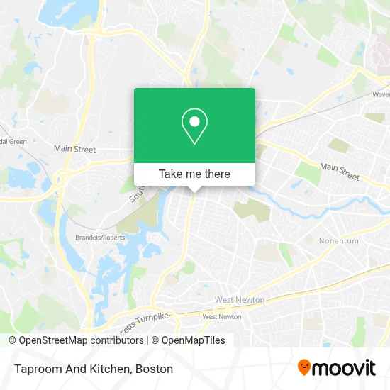
See Taproom And Kitchen, Waltham, on the map
Public Transit to Taproom And Kitchen in Waltham
Wondering how to get to Taproom And Kitchen in Waltham? Moovit helps you find the best way to get to Taproom And Kitchen with step-by-step directions from the nearest public transit station.
Moovit provides free maps and live directions to help you navigate through your city. View schedules, routes, timetables, and find out how long does it take to get to Taproom And Kitchen in real time.
Looking for the nearest stop or station to Taproom And Kitchen? Check out this list of stops closest to your destination: Moody St @ Ash St; Crescent St @ Walnut St; Auburndale; Brandeis/Roberts.
Bus: 553, 554, 556, 558, 70, 505.Train: FITCHBURG, FRAMINGHAM/WORCESTER.Subway: GREEN LINE D.
Want to see if there’s another route that gets you there at an earlier time? Moovit helps you find alternative routes or times. Get directions from and directions to Taproom And Kitchen easily from the Moovit App or Website.
We make riding to Taproom And Kitchen easy, which is why over 1.7 million users, including users in Waltham, trust Moovit as the best app for public transit. You don’t need to download an individual bus app or train app, Moovit is your all-in-one transit app that helps you find the best bus time or train time available.
For information on prices of bus, subway and train, costs and ride fares to Taproom And Kitchen, please check the Moovit app.
Use the app to navigate to popular places including to the airport, hospital, stadium, grocery store, mall, coffee shop, school, college, and university.
Taproom And Kitchen Address: 458 Moody St street in Waltham
- Rassa,
- DJ O'Connor's,
- Amuleto,
- Pho and Spice,
- United Shaolin Kempo,
- JNB Sew & Vac,
- Julio Perez Landscaping,
- Chepe S Bakery,
- Boutique Rose Marlborough,
- Patel Brothers,
- Wakuwaku Ramen Waltham,
- Waltham Dual Language School,
- Los Primos Barber Shop #3 398 Moody St Waltham Ma,
- A D T,
- Harrington Block,
- Luna Tapas,
- Iglesia Evangelica Pentecostal,
- Namirembe Church,
- Opportunities for Inclusion,
- Jen Pintos at Guaranteed Rate Affinity (NMLS #1596923)
Places Near Taproom And Kitchen (Waltham)
- Boston Medical Center, Boston,
- Prudential Center, Boston,
- House Of Blues, Boston,
- Quincy Market, Boston,
- Boston Common, Boston,
- Museum Of Science, Boston,
- Isabella Stewart Gardner Museum, Boston,
- Seaport District, Boston,
- Leader Bank Pavilion (Leader Bank Pavillion), Boston,
- Castle Island, Boston,
- North End, Boston,
- Boston Children's Hospital, Boston,
- Boston Convention & Exhibition Center, Boston,
- Massachusetts General Hospital, Boston,
- Wilbur Theatre, Boston,
- Faneuil Hall, Boston,
- Cheers, Boston,
- Mgm Music Hall, Boston,
- Wang Theater, Boston,
- Td Garden, Boston
How to get to popular places in Boston with public transit
Get around Waltham by public transit!
Traveling around Waltham has never been so easy. See step by step directions as you travel to any attraction, street or major public transit station. View bus and train schedules, arrival times, service alerts and detailed routes on a map, so you know exactly how to get to anywhere in Waltham.
When traveling to any destination around Waltham use Moovit's Live Directions with Get Off Notifications to know exactly where and how far to walk, how long to wait for your line, and how many stops are left. Moovit will alert you when it's time to get off — no need to constantly re-check whether yours is the next stop.
Wondering how to use public transit in Waltham or how to pay for public transit in Waltham? Moovit public transit app can help you navigate your way with public transit easily, and at minimum cost. It includes public transit fees, ticket prices, and costs. Looking for a map of Waltham public transit lines? Moovit public transit app shows all public transit maps in Waltham with all Bus, Train, Subway and Ferry routes and stops on an interactive map.
Boston has 4 transit type(s), including: Bus, Train, Subway and Ferry, operated by several transit agencies, including MBTA, Southeastern Regional Transit Authority, MetroWest Regional Transit Authority, Rhode Island Public Transit Authority, WRTA, Lowell Regional Transit Authority, Merrimack Valley Transit, Montachusett Regional Transit Authority, Cape Cod Regional Transit Authority, Brockton Area Transit Authority, Martha's Vineyard Transit Authority, the WAVE - Nantucket Regional Transit Authority, GATRA, Cape Ann Transportation Authority and Massport