Directions to Taracon (Acushnet Center) with public transportation
The following transit lines have routes that pass near Taracon
 Bus: 202, 221.
- Train: FALL RIVER/NEW BEDFORD.
How to get to Taracon by bus?
Click on the bus route to see step by step directions with maps, line arrival times and updated time schedules.
From B.M.C. Durfee High School, Fall River
95 minFrom Walmart Fall River Supercenter, Fall River
109 minFrom Lizzy Borden House, Fall River
73 minFrom Amazon Fulfillment Bos7, Fall River
121 minFrom RMV New Bedford, New Bedford
59 minFrom Bedford Industrial Park, New Bedford
62 minFrom Charlton Memorial Hospital, Fall River
114 minFrom Bristol Community College, Fall River
96 minFrom Mass Maritime Academy, Buzzards Bay
160 min
How to get to Taracon by train?
Click on the train route to see step by step directions with maps, line arrival times and updated time schedules.
Bus stops near Taracon in Acushnet Center
Train station near Taracon in Acushnet Center
- Church Street, 22 min walk,VIEW
What are the closest stations to Taracon?
The closest stations to Taracon are:
- Acushnet Ave And Ohio St is 769 yards away, 9 min walk.
- Lund's Corner is 1395 yards away, 17 min walk.
- Church Street is 1836 yards away, 22 min walk.
Which bus lines stop near Taracon?
These bus lines stop near Taracon: 202, 221.
Which train line stops near Taracon?
FALL RIVER/NEW BEDFORD (#2011 | New Bedford)
What’s the nearest train station to Taracon in Acushnet Center?
The nearest train station to Taracon in Acushnet Center is Church Street. It’s a 22 min walk away.
What’s the nearest bus station to Taracon in Acushnet Center?
The nearest bus station to Taracon in Acushnet Center is Acushnet Ave And Ohio St. It’s a 9 min walk away.
What time is the first train to Taracon in Acushnet Center?
The FALL RIVER/NEW BEDFORD is the first train that goes to Taracon in Acushnet Center. It stops nearby at 4:22 AM.
What time is the last train to Taracon in Acushnet Center?
The FALL RIVER/NEW BEDFORD is the last train that goes to Taracon in Acushnet Center. It stops nearby at 1:28 AM.
What time is the first bus to Taracon in Acushnet Center?
The 202 is the first bus that goes to Taracon in Acushnet Center. It stops nearby at 5:36 AM.
What time is the last bus to Taracon in Acushnet Center?
The 202 is the last bus that goes to Taracon in Acushnet Center. It stops nearby at 9:42 PM.
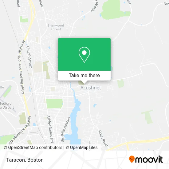
See Taracon, Acushnet Center, on the map
Public Transit to Taracon in Acushnet Center
Wondering how to get to Taracon in Acushnet Center? Moovit helps you find the best way to get to Taracon with step-by-step directions from the nearest public transit station.
Moovit provides free maps and live directions to help you navigate through your city. View schedules, routes, timetables, and find out how long does it take to get to Taracon in real time.
Looking for the nearest stop or station to Taracon? Check out this list of stops closest to your destination: Acushnet Ave And Ohio St; Lund's Corner; Church Street.
Bus: 202, 221.Train: FALL RIVER/NEW BEDFORD.
Want to see if there’s another route that gets you there at an earlier time? Moovit helps you find alternative routes or times. Get directions from and directions to Taracon easily from the Moovit App or Website.
We make riding to Taracon easy, which is why over 1.7 million users, including users in Acushnet Center, trust Moovit as the best app for public transit. You don’t need to download an individual bus app or train app, Moovit is your all-in-one transit app that helps you find the best bus time or train time available.
For information on prices of bus and train, costs and ride fares to Taracon, please check the Moovit app.
Use the app to navigate to popular places including to the airport, hospital, stadium, grocery store, mall, coffee shop, school, college, and university.
Taracon Address: 5 Boylston St street in Acushnet Center
- Bella's Beauty Sallon,
- A'Spa Salon,
- Care, Southcoast,
- Coastal Kids,
- Go Fetch,
- Statewide Protective Security Services,
- Belle Vie Aesthetics,
- Divinely Balanced Holistic Healing,
- Gps Tile And More,
- 9/11 Memorial-Acushnet,
- Acushnet Fire Department Station 1 Headquarters,
- Acushnet Fire Department,
- Acushnet Wesley United Methodist Church,
- Brotherhood Construction,
- Liberty Auto Parts Ii,Inc - Napa Auto Parts,
- New England Farms,
- Suitable For Framing,
- United States Postal Service,
- Veterans Of Foreign Wars 7239,
- Tabor Cemetery
Places Near Taracon (Acushnet Center)
- Museum Of Science, Boston,
- Massachusetts General Hospital, Boston,
- Td Garden, Boston,
- Cheers, Boston,
- House Of Blues, Boston,
- Leader Bank Pavilion (Leader Bank Pavillion), Boston,
- Isabella Stewart Gardner Museum, Boston,
- Boston Children's Hospital, Boston,
- North End, Boston,
- Wilbur Theatre, Boston,
- Seaport District, Boston,
- Boston Medical Center, Boston,
- Boston Common, Boston,
- Wang Theater, Boston,
- Castle Island, Boston,
- Mgm Music Hall, Boston,
- Boston Convention & Exhibition Center, Boston,
- Prudential Center, Boston,
- Faneuil Hall, Boston,
- Quincy Market, Boston
How to get to popular places in Boston with public transit
Get around Acushnet Center by public transit!
Traveling around Acushnet Center has never been so easy. See step by step directions as you travel to any attraction, street or major public transit station. View bus and train schedules, arrival times, service alerts and detailed routes on a map, so you know exactly how to get to anywhere in Acushnet Center.
When traveling to any destination around Acushnet Center use Moovit's Live Directions with Get Off Notifications to know exactly where and how far to walk, how long to wait for your line, and how many stops are left. Moovit will alert you when it's time to get off — no need to constantly re-check whether yours is the next stop.
Wondering how to use public transit in Acushnet Center or how to pay for public transit in Acushnet Center? Moovit public transit app can help you navigate your way with public transit easily, and at minimum cost. It includes public transit fees, ticket prices, and costs. Looking for a map of Acushnet Center public transit lines? Moovit public transit app shows all public transit maps in Acushnet Center with all Bus, Train, Subway and Ferry routes and stops on an interactive map.
Boston has 4 transit type(s), including: Bus, Train, Subway and Ferry, operated by several transit agencies, including MBTA, Southeastern Regional Transit Authority, MetroWest Regional Transit Authority, Rhode Island Public Transit Authority, WRTA, Lowell Regional Transit Authority, Merrimack Valley Transit, Montachusett Regional Transit Authority, Cape Cod Regional Transit Authority, Brockton Area Transit Authority, Martha's Vineyard Transit Authority, the WAVE - Nantucket Regional Transit Authority, GATRA, Cape Ann Transportation Authority and Massport