Directions to Target Field (Minneapolis) with public transportation
The following transit lines have routes that pass near Target Field
 Bus: 17, 22, 61, 94, METRO C LINE.
- Light Rail: METRO BLUE LINE, METRO GREEN LINE.
How to get to Target Field by bus?
Click on the bus route to see step by step directions with maps, line arrival times and updated time schedules.
Bus stops near Target Field in Minneapolis
- Minneapolis Bus Station, 5 min walk,
- 5th St Transit Center Gate A, 5 min walk,
- 7th St N & Twins Way, 6 min walk,
- 7th St & Olson Station, 7 min walk,
- Washington Ave N & 6th Ave N, 9 min walk,
- Glenwood Ave & 10th St N, 9 min walk,
- 3rd St N & 1st Ave N, 11 min walk,
- 2nd St N & 3rd Ave - Layover, 11 min walk,
Light Rail stations near Target Field in Minneapolis
- Target Field Platform 2, 13 min walk,
Bus lines to Target Field in Minneapolis
- GREYHOUND US0150, Chicago Bus Station,
- GREYHOUND US0150S, Chicago Bus Station,
- FLIXBUS 2548, Minneapolis Bus Station,
- 14, Broadway / Robbinsdale / Via France,
- 94, Express / I-94 / Downtown St Paul,
- 134, Ltd Stop / Cleveland / Norfolk,
- 355, Express / Woodbury,
- 363, Express / St Paul / Cottage Grove P&R,
- 5, Chicago - 56st,
- 22, Brklyn Ctr Tc / N Lyndale / Via Penn Av,
- 755, Ltd Stop / Downtown / Gold Vall Rd,
- METRO C LINE, Penn / Downtown Minneapolis,
- METRO D LINE, Chicago-Fremont / Brooklyn Ctr Tc,
- 3, Como Av / Eustis Pr,
- 7, Plymouth / Theo Wirth,
- 9, E 25st - 36av / 46st Station,
- 760, Express / 65av-Brooklyn,
- 763, Express / Brookdale Dr / Xerxes Av,
- 765, Express / Target N Campus,
- 766, Express / Richardson Pr / Cartway Rd,
What are the closest stations to Target Field?
The closest stations to Target Field are:
- Minneapolis Bus Station is 344 yards away, 5 min walk.
- 5th St Transit Center Gate A is 398 yards away, 5 min walk.
- 7th St N & Twins Way is 471 yards away, 6 min walk.
- 7th St & Olson Station is 588 yards away, 7 min walk.
- Washington Ave N & 6th Ave N is 687 yards away, 9 min walk.
- Glenwood Ave & 10th St N is 761 yards away, 9 min walk.
- 3rd St N & 1st Ave N is 846 yards away, 11 min walk.
- 2nd St N & 3rd Ave - Layover is 866 yards away, 11 min walk.
- Target Field Platform 2 is 1063 yards away, 13 min walk.
Which bus lines stop near Target Field?
These bus lines stop near Target Field: 17, 22, 61, 94, METRO C LINE, METRO E LINE.
Which light rail lines stop near Target Field?
These light rail lines stop near Target Field: METRO BLUE LINE, METRO GREEN LINE.
What’s the nearest light rail station to Target Field in Minneapolis?
The nearest light rail station to Target Field in Minneapolis is Target Field Platform 2. It’s a 13 min walk away.
What’s the nearest bus station to Target Field in Minneapolis?
The nearest bus stations to Target Field in Minneapolis are Minneapolis Bus Station and 5th St Transit Center Gate A. The closest one is a 5 min walk away.
What time is the first light rail to Target Field in Minneapolis?
The METRO BLUE LINE is the first light rail that goes to Target Field in Minneapolis. It stops nearby at 4:28 AM.
What time is the last light rail to Target Field in Minneapolis?
The METRO BLUE LINE is the last light rail that goes to Target Field in Minneapolis. It stops nearby at 12:51 AM.
What time is the first bus to Target Field in Minneapolis?
The 3 is the first bus that goes to Target Field in Minneapolis. It stops nearby at 4:05 AM.
What time is the last bus to Target Field in Minneapolis?
The GREYHOUND US0150 is the last bus that goes to Target Field in Minneapolis. It stops nearby at 7:30 AM.
See Target Field, Minneapolis, on the map
Public Transit to Target Field in Minneapolis
Wondering how to get to Target Field in Minneapolis? Moovit helps you find the best way to get to Target Field with step-by-step directions from the nearest public transit station.
Moovit provides free maps and live directions to help you navigate through your city. View schedules, routes, timetables, and find out how long does it take to get to Target Field in real time.
Looking for the nearest stop or station to Target Field? Check out this list of stops closest to your destination: Minneapolis Bus Station; 5th St Transit Center Gate A; 7th St N & Twins Way; 7th St & Olson Station; Washington Ave N & 6th Ave N; Glenwood Ave & 10th St N; 3rd St N & 1st Ave N; 2nd St N & 3rd Ave - Layover; Target Field Platform 2.
Bus: 17, 22, 61, 94, METRO C LINE, METRO E LINE, GREYHOUND US0150, GREYHOUND US0150S, FLIXBUS 2548, 14, 134, 355, 363, 5, 755, METRO D LINE, 3, 7, 9.Light Rail: METRO BLUE LINE, METRO GREEN LINE.
Want to see if there’s another route that gets you there at an earlier time? Moovit helps you find alternative routes or times. Get directions from and directions to Target Field easily from the Moovit App or Website.
We make riding to Target Field easy, which is why over 1.5 million users, including users in Minneapolis, trust Moovit as the best app for public transit. You don’t need to download an individual bus app or train app, Moovit is your all-in-one transit app that helps you find the best bus time or train time available.
For information on prices of bus and light rail, costs and ride fares to Target Field, please check the Moovit app.
Use the app to navigate to popular places including to the airport, hospital, stadium, grocery store, mall, coffee shop, school, college, and university.
Target Field Address: North 5th Street street in Minneapolis
- Burlington Northern Railroad,
- Regional Railroad Authority,
- Red Circle,
- North Star Line,
- Minneapolis Christkindl Market,
- Salt & Flour Kitchen,
- Hope Breakfast Bar - Minneapolis North Loop,
- Target Field Station,
- Target Field Gate 6,
- Bassett Hound,
- Coffee Beanery,
- Budweiser Roof Deck,
- Trax Burgers and Bar,
- Fillmore Minneapolis,
- The Harp,
- Paris Dining Club,
- Hushcha Studio,
- Comedy at the Crane,
- Suite 42 - Target Field,
- Pizza Lucé
Places Near Target Field (Minneapolis)
- Minneapolis Institute of Art, Minneapolis,
- St. Paul College, St. Paul,
- 3m Arena at Mariucci, Minneapolis,
- Minnesota State Capitol, St. Paul,
- Minneapolis Convention Center, Minneapolis,
- Surly Brewing Co., Minneapolis,
- Treasure Island Resort & Casino, St. Paul,
- Minnehaha Falls, Minneapolis,
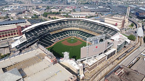
- Target Field, Minneapolis,
- Huntington Bank Stadium, Minneapolis,
- Harriet Island Regional Park, St. Paul,
- Abbott Northwestern Piper Building, Minneapolis,
- Mpls. Convention Center, Minneapolis,
- Grand Casino Hinckley,MN, Minneapolis,
- Mystic lake casino bus, Minneapolis,
- Bishop Henry Whipple Federal Building,
- Xcel Energy Center, St. Paul,
- Northrop Auditorium, Minneapolis,
- Target Center, Minneapolis,
- St. Nygaard's House Of Legal Prostitution, St. Paul
How to get to popular places in Minneapolis - St. Paul, MN with public transit
Get around Minneapolis by public transit!
Traveling around Minneapolis has never been so easy. See step by step directions as you travel to any attraction, street or major public transit station. View bus and train schedules, arrival times, service alerts and detailed routes on a map, so you know exactly how to get to anywhere in Minneapolis.
When traveling to any destination around Minneapolis use Moovit's Live Directions with Get Off Notifications to know exactly where and how far to walk, how long to wait for your line, and how many stops are left. Moovit will alert you when it's time to get off — no need to constantly re-check whether yours is the next stop.
Wondering how to use public transit in Minneapolis or how to pay for public transit in Minneapolis? Moovit public transit app can help you navigate your way with public transit easily, and at minimum cost. It includes public transit fees, ticket prices, and costs. Looking for a map of Minneapolis public transit lines? Moovit public transit app shows all public transit maps in Minneapolis with all Bus, Train and Light Rail routes and stops on an interactive map.
Minneapolis - St. Paul, MN has 3 transit type(s), including: Bus, Train and Light Rail, operated by several transit agencies, including Metro Transit , Metro Transit, MVTA, Plymouth Metrolink, SouthWest Transit, Maple Grove, University of Minnesota, Airport (MAC), Amtrak, Mankato Transit System, SMART, FlixBus-us and Greyhound-us