See Tariff Commission Building, Washington, on the map
Directions to Tariff Commission Building (Washington) with public transportation
The following transit lines have routes that pass near Tariff Commission Building
 Bus:
Bus: - Train:
- Metro:
How to get to Tariff Commission Building by bus?
Click on the bus route to see step by step directions with maps, line arrival times and updated time schedules.
How to get to Tariff Commission Building by train?
Click on the train route to see step by step directions with maps, line arrival times and updated time schedules.
How to get to Tariff Commission Building by metro?
Click on the metro route to see step by step directions with maps, line arrival times and updated time schedules.
Bus stations near Tariff Commission Building in Washington
- E St NW + 7th St NW,2 min walk,
- 7th St + E St,2 min walk,
- 9th St NW + G St NW,5 min walk,
- 7th St + H St,5 min walk,
- Pennsylvania Ave & 9th St NW Wb,6 min walk,
- Pennsylvania Ave Nw & 7th St Nw,6 min walk,
Metro stations near Tariff Commission Building in Washington
- Gallery Place-Chinatown,4 min walk,
- Smithsonian National Mall,18 min walk,
- L'Enfant Plaza,19 min walk,
Bus lines to Tariff Commission Building in Washington
- D6,West To Sibley Hospital,
- 70,North To Silver Spring,
- 74,North To Convention Center,
- X9,East To Capitol Heights,
- 79,North To Silver Spring,
- 230,230/12 Severna Park,
- 250,250/7 Kent Island,
- 830,830/14 Sunderland / Dunkirk,
- 840,840/10 Prince Frederick / St Leonard,
- 943,Pentagon / Staffordboro Lot,
- 953,234 Lot / Montclair,
- P6,North To Rhode Island Ave Station,
- 32,West To Potomac Park,
- 36,West To Potomac Park,
What are the closest stations to Tariff Commission Building?
The closest stations to Tariff Commission Building are:
- E St NW + 7th St NW is 77 yards away, 2 min walk.
- 7th St + E St is 94 yards away, 2 min walk.
- Gallery Place-Chinatown is 262 yards away, 4 min walk.
- 9th St NW + G St NW is 330 yards away, 5 min walk.
- 7th St + H St is 365 yards away, 5 min walk.
- Pennsylvania Ave & 9th St NW Wb is 395 yards away, 6 min walk.
- Pennsylvania Ave Nw & 7th St Nw is 413 yards away, 6 min walk.
- Smithsonian National Mall is 1459 yards away, 18 min walk.
- L'Enfant Plaza is 1480 yards away, 19 min walk.
Which bus lines stop near Tariff Commission Building?
These bus lines stop near Tariff Commission Building: 315, 33, 42, 43, 70, D6, G8, L-100, MC-100.
Which train lines stop near Tariff Commission Building?
These train lines stop near Tariff Commission Building: MANASSAS LINE, MARC.
Which metro lines stop near Tariff Commission Building?
These metro lines stop near Tariff Commission Building: METRORAIL GREEN LINE, METRORAIL ORANGE LINE, METRORAIL RED LINE, METRORAIL YELLOW LINE.
What’s the nearest metro station to Tariff Commission Building in Washington?
The nearest metro station to Tariff Commission Building in Washington is Gallery Place-Chinatown. It’s a 4 min walk away.
What’s the nearest bus stop to Tariff Commission Building in Washington?
The nearest bus stops to Tariff Commission Building in Washington are E St NW + 7th St NW and 7th St + E St. The closest one is a 2 min walk away.
See Tariff Commission Building, Washington, on the map
Public Transit to Tariff Commission Building in Washington
Wondering how to get to Tariff Commission Building in Washington, United States? Moovit helps you find the best way to get to Tariff Commission Building with step-by-step directions from the nearest public transit station.
Moovit provides free maps and live directions to help you navigate through your city. View schedules, routes, timetables, and find out how long does it take to get to Tariff Commission Building in real time.
Looking for the nearest stop or station to Tariff Commission Building? Check out this list of stops closest to your destination: E St NW + 7th St NW; 7th St + E St; Gallery Place-Chinatown; 9th St NW + G St NW; 7th St + H St; Pennsylvania Ave & 9th St NW Wb; Pennsylvania Ave Nw & 7th St Nw; Smithsonian National Mall; L'Enfant Plaza.
Bus:Train:Metro:
Want to see if there’s another route that gets you there at an earlier time? Moovit helps you find alternative routes or times. Get directions from and directions to Tariff Commission Building easily from the Moovit App or Website.
We make riding to Tariff Commission Building easy, which is why over 1.5 million users, including users in Washington, trust Moovit as the best app for public transit. You don’t need to download an individual bus app or train app, Moovit is your all-in-one transit app that helps you find the best bus time or train time available.
For information on prices of metro, bus and train, costs and ride fares to Tariff Commission Building, please check the Moovit app.
Use the app to navigate to popular places including to the airport, hospital, stadium, grocery store, mall, coffee shop, school, college, and university.
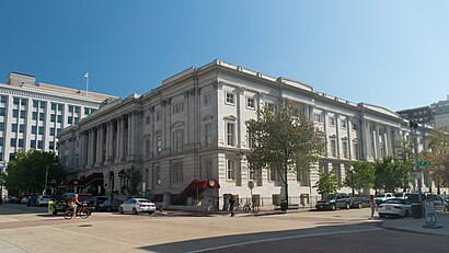
Tariff Commission Building Address: 7th Street Northwest street in Washington
Attractions near Tariff Commission Building
Dirty Habit,Kimpton Hotels-Impton Hotel Monaco Washington Dc (Monaco Hotel Washington Dc),Kimpton Hotel Monaco Washington DC,Venga - www.govenga.com,District Chophouse & Brewery,AARP Hatchery,Rosa Mexicano - Penn Quarter,DLA Piper LLP,DC Flacks Meetup,Red Velvet Cupcakery,AARP Foundation,8th St St F St,Museum of Censored Art,Matchbox - Penn Quarter,The Boardwalk,7th E St,Jaleo,Penn Social,509 7th St NW,Venable LLPHow to get to popular attractions in Washington with public transit
AU – Kerwin Hall, Washington,The Ugly Mug, Washington,Sweetwater Tavern, Fairfax County,P.J. Clarke's, Washington,Odenton MARC Station, Anne Arundel County,Merritt Downtown Athletic Club, Baltimore,Horseshoe Baltimore, Baltimore,Daniel O'Connell's Irish Restaurant & Bar, Alexandria,Dave & Buster's, Anne Arundel County,Anne Arundel Community College, Anne Arundel County,Miss Shirley's Cafe, Baltimore,Duffy's Irish Pub, Washington,Fogo de Chao, Washington,Nordstrom Tysons Corner Center, Fairfax County,Hyatt Regency Reston, Fairfax County,Urbana, Washington,Glen Burnie, MD, Anne Arundel County,Mount Vernon Place, Baltimore,Greater Baltimore Medical Center, Baltimore County,Union Pub, WashingtonGet around Washington by public transit!
Traveling around Washington has never been so easy. See step by step directions as you travel to any attraction, street or major public transit station. View bus and train schedules, arrival times, service alerts and detailed routes on a map, so you know exactly how to get to anywhere in Washington.
When traveling to any destination around Washington use Moovit's Live Directions with Get Off Notifications to know exactly where and how far to walk, how long to wait for your line, and how many stops are left. Moovit will alert you when it's time to get off — no need to constantly re-check whether yours is the next stop.
Wondering how to use public transit in Washington or how to pay for public transit in Washington? Moovit public transit app can help you navigate your way with public transit easily, and at minimum cost. It includes public transit fees, ticket prices, and costs. Looking for a map of Washington public transit lines? Moovit public transit app shows all public transit maps in Washington with all metro, bus or train routes and stops on an interactive map.
Washington has 3 transit type(s), including: metro, bus or train, operated by several transit agencies, including WMATA, WMATA, Montgomery County Ride On, Fairfax Connector, TheBus, DC Circulator, MDOT MTA, Marc, MDOT MTA, MDOT MTA, Virginia Railway Express (VRE), PRTC, DASH - Alexandria, Arlington Transit (ART) and DC Streetcar