See Taube Tennis Center, Stanford, on the map
Directions to Taube Tennis Center (Stanford) with public transportation
The following transit lines have routes that pass near Taube Tennis Center
 Bus:
Bus: - Train:
How to get to Taube Tennis Center by bus?
Click on the bus route to see step by step directions with maps, line arrival times and updated time schedules.
How to get to Taube Tennis Center by train?
Click on the train route to see step by step directions with maps, line arrival times and updated time schedules.
Bus stations near Taube Tennis Center in Stanford
- Serra St @ Schwab Ctr,7 min walk,
- El Camino & Pamf Sb,16 min walk,
- El Camino & Pamf/Wells,17 min walk,
Bus lines to Taube Tennis Center in Stanford
- C LINE,On Clark Way @ VI at Palo Alto,
- C LINE LIMITED AM/PM,Stock Farm Garage,
- 22,Eastridge,
- RP PM,Research Park,
- X,X Line,
- XL-PM,X Limited PM,
What are the closest stations to Taube Tennis Center?
The closest stations to Taube Tennis Center are:
- Serra St @ Schwab Ctr is 544 yards away, 7 min walk.
- El Camino & Pamf Sb is 1275 yards away, 16 min walk.
- El Camino & Pamf/Wells is 1395 yards away, 17 min walk.
Which bus line stops near Taube Tennis Center?
Y
Which train line stops near Taube Tennis Center?
LIMITED
What’s the nearest bus stop to Taube Tennis Center in Stanford?
The nearest bus stop to Taube Tennis Center in Stanford is Serra St @ Schwab Ctr. It’s a 7 min walk away.
See Taube Tennis Center, Stanford, on the map
Public Transit to Taube Tennis Center in Stanford
Wondering how to get to Taube Tennis Center in Stanford, United States? Moovit helps you find the best way to get to Taube Tennis Center with step-by-step directions from the nearest public transit station.
Moovit provides free maps and live directions to help you navigate through your city. View schedules, routes, timetables, and find out how long does it take to get to Taube Tennis Center in real time.
Looking for the nearest stop or station to Taube Tennis Center? Check out this list of stops closest to your destination: Serra St @ Schwab Ctr; El Camino & Pamf Sb; El Camino & Pamf/Wells.
Bus:Train:
Want to see if there’s another route that gets you there at an earlier time? Moovit helps you find alternative routes or times. Get directions from and directions to Taube Tennis Center easily from the Moovit App or Website.
We make riding to Taube Tennis Center easy, which is why over 1.5 million users, including users in Stanford, trust Moovit as the best app for public transit. You don’t need to download an individual bus app or train app, Moovit is your all-in-one transit app that helps you find the best bus time or train time available.
For information on prices of bus, train and light rail, costs and ride fares to Taube Tennis Center, please check the Moovit app.
Use the app to navigate to popular places including to the airport, hospital, stadium, grocery store, mall, coffee shop, school, college, and university.
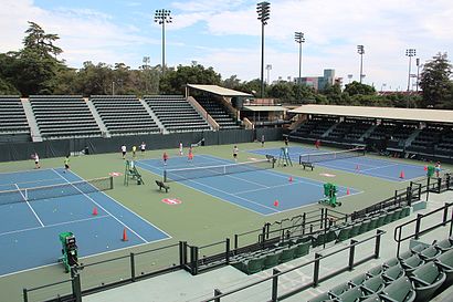
Taube Tennis Center Address: Campus Drive street in Stanford
Attractions near Taube Tennis Center
Taube Family Tennis Stadium,Stanford Softball Stadium,Kissick Auditorium,Arrillaga Sports Center,655 Campus Dr,In Memory Of Charles A. “Chuck” Taylor,De Guerre Pool,Stanford Beach Volleyball Courts,Encina Gymnasium,Cardinal Wrestling Camps,Stanford Visitor Center,In Memory Of Glenn S. “Pop” Warner,Baker Pool,235 Sam MacDonald Mall,Track House,Stanford Alumni Association,Stanford Alumni (Frances C. Arrillaga Alumni Center),Beam, Stanford Career Education,355 Galvez Street,Pogoseat with Stanford Cardinal BasketballHow to get to popular attractions in Stanford with public transit
Costco Wholesale, Sunnyvale,Daly City BART, Daly City,Downtown San Jose, San Jose,Walmart Supercenter, Antioch,West Dublin / Pleasanton BART Station, Pleasanton,City of Cupertino, Cupertino,Safeway, Campbell,Colma, Colma,City of San Carlos, San Carlos,Googleplex - Charlie's Cafe,Tamien Caltrain Station, San Jose,McCarthy Ranch, Milpitas,Boudin Bakery Café SFO, Sfo,Kaiser Permanente Medical Center, Santa Clara,Silicon Valley, Santa Clara,AMC Saratoga 14, San Jose,Norman Y. Mineta San José International Airport (SJC), San Jose,eBay Headquarters, San Jose,Sonoma County Fairgrounds, Santa Rosa,City of Pinole, PinoleGet around Stanford by public transit!
Traveling around Stanford has never been so easy. See step by step directions as you travel to any attraction, street or major public transit station. View bus and train schedules, arrival times, service alerts and detailed routes on a map, so you know exactly how to get to anywhere in Stanford.
When traveling to any destination around Stanford use Moovit's Live Directions with Get Off Notifications to know exactly where and how far to walk, how long to wait for your line, and how many stops are left. Moovit will alert you when it's time to get off — no need to constantly re-check whether yours is the next stop.
Wondering how to use public transit in Stanford or how to pay for public transit in Stanford? Moovit public transit app can help you navigate your way with public transit easily, and at minimum cost. It includes public transit fees, ticket prices, and costs. Looking for a map of Stanford public transit lines? Moovit public transit app shows all public transit maps in Stanford with all bus, train or light rail routes and stops on an interactive map.
Stanford has 3 transit type(s), including: bus, train or light rail, operated by several transit agencies, including BART, Bay Area Rapid Transit, Muni Metro, Caltrain, VTA, Capitol Corridor, Sonoma Marin Area Rail Transit, MUNI, VTA, SF Cable Car, AC Transit, Dumbarton Express, Golden Gate Transit, County Connection and SamTrans