How to get to Taunton Orthodontic by bus?
Click on the bus route to see step by step directions with maps, line arrival times and updated time schedules.
Bus stops near Taunton Orthodontic
Bus lines to Taunton Orthodontic
What are the closest stations to Taunton Orthodontic?
The closest stations to Taunton Orthodontic are:
- Thomas School is 289 yards away, 4 min walk.
- Court St. is 715 yards away, 9 min walk.
- Green is 734 yards away, 9 min walk.
- Martin Sr. Pkwy is 781 yards away, 10 min walk.
- Taunton Terminal is 841 yards away, 11 min walk.
Which bus lines stop near Taunton Orthodontic?
These bus lines stop near Taunton Orthodontic: 18, 8.
What’s the nearest bus station to Taunton Orthodontic?
The nearest bus station to Taunton Orthodontic is Thomas School. It’s a 4 min walk away.
What time is the first bus to Taunton Orthodontic?
The 18 is the first bus that goes to Taunton Orthodontic. It stops nearby at 4:50 AM.
What time is the last bus to Taunton Orthodontic?
The 8 is the last bus that goes to Taunton Orthodontic. It stops nearby at 8:50 PM.
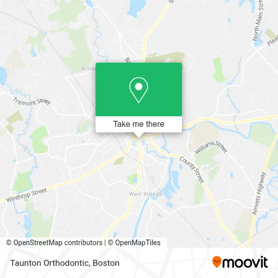
See Taunton Orthodontic on the map
Public Transportation to Taunton Orthodontic
Wondering how to get to Taunton Orthodontic? Moovit helps you find the best way to get to Taunton Orthodontic with step-by-step directions from the nearest public transit station.
Moovit provides free maps and live directions to help you navigate through your city. View schedules, routes, timetables, and find out how long does it take to get to Taunton Orthodontic in real time.
Looking for the nearest stop or station to Taunton Orthodontic? Check out this list of stops closest to your destination: Thomas School; Court St.; Green; Martin Sr. Pkwy; Taunton Terminal.
Bus: 18, 8, 7, 4, 6, 2.
Want to see if there’s another route that gets you there at an earlier time? Moovit helps you find alternative routes or times. Get directions from and directions to Taunton Orthodontic easily from the Moovit App or Website.
We make riding to Taunton Orthodontic easy, which is why over 1.7 million users, including users in Taunton, trust Moovit as the best app for public transit. You don’t need to download an individual bus app or train app, Moovit is your all-in-one transit app that helps you find the best bus time or train time available.
For information on prices of bus and train, costs and ride fares to Taunton Orthodontic, please check the Moovit app.
Use the app to navigate to popular places including to the airport, hospital, stadium, grocery store, mall, coffee shop, school, college, and university.
Taunton Orthodontic Address: 36 Weir St street in Taunton
- Natalie Shlosman,
- Barry M Jaye DDS,
- Neighbors Coffee & Co,
- Budget,
- Candid Autocare Auto Repair,
- KBT Hair Supplies,
- Katiejodly,
- Lomba Driving School,
- Tex Barry's Coney Island Hot Dogs,
- Mabrouk Financial Services,
- Painting at Splash,
- Pillsbury Florist at Studio,
- Justine Marie Spiritual Medium,
- City Thrift Taunton,
- New Hope Christian Chapel,
- Brazilian Top Team Boston,
- Family Resource Center - Taunton / Attleboro,
- Brighter Daze Hair Salon,
- Eat Africana,
- Sentry Federal Savings Bank
Places Near Taunton Orthodontic
- Wilbur Theatre, Boston,
- Museum Of Science, Boston,
- Quincy Market, Boston,
- Leader Bank Pavilion (Leader Bank Pavillion), Boston,
- Boston Common, Boston,
- Cheers, Boston,
- Boston Convention & Exhibition Center, Boston,
- House Of Blues, Boston,
- Boston Children's Hospital, Boston,
- Seaport District, Boston,
- Castle Island, Boston,
- Faneuil Hall, Boston,
- Mgm Music Hall, Boston,
- North End, Boston,
- Td Garden, Boston,
- Wang Theater, Boston,
- Boston Medical Center, Boston,
- Isabella Stewart Gardner Museum, Boston,
- Massachusetts General Hospital, Boston,
- Prudential Center, Boston
How to get to popular places in Boston with public transit
Get around Taunton by public transit!
Traveling around Taunton has never been so easy. See step by step directions as you travel to any attraction, street or major public transit station. View bus and train schedules, arrival times, service alerts and detailed routes on a map, so you know exactly how to get to anywhere in Taunton.
When traveling to any destination around Taunton use Moovit's Live Directions with Get Off Notifications to know exactly where and how far to walk, how long to wait for your line, and how many stops are left. Moovit will alert you when it's time to get off — no need to constantly re-check whether yours is the next stop.
Wondering how to use public transit in Taunton or how to pay for public transit in Taunton? Moovit public transit app can help you navigate your way with public transit easily, and at minimum cost. It includes public transit fees, ticket prices, and costs. Looking for a map of Taunton public transit lines? Moovit public transit app shows all public transit maps in Taunton with all Bus, Train, Subway and Ferry routes and stops on an interactive map.
Boston has 4 transit type(s), including: Bus, Train, Subway and Ferry, operated by several transit agencies, including MBTA, Southeastern Regional Transit Authority, MetroWest Regional Transit Authority, Rhode Island Public Transit Authority, WRTA, Lowell Regional Transit Authority, Merrimack Valley Transit, Montachusett Regional Transit Authority, Cape Cod Regional Transit Authority, Brockton Area Transit Authority, Martha's Vineyard Transit Authority, the WAVE - Nantucket Regional Transit Authority, GATRA, Cape Ann Transportation Authority and Massport