Directions to Tca Counseling Group (Boston) with public transportation
The following transit lines have routes that pass near Tca Counseling Group
 Bus: 354, 501, 504, 9, BB.
- Train: FRAMINGHAM/WORCESTER, HAVERHILL, NEEDHAM, FOXBORO EVENT SERVICE, FRANKLIN/FOXBORO.
- Subway: GREEN LINE B, GREEN LINE C, GREEN LINE D, ORANGE LINE, GREEN LINE E.
How to get to Tca Counseling Group by bus?
Click on the bus route to see step by step directions with maps, line arrival times and updated time schedules.
From Melrose Wakefield Hospital, Malden
80 minFrom Heartbreak Hill, Newton
42 minFrom Wollaston Beach, Quincy
108 minFrom Newton, MA, Newton
54 minFrom New Balance, Boston
58 minFrom Newton, MA, Newton
42 minFrom West Roxbury, Boston
69 minFrom Milton Academy, Milton
92 minFrom Watertown, MA, Watertown Town
44 minFrom Malden, MA, Malden
73 min
How to get to Tca Counseling Group by train?
Click on the train route to see step by step directions with maps, line arrival times and updated time schedules.
How to get to Tca Counseling Group by subway?
Click on the subway route to see step by step directions with maps, line arrival times and updated time schedules.
Bus stops near Tca Counseling Group in Boston
Train station near Tca Counseling Group in Boston
- Back Bay - South End, 8 min walk,VIEW
Subway station near Tca Counseling Group in Boston
- Arlington, 9 min walk,VIEW
Bus lines to Tca Counseling Group in Boston
- 43, Ruggles,VIEW
- 9, Kenmore Via Boston Latin,VIEW
- 39, Haymarket Via Forest Hills,VIEW
- 57, Haymarket Via Kenmore,VIEW
- 501, Brighton Via Copley (Express),VIEW
- 504, Watertown Via Copley And Newton Corner (Express),VIEW
- 10, Arlington via South Bay Center - City Point via South Bay Center,VIEW
- 55, Arlington - West Fenway,VIEW
- GREEN LINE E SHUTTLE, Heath Street - Park Street,VIEW
- GREEN LINE SHUTTLE, Boston University East - Park Street,VIEW
What are the closest stations to Tca Counseling Group?
The closest stations to Tca Counseling Group are:
- Tremont St @ Appleton St is 45 yards away, 1 min walk.
- Herald St @ Tremont St is 137 yards away, 2 min walk.
- Stuart St @ Charles St S is 395 yards away, 5 min walk.
- Saint James Ave @ Arlington St is 526 yards away, 7 min walk.
- Back Bay - South End is 611 yards away, 8 min walk.
- Arlington is 694 yards away, 9 min walk.
Which bus lines stop near Tca Counseling Group?
These bus lines stop near Tca Counseling Group: 354, 501, 504, 9, BB, SL4.
Which train lines stop near Tca Counseling Group?
These train lines stop near Tca Counseling Group: FRAMINGHAM/WORCESTER, HAVERHILL, NEEDHAM.
Which subway lines stop near Tca Counseling Group?
These subway lines stop near Tca Counseling Group: GREEN LINE B, GREEN LINE C, GREEN LINE D, ORANGE LINE.
What’s the nearest subway station to Tca Counseling Group in Boston?
The nearest subway station to Tca Counseling Group in Boston is Arlington. It’s a 9 min walk away.
What’s the nearest train station to Tca Counseling Group in Boston?
The nearest train station to Tca Counseling Group in Boston is Back Bay - South End. It’s a 8 min walk away.
What’s the nearest bus station to Tca Counseling Group in Boston?
The nearest bus station to Tca Counseling Group in Boston is Tremont St @ Appleton St. It’s a 1 min walk away.
What time is the first subway to Tca Counseling Group in Boston?
The GREEN LINE D is the first subway that goes to Tca Counseling Group in Boston. It stops nearby at 5:07 AM.
What time is the last subway to Tca Counseling Group in Boston?
The GREEN LINE E is the last subway that goes to Tca Counseling Group in Boston. It stops nearby at 2:16 AM.
What time is the first train to Tca Counseling Group in Boston?
The PROVIDENCE/STOUGHTON is the first train that goes to Tca Counseling Group in Boston. It stops nearby at 4:25 AM.
What time is the last train to Tca Counseling Group in Boston?
The LAKE SHORE LIMITED is the last train that goes to Tca Counseling Group in Boston. It stops nearby at 8:26 PM.
What time is the first bus to Tca Counseling Group in Boston?
The 57 is the first bus that goes to Tca Counseling Group in Boston. It stops nearby at 4:55 AM.
What time is the last bus to Tca Counseling Group in Boston?
The 10 is the last bus that goes to Tca Counseling Group in Boston. It stops nearby at 1:19 AM.
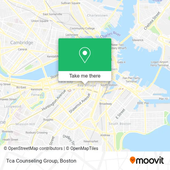
See Tca Counseling Group, Boston, on the map
Public Transit to Tca Counseling Group in Boston
Wondering how to get to Tca Counseling Group in Boston? Moovit helps you find the best way to get to Tca Counseling Group with step-by-step directions from the nearest public transit station.
Moovit provides free maps and live directions to help you navigate through your city. View schedules, routes, timetables, and find out how long does it take to get to Tca Counseling Group in real time.
Looking for the nearest stop or station to Tca Counseling Group? Check out this list of stops closest to your destination: Tremont St @ Appleton St; Herald St @ Tremont St; Stuart St @ Charles St S; Saint James Ave @ Arlington St; Back Bay - South End; Arlington.
Bus: 354, 501, 504, 9, BB, SL4, 43, 39, 57, 10, 55, GREEN LINE E SHUTTLE, GREEN LINE SHUTTLE.Train: FRAMINGHAM/WORCESTER, HAVERHILL, NEEDHAM, FOXBORO EVENT SERVICE, FRANKLIN/FOXBORO, ORANGE LINE.Subway: GREEN LINE B, GREEN LINE C, GREEN LINE D, ORANGE LINE, GREEN LINE E.
Want to see if there’s another route that gets you there at an earlier time? Moovit helps you find alternative routes or times. Get directions from and directions to Tca Counseling Group easily from the Moovit App or Website.
We make riding to Tca Counseling Group easy, which is why over 1.7 million users, including users in Boston, trust Moovit as the best app for public transit. You don’t need to download an individual bus app or train app, Moovit is your all-in-one transit app that helps you find the best bus time or train time available.
For information on prices of bus, subway and train, costs and ride fares to Tca Counseling Group, please check the Moovit app.
Use the app to navigate to popular places including to the airport, hospital, stadium, grocery store, mall, coffee shop, school, college, and university.
Tca Counseling Group Address: 6 Edgerly Pl street in Boston
- Bay Village Park (Bay Village Clean-Up),
- Bay Village MA USA,
- Arlington St & Winchester St,
- Bay Village Park,
- Boston Adult Academy (Boston Adult Technical Academy- Bata Students),
- Boston Adult Technical Academy- Bata Students,
- Google Maps Site Navigation,
- Tower,
- Haynes WM S Co (Haynes Flute & Piccolo Co.),
- Downton Abbey: the Exhibition,
- Castle at Park Plaza (Salvation Army Christmas Castle),
- Park Plaza Castle,
- Eugene T. Zanni Square,
- Medeiros Homeless Shelter (Cardinal Medeiros Center for the Homeless),
- Basile,
- Park Plaza Hotel Boston,
- Bay Club at Mattapoisett,
- South Cove Plaza,
- Slate Casting,
- davio's
Places Near Tca Counseling Group (Boston)
- Museum Of Science, Boston,
- House Of Blues, Boston,
- Boston Convention & Exhibition Center, Boston,
- Leader Bank Pavilion (Leader Bank Pavillion), Boston,
- Wilbur Theatre, Boston,
- Seaport District, Boston,
- Boston Children's Hospital, Boston,
- Td Garden, Boston,
- Massachusetts General Hospital, Boston,
- Wang Theater, Boston,
- Boston Medical Center, Boston,
- Faneuil Hall, Boston,
- Cheers, Boston,
- North End, Boston,
- Castle Island, Boston,
- Prudential Center, Boston,
- Mgm Music Hall, Boston,
- Quincy Market, Boston,
- Isabella Stewart Gardner Museum, Boston,
- Boston Common, Boston
How to get to popular places in Boston with public transit
Get around Boston by public transit!
Traveling around Boston has never been so easy. See step by step directions as you travel to any attraction, street or major public transit station. View bus and train schedules, arrival times, service alerts and detailed routes on a map, so you know exactly how to get to anywhere in Boston.
When traveling to any destination around Boston use Moovit's Live Directions with Get Off Notifications to know exactly where and how far to walk, how long to wait for your line, and how many stops are left. Moovit will alert you when it's time to get off — no need to constantly re-check whether yours is the next stop.
Wondering how to use public transit in Boston or how to pay for public transit in Boston? Moovit public transit app can help you navigate your way with public transit easily, and at minimum cost. It includes public transit fees, ticket prices, and costs. Looking for a map of Boston public transit lines? Moovit public transit app shows all public transit maps in Boston with all Bus, Train, Subway and Ferry routes and stops on an interactive map.
Boston has 4 transit type(s), including: Bus, Train, Subway and Ferry, operated by several transit agencies, including MBTA, Southeastern Regional Transit Authority, MetroWest Regional Transit Authority, Rhode Island Public Transit Authority, WRTA, Lowell Regional Transit Authority, Merrimack Valley Transit, Montachusett Regional Transit Authority, Cape Cod Regional Transit Authority, Brockton Area Transit Authority, Martha's Vineyard Transit Authority, the WAVE - Nantucket Regional Transit Authority, GATRA, Cape Ann Transportation Authority and Massport