Directions to Tcc - the Collaborative Companies (Boston) with public transportation
The following transit lines have routes that pass near Tcc - the Collaborative Companies
 Bus: 39, 43, 501, 504, SL4.
- Train: FAIRMOUNT, FRAMINGHAM/WORCESTER, FOXBORO EVENT SERVICE, FRANKLIN/FOXBORO, NEEDHAM.
- Subway: GREEN LINE B, GREEN LINE D, ORANGE LINE, RED LINE, GREEN LINE C.
How to get to Tcc - the Collaborative Companies by bus?
Click on the bus route to see step by step directions with maps, line arrival times and updated time schedules.
From MBTA / Alewife #6, Cambridge
73 minFrom Newton, MA, Newton
57 minFrom Washington St, Boston
72 minFrom Newton, MA, Newton
46 minFrom Arlington, MA, Arlington
83 minFrom The Track at New Balance, Boston
60 minFrom Milton Academy, Milton
94 minFrom Alumni Stadium, Boston
59 minFrom Heartbreak Hill, Newton
45 minFrom Assembly Square Mall Shopping Center, Somerville
68 min
How to get to Tcc - the Collaborative Companies by train?
Click on the train route to see step by step directions with maps, line arrival times and updated time schedules.
How to get to Tcc - the Collaborative Companies by subway?
Click on the subway route to see step by step directions with maps, line arrival times and updated time schedules.
From MBTA / Alewife #6, Cambridge
31 minFrom Newton, MA, Newton
44 minFrom Washington St, Boston
42 minFrom Newton, MA, Newton
49 minFrom The Track at New Balance, Boston
51 minFrom Milton Academy, Milton
62 minFrom Alumni Stadium, Boston
56 minFrom Heartbreak Hill, Newton
49 minFrom Assembly Square Mall Shopping Center, Somerville
31 min
Bus stops near Tcc - the Collaborative Companies in Boston
Subway stations near Tcc - the Collaborative Companies in Boston
Train station near Tcc - the Collaborative Companies in Boston
- Back Bay - South End, 11 min walk,VIEW
Bus lines to Tcc - the Collaborative Companies in Boston
- 43, Ruggles,VIEW
- 15, Ruggles - Fields Corner,VIEW
- 39, Back Bay - Forest Hills,VIEW
- 57, Kenmore - Watertown Yard,VIEW
- GREEN LINE E SHUTTLE, Heath Street - Park Street,VIEW
- GREEN LINE SHUTTLE, Boston University East - Park Street,VIEW
- SL5, Downtown - Nubian,VIEW
- 9, Kenmore Via Boston Latin,VIEW
- 10, Arlington Via South Bay Center,VIEW
- 55, West Fenway,VIEW
- 501, Brighton Via Copley (Express),VIEW
- 504, Watertown Via Copley And Newton Corner (Express),VIEW
- SL4, Nubian,VIEW
What are the closest stations to Tcc - the Collaborative Companies?
The closest stations to Tcc - the Collaborative Companies are:
- Tremont St @ Marginal St is 105 yards away, 2 min walk.
- Tremont St @ Boylston Station is 159 yards away, 3 min walk.
- Boylston is 179 yards away, 3 min walk.
- Arlington St @ Isabella St is 185 yards away, 3 min walk.
- Saint James Ave @ Arlington St is 445 yards away, 6 min walk.
- Washington St @ Tufts Med Ctr is 587 yards away, 7 min walk.
- Tufts Medical Center is 592 yards away, 8 min walk.
- Back Bay - South End is 876 yards away, 11 min walk.
Which bus lines stop near Tcc - the Collaborative Companies?
These bus lines stop near Tcc - the Collaborative Companies: 39, 43, 501, 504, SL4.
Which train lines stop near Tcc - the Collaborative Companies?
These train lines stop near Tcc - the Collaborative Companies: FAIRMOUNT, FRAMINGHAM/WORCESTER.
Which subway lines stop near Tcc - the Collaborative Companies?
These subway lines stop near Tcc - the Collaborative Companies: GREEN LINE B, GREEN LINE D, ORANGE LINE, RED LINE.
What’s the nearest subway station to Tcc - the Collaborative Companies in Boston?
The nearest subway station to Tcc - the Collaborative Companies in Boston is Boylston. It’s a 3 min walk away.
What’s the nearest train station to Tcc - the Collaborative Companies in Boston?
The nearest train station to Tcc - the Collaborative Companies in Boston is Back Bay - South End. It’s a 11 min walk away.
What’s the nearest bus station to Tcc - the Collaborative Companies in Boston?
The nearest bus station to Tcc - the Collaborative Companies in Boston is Tremont St @ Marginal St. It’s a 2 min walk away.
What time is the first subway to Tcc - the Collaborative Companies in Boston?
The GREEN LINE D is the first subway that goes to Tcc - the Collaborative Companies in Boston. It stops nearby at 5:07 AM.
What time is the last subway to Tcc - the Collaborative Companies in Boston?
The GREEN LINE E is the last subway that goes to Tcc - the Collaborative Companies in Boston. It stops nearby at 2:16 AM.
What time is the first train to Tcc - the Collaborative Companies in Boston?
The PROVIDENCE/STOUGHTON is the first train that goes to Tcc - the Collaborative Companies in Boston. It stops nearby at 4:25 AM.
What time is the last train to Tcc - the Collaborative Companies in Boston?
The LAKE SHORE LIMITED is the last train that goes to Tcc - the Collaborative Companies in Boston. It stops nearby at 8:26 PM.
What time is the first bus to Tcc - the Collaborative Companies in Boston?
The 57 is the first bus that goes to Tcc - the Collaborative Companies in Boston. It stops nearby at 4:55 AM.
What time is the last bus to Tcc - the Collaborative Companies in Boston?
The 10 is the last bus that goes to Tcc - the Collaborative Companies in Boston. It stops nearby at 1:19 AM.
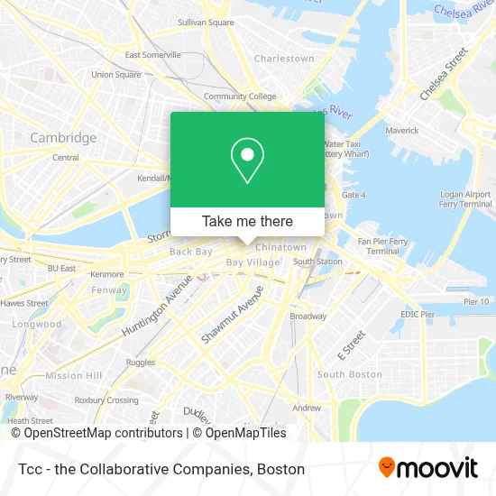
See Tcc - the Collaborative Companies, Boston, on the map
Public Transit to Tcc - the Collaborative Companies in Boston
Wondering how to get to Tcc - the Collaborative Companies in Boston? Moovit helps you find the best way to get to Tcc - the Collaborative Companies with step-by-step directions from the nearest public transit station.
Moovit provides free maps and live directions to help you navigate through your city. View schedules, routes, timetables, and find out how long does it take to get to Tcc - the Collaborative Companies in real time.
Looking for the nearest stop or station to Tcc - the Collaborative Companies? Check out this list of stops closest to your destination: Tremont St @ Marginal St; Tremont St @ Boylston Station; Boylston; Arlington St @ Isabella St; Saint James Ave @ Arlington St; Washington St @ Tufts Med Ctr; Tufts Medical Center; Back Bay - South End.
Bus: 39, 43, 501, 504, SL4, 15, 57, GREEN LINE E SHUTTLE, GREEN LINE SHUTTLE, 9.Train: FAIRMOUNT, FRAMINGHAM/WORCESTER, FOXBORO EVENT SERVICE, FRANKLIN/FOXBORO, NEEDHAM, PROVIDENCE/STOUGHTON.Subway: GREEN LINE B, GREEN LINE D, ORANGE LINE, RED LINE, GREEN LINE C, GREEN LINE E.
Want to see if there’s another route that gets you there at an earlier time? Moovit helps you find alternative routes or times. Get directions from and directions to Tcc - the Collaborative Companies easily from the Moovit App or Website.
We make riding to Tcc - the Collaborative Companies easy, which is why over 1.7 million users, including users in Boston, trust Moovit as the best app for public transit. You don’t need to download an individual bus app or train app, Moovit is your all-in-one transit app that helps you find the best bus time or train time available.
For information on prices of bus, subway and train, costs and ride fares to Tcc - the Collaborative Companies, please check the Moovit app.
Use the app to navigate to popular places including to the airport, hospital, stadium, grocery store, mall, coffee shop, school, college, and university.
Tcc - the Collaborative Companies Address: 20 Park Plz street in Boston
- Douglas Elliman Real Estate,
- Age Management Boston,
- Consulate General of Israel,
- Maggiano's Little Italy,
- Park Square,
- FedEx,
- FedEx Office,
- Consulado do Brasil - Boston,
- MBTA Commuter Rail Train #715,
- Maggiano's (Maggiano's Little Italy),
- Hertz-Park Plaza (Hertz Car Rental),
- Old Town Trolley Tours of Boston,
- Park Plaza Hotel,
- Chocolate Tour,
- South Cove Plaza,
- Lincoln Square,
- Greylock McKinnon Associates,
- Plymouth Brockton Bus Park Plaza Stop,
- Consulate of the Dominican Republic in Boston,
- Park Plaza Hotel Boston
Places Near Tcc - the Collaborative Companies (Boston)
- Leader Bank Pavilion (Leader Bank Pavillion), Boston,
- Quincy Market, Boston,
- Boston Convention & Exhibition Center, Boston,
- Boston Common, Boston,
- Boston Children's Hospital, Boston,
- Isabella Stewart Gardner Museum, Boston,
- Faneuil Hall, Boston,
- Wang Theater, Boston,
- Wilbur Theatre, Boston,
- Mgm Music Hall, Boston,
- Td Garden, Boston,
- Boston Medical Center, Boston,
- North End, Boston,
- Cheers, Boston,
- Castle Island, Boston,
- Prudential Center, Boston,
- Massachusetts General Hospital, Boston,
- Museum Of Science, Boston,
- House Of Blues, Boston,
- Seaport District, Boston
How to get to popular places in Boston with public transit
Get around Boston by public transit!
Traveling around Boston has never been so easy. See step by step directions as you travel to any attraction, street or major public transit station. View bus and train schedules, arrival times, service alerts and detailed routes on a map, so you know exactly how to get to anywhere in Boston.
When traveling to any destination around Boston use Moovit's Live Directions with Get Off Notifications to know exactly where and how far to walk, how long to wait for your line, and how many stops are left. Moovit will alert you when it's time to get off — no need to constantly re-check whether yours is the next stop.
Wondering how to use public transit in Boston or how to pay for public transit in Boston? Moovit public transit app can help you navigate your way with public transit easily, and at minimum cost. It includes public transit fees, ticket prices, and costs. Looking for a map of Boston public transit lines? Moovit public transit app shows all public transit maps in Boston with all Bus, Train, Subway and Ferry routes and stops on an interactive map.
Boston has 4 transit type(s), including: Bus, Train, Subway and Ferry, operated by several transit agencies, including MBTA, Southeastern Regional Transit Authority, MetroWest Regional Transit Authority, Rhode Island Public Transit Authority, WRTA, Lowell Regional Transit Authority, Merrimack Valley Transit, Montachusett Regional Transit Authority, Cape Cod Regional Transit Authority, Brockton Area Transit Authority, Martha's Vineyard Transit Authority, the WAVE - Nantucket Regional Transit Authority, GATRA, Cape Ann Transportation Authority and Massport