Directions to Td Bank Atm (Everett) with public transportation
The following transit lines have routes that pass near Td Bank Atm
 Bus: 104, 109, 110.
- Train: NEWBURYPORT/ROCKPORT, HAVERHILL.
- Subway: ORANGE LINE.
How to get to Td Bank Atm by bus?
Click on the bus route to see step by step directions with maps, line arrival times and updated time schedules.
From Micro Center (Micro Elecronics), Cambridge
58 minFrom Belmont, MA, Belmont
56 minFrom Nahant Beach, Nahant
69 minFrom Bistro du Midi, Boston
62 minFrom Omni Parker House, Boston
41 minFrom 110 Francis Street Garage, Boston
62 minFrom Massachusetts, Boston
65 minFrom Brigham and Women's Hospital, Boston
65 minFrom Maverick Station, Boston
34 minFrom Le Meridien Cambridge-Mit, Cambridge
56 min
How to get to Td Bank Atm by train?
Click on the train route to see step by step directions with maps, line arrival times and updated time schedules.
How to get to Td Bank Atm by subway?
Click on the subway route to see step by step directions with maps, line arrival times and updated time schedules.
From Micro Center (Micro Elecronics), Cambridge
87 minFrom Bistro du Midi, Boston
64 minFrom Omni Parker House, Boston
57 minFrom 110 Francis Street Garage, Boston
89 minFrom Massachusetts, Boston
110 minFrom Brigham and Women's Hospital, Boston
86 minFrom Maverick Station, Boston
64 minFrom Le Meridien Cambridge-Mit, Cambridge
75 min
Bus stops near Td Bank Atm in Everett
Subway station near Td Bank Atm in Everett
- Wellington, 28 min walk,VIEW
Bus lines to Td Bank Atm in Everett
What are the closest stations to Td Bank Atm?
The closest stations to Td Bank Atm are:
- Broadway @ Summit Ave is 209 yards away, 3 min walk.
- Ferry St @ Elm St is 271 yards away, 4 min walk.
- Broadway @ Timothy Ave is 320 yards away, 4 min walk.
- Wellington is 2300 yards away, 28 min walk.
- Oak Grove is 2421 yards away, 29 min walk.
- Chelsea is 2507 yards away, 33 min walk.
Which bus lines stop near Td Bank Atm?
These bus lines stop near Td Bank Atm: 104, 109, 110.
Which train line stops near Td Bank Atm?
NEWBURYPORT/ROCKPORT (#120 | North Station)
Which subway line stops near Td Bank Atm?
ORANGE LINE (Oak Grove)
What’s the nearest subway station to Td Bank Atm in Everett?
The nearest subway station to Td Bank Atm in Everett is Wellington. It’s a 28 min walk away.
What’s the nearest train station to Td Bank Atm in Everett?
The nearest train station to Td Bank Atm in Everett is Oak Grove. It’s a 29 min walk away.
What’s the nearest bus station to Td Bank Atm in Everett?
The nearest bus station to Td Bank Atm in Everett is Broadway @ Summit Ave. It’s a 3 min walk away.
What time is the first subway to Td Bank Atm in Everett?
The ORANGE LINE is the first subway that goes to Td Bank Atm in Everett. It stops nearby at 5:15 AM.
What time is the last subway to Td Bank Atm in Everett?
The ORANGE LINE is the last subway that goes to Td Bank Atm in Everett. It stops nearby at 1:59 AM.
What time is the first train to Td Bank Atm in Everett?
The HAVERHILL is the first train that goes to Td Bank Atm in Everett. It stops nearby at 5:35 AM.
What time is the last train to Td Bank Atm in Everett?
The NEWBURYPORT/ROCKPORT is the last train that goes to Td Bank Atm in Everett. It stops nearby at 12:06 AM.
What time is the first bus to Td Bank Atm in Everett?
The 104 is the first bus that goes to Td Bank Atm in Everett. It stops nearby at 4:32 AM.
What time is the last bus to Td Bank Atm in Everett?
The 110 is the last bus that goes to Td Bank Atm in Everett. It stops nearby at 2:12 AM.
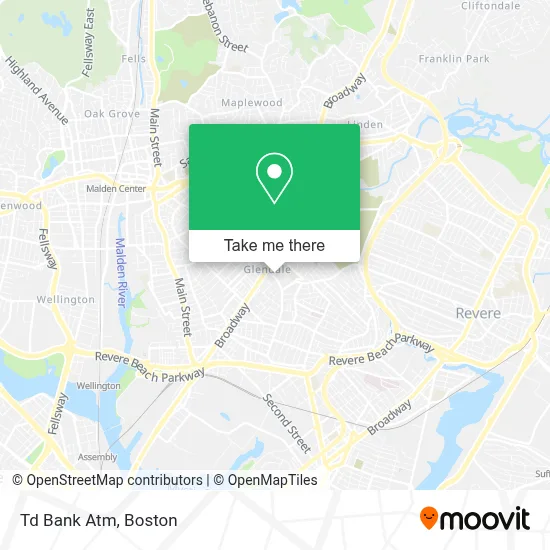
See Td Bank Atm, Everett, on the map
Public Transit to Td Bank Atm in Everett
Wondering how to get to Td Bank Atm in Everett? Moovit helps you find the best way to get to Td Bank Atm with step-by-step directions from the nearest public transit station.
Moovit provides free maps and live directions to help you navigate through your city. View schedules, routes, timetables, and find out how long does it take to get to Td Bank Atm in real time.
Looking for the nearest stop or station to Td Bank Atm? Check out this list of stops closest to your destination: Broadway @ Summit Ave; Ferry St @ Elm St; Broadway @ Timothy Ave; Wellington; Oak Grove; Chelsea.
Bus: 104, 109, 110.Train: NEWBURYPORT/ROCKPORT, HAVERHILL.Subway: ORANGE LINE.
Want to see if there’s another route that gets you there at an earlier time? Moovit helps you find alternative routes or times. Get directions from and directions to Td Bank Atm easily from the Moovit App or Website.
We make riding to Td Bank Atm easy, which is why over 1.7 million users, including users in Everett, trust Moovit as the best app for public transit. You don’t need to download an individual bus app or train app, Moovit is your all-in-one transit app that helps you find the best bus time or train time available.
For information on prices of bus, subway and train, costs and ride fares to Td Bank Atm, please check the Moovit app.
Use the app to navigate to popular places including to the airport, hospital, stadium, grocery store, mall, coffee shop, school, college, and university.
Td Bank Atm Address: 317 Ferry St street in Everett
- Glendale Convenience Store,
- M & M Retail,
- Corner Store,
- Foxwoods Drop Off,
- Executive Protection Training Institute,
- PSPS Legal Support Services,
- TD Bank,
- Sky Hookah Lounge,
- Glendale Park (Glendale Laundromat),
- Monza Motors,
- Ferry St (broadway ferry),
- Progressive Insurance,
- Mixed Grill Cafe,
- El Valle De La Sultana Market,
- 738 Broadway Parking,
- K-Chivo Market,
- Bloom Cleaners,
- Sandra Enterprise Serv,
- Bishop Robert G. Brown Ministries, Inc.,
- Fantasy Unisex Salon
Places Near Td Bank Atm (Everett)
- Leader Bank Pavilion (Leader Bank Pavillion), Boston,
- Boston Common, Boston,
- House Of Blues, Boston,
- Wilbur Theatre, Boston,
- Massachusetts General Hospital, Boston,
- Quincy Market, Boston,
- Boston Children's Hospital, Boston,
- Mgm Music Hall, Boston,
- Faneuil Hall, Boston,
- Prudential Center, Boston,
- Wang Theater, Boston,
- North End, Boston,
- Museum Of Science, Boston,
- Boston Medical Center, Boston,
- Boston Convention & Exhibition Center, Boston,
- Castle Island, Boston,
- Td Garden, Boston,
- Cheers, Boston,
- Seaport District, Boston,
- Isabella Stewart Gardner Museum, Boston
How to get to popular places in Boston with public transit
Get around Everett by public transit!
Traveling around Everett has never been so easy. See step by step directions as you travel to any attraction, street or major public transit station. View bus and train schedules, arrival times, service alerts and detailed routes on a map, so you know exactly how to get to anywhere in Everett.
When traveling to any destination around Everett use Moovit's Live Directions with Get Off Notifications to know exactly where and how far to walk, how long to wait for your line, and how many stops are left. Moovit will alert you when it's time to get off — no need to constantly re-check whether yours is the next stop.
Wondering how to use public transit in Everett or how to pay for public transit in Everett? Moovit public transit app can help you navigate your way with public transit easily, and at minimum cost. It includes public transit fees, ticket prices, and costs. Looking for a map of Everett public transit lines? Moovit public transit app shows all public transit maps in Everett with all Bus, Train, Subway and Ferry routes and stops on an interactive map.
Boston has 4 transit type(s), including: Bus, Train, Subway and Ferry, operated by several transit agencies, including MBTA, Southeastern Regional Transit Authority, MetroWest Regional Transit Authority, Rhode Island Public Transit Authority, WRTA, Lowell Regional Transit Authority, Merrimack Valley Transit, Montachusett Regional Transit Authority, Cape Cod Regional Transit Authority, Brockton Area Transit Authority, Martha's Vineyard Transit Authority, the WAVE - Nantucket Regional Transit Authority, GATRA, Cape Ann Transportation Authority and Massport