Directions to Td Bank Atm (Boston) with public transportation
The following transit lines have routes that pass near Td Bank Atm
 Bus: 1, 39, 504, BB, 55.
- Train: FITCHBURG, FRAMINGHAM/WORCESTER, NEEDHAM, FOXBORO EVENT SERVICE, FRANKLIN/FOXBORO.
- Subway: GREEN LINE B, GREEN LINE C, GREEN LINE D, ORANGE LINE, GREEN LINE E.
How to get to Td Bank Atm by bus?
Click on the bus route to see step by step directions with maps, line arrival times and updated time schedules.
From Four Points by Sheraton Boston Logan Airport, Revere
103 minFrom Qea, Quincy
112 minFrom Six Flags New England, Newton
41 minFrom McLean Hospital, Belmont
66 minFrom Apple Cinemas, Cambridge
55 minFrom Milton Academy, Milton
95 minFrom Target, Everett
83 minFrom John F. Kennedy Presidential Library And Museum, Boston
57 minFrom East Boston, Boston
27 minFrom Rental Car Center - Logan Airport, Boston
26 min
How to get to Td Bank Atm by train?
Click on the train route to see step by step directions with maps, line arrival times and updated time schedules.
How to get to Td Bank Atm by subway?
Click on the subway route to see step by step directions with maps, line arrival times and updated time schedules.
Bus stops near Td Bank Atm in Boston
- Announcement #3 - Airport To Back Bay, 3 min walk,VIEW
- Boylston St @ Prudential Center, 3 min walk,VIEW
- Huntington Ave @ Ring Rd, 4 min walk,VIEW
- Hynes T Station (To Crc), 5 min walk,VIEW
- Hynes Convention Center - Cambria St @ Boylston St, 5 min walk,VIEW
- Massachusetts Ave @ Newbury St, 5 min walk,VIEW
- Ring Rd @ Boylston St, 6 min walk,VIEW
- Huntington Ave @ Belvidere St, 7 min walk,VIEW
Subway stations near Td Bank Atm in Boston
Train station near Td Bank Atm in Boston
- Back Bay - South End, 13 min walk,VIEW
Bus lines to Td Bank Atm in Boston
- BB, Back Bay,VIEW
- 55, West Fenway,VIEW
- 57, Haymarket Via Kenmore,VIEW
- 9, Kenmore Via Boston Latin,VIEW
- 1 BU (CHARLES RIVER-MEDICAL CAMPUS), Comm Ave @ Buick St,VIEW
- GREEN LINE B SHUTTLE, Back Bay (Shuttle),VIEW
- GREEN LINE C SHUTTLE, Saint Mary's Street (Shuttle),VIEW
- 1, Harvard,VIEW
- GREEN LINE SHUTTLE, Blandford Street (Shuttle),VIEW
- 39, Haymarket Via Forest Hills,VIEW
- GREEN LINE E SHUTTLE, Park Street (Shuttle),VIEW
- GREEN LINE E SHUTTLE, Prudential (Shuttle),VIEW
What are the closest stations to Td Bank Atm?
The closest stations to Td Bank Atm are:
- Announcement #3 - Airport To Back Bay is 166 yards away, 3 min walk.
- Boylston St @ Prudential Center is 227 yards away, 3 min walk.
- Hynes Convention Center is 265 yards away, 4 min walk.
- Huntington Ave @ Ring Rd is 266 yards away, 4 min walk.
- Hynes T Station (To Crc) is 320 yards away, 5 min walk.
- Hynes Convention Center - Cambria St @ Boylston St is 335 yards away, 5 min walk.
- Massachusetts Ave @ Newbury St is 337 yards away, 5 min walk.
- Ring Rd @ Boylston St is 446 yards away, 6 min walk.
- Huntington Ave @ Belvidere St is 506 yards away, 7 min walk.
- Prudential is 665 yards away, 9 min walk.
- Back Bay - South End is 1026 yards away, 13 min walk.
Which bus lines stop near Td Bank Atm?
These bus lines stop near Td Bank Atm: 1, 39, 504, BB.
Which train lines stop near Td Bank Atm?
These train lines stop near Td Bank Atm: FITCHBURG, FRAMINGHAM/WORCESTER, NEEDHAM.
Which subway lines stop near Td Bank Atm?
These subway lines stop near Td Bank Atm: GREEN LINE B, GREEN LINE C, GREEN LINE D, ORANGE LINE.
What’s the nearest subway station to Td Bank Atm in Boston?
The nearest subway station to Td Bank Atm in Boston is Hynes Convention Center. It’s a 4 min walk away.
What’s the nearest train station to Td Bank Atm in Boston?
The nearest train station to Td Bank Atm in Boston is Back Bay - South End. It’s a 13 min walk away.
What’s the nearest bus station to Td Bank Atm in Boston?
The nearest bus stations to Td Bank Atm in Boston are Announcement #3 - Airport To Back Bay and Boylston St @ Prudential Center. The closest one is a 3 min walk away.
What time is the first subway to Td Bank Atm in Boston?
The GREEN LINE D is the first subway that goes to Td Bank Atm in Boston. It stops nearby at 5:03 AM.
What time is the last subway to Td Bank Atm in Boston?
The GREEN LINE D is the last subway that goes to Td Bank Atm in Boston. It stops nearby at 2:15 AM.
What time is the first train to Td Bank Atm in Boston?
The PROVIDENCE/STOUGHTON is the first train that goes to Td Bank Atm in Boston. It stops nearby at 4:25 AM.
What time is the last train to Td Bank Atm in Boston?
The LAKE SHORE LIMITED is the last train that goes to Td Bank Atm in Boston. It stops nearby at 8:26 PM.
What time is the first bus to Td Bank Atm in Boston?
The 1 is the first bus that goes to Td Bank Atm in Boston. It stops nearby at 4:50 AM.
What time is the last bus to Td Bank Atm in Boston?
The 1 is the last bus that goes to Td Bank Atm in Boston. It stops nearby at 2:22 AM.
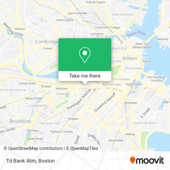
See Td Bank Atm, Boston, on the map
Public Transit to Td Bank Atm in Boston
Wondering how to get to Td Bank Atm in Boston? Moovit helps you find the best way to get to Td Bank Atm with step-by-step directions from the nearest public transit station.
Moovit provides free maps and live directions to help you navigate through your city. View schedules, routes, timetables, and find out how long does it take to get to Td Bank Atm in real time.
Looking for the nearest stop or station to Td Bank Atm? Check out this list of stops closest to your destination: Announcement #3 - Airport To Back Bay; Boylston St @ Prudential Center; Hynes Convention Center; Huntington Ave @ Ring Rd; Hynes T Station (To Crc); Hynes Convention Center - Cambria St @ Boylston St; Massachusetts Ave @ Newbury St; Ring Rd @ Boylston St; Huntington Ave @ Belvidere St; Prudential; Back Bay - South End.
Bus: 1, 39, 504, BB, 55, 57, 9.Train: FITCHBURG, FRAMINGHAM/WORCESTER, NEEDHAM, FOXBORO EVENT SERVICE, FRANKLIN/FOXBORO, ORANGE LINE.Subway: GREEN LINE B, GREEN LINE C, GREEN LINE D, ORANGE LINE, GREEN LINE E.
Want to see if there’s another route that gets you there at an earlier time? Moovit helps you find alternative routes or times. Get directions from and directions to Td Bank Atm easily from the Moovit App or Website.
We make riding to Td Bank Atm easy, which is why over 1.7 million users, including users in Boston, trust Moovit as the best app for public transit. You don’t need to download an individual bus app or train app, Moovit is your all-in-one transit app that helps you find the best bus time or train time available.
For information on prices of bus, subway and train, costs and ride fares to Td Bank Atm, please check the Moovit app.
Use the app to navigate to popular places including to the airport, hospital, stadium, grocery store, mall, coffee shop, school, college, and university.
Td Bank Atm Address: 841 BOYLSTON ST street in Boston
- Hunts Photo & Video,
- Apple Boylston Street,
- Wagamama,
- Freedom Tail,
- Apple Store,
- Apple Store #149,
- Boston Marathon RunBase,
- Gucci,
- Bethany House (Bethany Union for Young Women),
- Eataly Boston,
- Gkc,
- Back Bay Social,
- Crazy Good Kitchen (Bangkok Bento Thai Kitchen & Sushi Bar),
- Aztec Masonry (Deluxe Paving and Masonry),
- Maron Realty,
- Curantis Private Nursing Services,
- Jolie Med Spa,
- G2O Spa & Salon,
- Faccia Brutta,
- Bar Pallino
Places Near Td Bank Atm (Boston)
- Isabella Stewart Gardner Museum, Boston,
- Seaport District, Boston,
- North End, Boston,
- Museum Of Science, Boston,
- Leader Bank Pavilion (Leader Bank Pavillion), Boston,
- House Of Blues, Boston,
- Td Garden, Boston,
- Prudential Center, Boston,
- Mgm Music Hall, Boston,
- Quincy Market, Boston,
- Faneuil Hall, Boston,
- Wilbur Theatre, Boston,
- Boston Common, Boston,
- Boston Children's Hospital, Boston,
- Boston Convention & Exhibition Center, Boston,
- Castle Island, Boston,
- Cheers, Boston,
- Wang Theater, Boston,
- Boston Medical Center, Boston,
- Massachusetts General Hospital, Boston
How to get to popular places in Boston with public transit
Get around Boston by public transit!
Traveling around Boston has never been so easy. See step by step directions as you travel to any attraction, street or major public transit station. View bus and train schedules, arrival times, service alerts and detailed routes on a map, so you know exactly how to get to anywhere in Boston.
When traveling to any destination around Boston use Moovit's Live Directions with Get Off Notifications to know exactly where and how far to walk, how long to wait for your line, and how many stops are left. Moovit will alert you when it's time to get off — no need to constantly re-check whether yours is the next stop.
Wondering how to use public transit in Boston or how to pay for public transit in Boston? Moovit public transit app can help you navigate your way with public transit easily, and at minimum cost. It includes public transit fees, ticket prices, and costs. Looking for a map of Boston public transit lines? Moovit public transit app shows all public transit maps in Boston with all Bus, Train, Subway and Ferry routes and stops on an interactive map.
Boston has 4 transit type(s), including: Bus, Train, Subway and Ferry, operated by several transit agencies, including MBTA, Southeastern Regional Transit Authority, MetroWest Regional Transit Authority, Rhode Island Public Transit Authority, WRTA, Lowell Regional Transit Authority, Merrimack Valley Transit, Montachusett Regional Transit Authority, Cape Cod Regional Transit Authority, Brockton Area Transit Authority, Martha's Vineyard Transit Authority, the WAVE - Nantucket Regional Transit Authority, GATRA, Cape Ann Transportation Authority and Massport