How to get to Team Pratt by bus?
Click on the bus route to see step by step directions with maps, line arrival times and updated time schedules.
From Goodwill Store, Boston
51 minFrom Paradise Rock Club, Boston
50 minFrom AC Hotel by Marriott Boston Cleveland Circle, Boston
61 minFrom Mount Ida College, Newton
64 minFrom Paradise Rock Club & Lounge, Boston
51 minFrom Harvard Square, Cambridge
72 minFrom Sonia, Boston
49 minFrom Conte Forum, Boston
59 minFrom Skating Club Of Boston, Boston
43 minFrom Arsenal Yards, Watertown Town
38 min
Bus stops near Team Pratt in Waltham
Bus lines to Team Pratt in Waltham
What are the closest stations to Team Pratt?
The closest stations to Team Pratt are:
- 691 Main St is 194 yards away, 3 min walk.
- School St @ Lexington St is 463 yards away, 6 min walk.
- Lexington St @ School St is 618 yards away, 8 min walk.
- Waltham is 2560 yards away, 30 min walk.
- West Newton is 4897 yards away, 58 min walk.
Which bus lines stop near Team Pratt?
These bus lines stop near Team Pratt: 554, 556, 70.
What’s the nearest train station to Team Pratt in Waltham?
The nearest train station to Team Pratt in Waltham is Waltham. It’s a 30 min walk away.
What’s the nearest bus station to Team Pratt in Waltham?
The nearest bus station to Team Pratt in Waltham is 691 Main St. It’s a 3 min walk away.
What time is the first train to Team Pratt in Waltham?
The FRAMINGHAM/WORCESTER is the first train that goes to Team Pratt in Waltham. It stops nearby at 5:22 AM.
What time is the last train to Team Pratt in Waltham?
The FRAMINGHAM/WORCESTER is the last train that goes to Team Pratt in Waltham. It stops nearby at 12:20 AM.
What time is the first bus to Team Pratt in Waltham?
The 70 is the first bus that goes to Team Pratt in Waltham. It stops nearby at 4:51 AM.
What time is the last bus to Team Pratt in Waltham?
The 70 is the last bus that goes to Team Pratt in Waltham. It stops nearby at 12:41 AM.
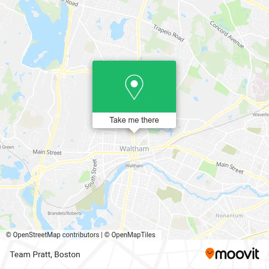
See Team Pratt, Waltham, on the map
Public Transit to Team Pratt in Waltham
Wondering how to get to Team Pratt in Waltham? Moovit helps you find the best way to get to Team Pratt with step-by-step directions from the nearest public transit station.
Moovit provides free maps and live directions to help you navigate through your city. View schedules, routes, timetables, and find out how long does it take to get to Team Pratt in real time.
Looking for the nearest stop or station to Team Pratt? Check out this list of stops closest to your destination: 691 Main St; School St @ Lexington St; Lexington St @ School St; Waltham; West Newton.
Bus: 554, 556, 70, 61, 553, 505.Train: FITCHBURG, FRAMINGHAM/WORCESTER.
Want to see if there’s another route that gets you there at an earlier time? Moovit helps you find alternative routes or times. Get directions from and directions to Team Pratt easily from the Moovit App or Website.
We make riding to Team Pratt easy, which is why over 1.7 million users, including users in Waltham, trust Moovit as the best app for public transit. You don’t need to download an individual bus app or train app, Moovit is your all-in-one transit app that helps you find the best bus time or train time available.
For information on prices of bus, subway and train, costs and ride fares to Team Pratt, please check the Moovit app.
Use the app to navigate to popular places including to the airport, hospital, stadium, grocery store, mall, coffee shop, school, college, and university.
Team Pratt Address: 131 Lexington St street in Waltham
- Women S Counseling & Psychotherapy Associates,
- Abacus Imaging Group,
- Advanced Locksmith Shop,
- Brad and Darleen Pratt Metro West Ma Real Estate Agents,
- 131 Lexington St Parking,
- Coinstar,
- Chase,
- Allegra Marketing Print Mail,
- Brookes + Hill Custom Builders,
- Victor Azer,
- Quick & Clean Car Wash,
- Locksmith High Security,
- Gracie's Catering Delivery,
- Mama's Hungarian Kitchen- Mama Magyar Konyhája,
- Waltham Ma,
- Classic Plumbing,
- Boston Scally,
- TM Garage,
- B'Nai or (Community of Light),
- First Parish in Waltham UU
Places Near Team Pratt (Waltham)
- Boston Convention & Exhibition Center, Boston,
- Faneuil Hall, Boston,
- Boston Medical Center, Boston,
- North End, Boston,
- Massachusetts General Hospital, Boston,
- Td Garden, Boston,
- Museum Of Science, Boston,
- Castle Island, Boston,
- Cheers, Boston,
- House Of Blues, Boston,
- Boston Children's Hospital, Boston,
- Leader Bank Pavilion (Leader Bank Pavillion), Boston,
- Prudential Center, Boston,
- Boston Common, Boston,
- Isabella Stewart Gardner Museum, Boston,
- Quincy Market, Boston,
- Seaport District, Boston,
- Wilbur Theatre, Boston,
- Mgm Music Hall, Boston,
- Wang Theater, Boston
How to get to popular places in Boston with public transit
Get around Waltham by public transit!
Traveling around Waltham has never been so easy. See step by step directions as you travel to any attraction, street or major public transit station. View bus and train schedules, arrival times, service alerts and detailed routes on a map, so you know exactly how to get to anywhere in Waltham.
When traveling to any destination around Waltham use Moovit's Live Directions with Get Off Notifications to know exactly where and how far to walk, how long to wait for your line, and how many stops are left. Moovit will alert you when it's time to get off — no need to constantly re-check whether yours is the next stop.
Wondering how to use public transit in Waltham or how to pay for public transit in Waltham? Moovit public transit app can help you navigate your way with public transit easily, and at minimum cost. It includes public transit fees, ticket prices, and costs. Looking for a map of Waltham public transit lines? Moovit public transit app shows all public transit maps in Waltham with all Bus, Train, Subway and Ferry routes and stops on an interactive map.
Boston has 4 transit type(s), including: Bus, Train, Subway and Ferry, operated by several transit agencies, including MBTA, Southeastern Regional Transit Authority, MetroWest Regional Transit Authority, Rhode Island Public Transit Authority, WRTA, Lowell Regional Transit Authority, Merrimack Valley Transit, Montachusett Regional Transit Authority, Cape Cod Regional Transit Authority, Brockton Area Transit Authority, Martha's Vineyard Transit Authority, the WAVE - Nantucket Regional Transit Authority, GATRA, Cape Ann Transportation Authority and Massport