Directions to Teesha Boston Re with public transportation
The following transit lines have routes that pass near Teesha Boston Re
 Bus: 51, 86, GREEN LINE C SHUTTLE, GREEN LINE C SHUTTLE, SHUTTLE.
- Train: FRAMINGHAM/WORCESTER.
- Subway: GREEN LINE C, GREEN LINE D, GREEN LINE B.
How to get to Teesha Boston Re by bus?
Click on the bus route to see step by step directions with maps, line arrival times and updated time schedules.
From JFK Library
100 minFrom Moakley Us Courthouse
56 minFrom Moderna Therapeutics - Corporate Headquarters
57 minFrom Black Falcon Cruise Terminal
71 minFrom Dana Farber Cancer Institute
70 minFrom Millennium Tower Boston
45 minFrom The Beehive
42 minFrom Berklee College of Music
40 minFrom East Boston
90 minFrom Sunrise Shuttle Pick Up
63 min
How to get to Teesha Boston Re by train?
Click on the train route to see step by step directions with maps, line arrival times and updated time schedules.
How to get to Teesha Boston Re by subway?
Click on the subway route to see step by step directions with maps, line arrival times and updated time schedules.
Bus stops near Teesha Boston Re
Subway stations near Teesha Boston Re
Bus lines to Teesha Boston Re
- 86, Harvard,VIEW
- GREEN LINE C SHUTTLE, Saint Mary's Street (Shuttle),VIEW
- GREEN LINE C SHUTTLE, Coolidge Corner (Shuttle),VIEW
- SHUTTLE, Cleveland Circle (Shuttle),VIEW
- GREEN LINE B SHUTTLE, Boston College - Blandford Street,VIEW
- GREEN LINE B SHUTTLE, Boston College - Washington Street,VIEW
- GREEN LINE B SHUTTLE, Boston College - Back Bay (Shuttle),VIEW
- GREEN LINE B SHUTTLE, Boston College - Babcock Street,VIEW
- GREEN LINE B SHUTTLE, Boston College - Packard's Corner,VIEW
- SHUTTLE, Boston College - Kenmore (Shuttle),VIEW
- 51, Forest Hills - Reservoir,VIEW
- GREEN LINE D SHUTTLE, Riverside - Kenmore (Shuttle),VIEW
- GREEN LINE D SHUTTLE, Reservoir - Fenway,VIEW
- GREEN LINE D SHUTTLE, Riverside - Reservoir,VIEW
- GREEN LINE D SHUTTLE, Newton Highlands - Brookline Hills,VIEW
- GREEN LINE D SHUTTLE, Reservoir - Brookline Hills,VIEW
- GREEN LINE D SHUTTLE, Riverside - Fenway,VIEW
- GREEN LINE D SHUTTLE, Newton Highlands - Reservoir,VIEW
- GREEN LINE D SHUTTLE, Reservoir - Kenmore,VIEW
- GREEN LINE D SHUTTLE, Newton Highlands - Kenmore,VIEW
What are the closest stations to Teesha Boston Re?
The closest stations to Teesha Boston Re are:
- Chestnut Hill Ave @ Englewood Ave is 148 yards away, 2 min walk.
- Cleveland Circle is 240 yards away, 4 min walk.
- Chestnut Hill Avenue - Commonwealth Ave @ Chestnut Hill Ave is 318 yards away, 4 min walk.
- Reservoir is 320 yards away, 4 min walk.
- Chestnut Hill Ave. is 2187 yards away, 26 min walk.
Which bus lines stop near Teesha Boston Re?
These bus lines stop near Teesha Boston Re: 51, 86.
Which train line stops near Teesha Boston Re?
FRAMINGHAM/WORCESTER (#525 | Worcester)
Which subway lines stop near Teesha Boston Re?
These subway lines stop near Teesha Boston Re: GREEN LINE C, GREEN LINE D.
What’s the nearest subway station to Teesha Boston Re?
The nearest subway station to Teesha Boston Re is Chestnut Hill Ave.. It’s a 26 min walk away.
What’s the nearest bus station to Teesha Boston Re?
The nearest bus station to Teesha Boston Re is Chestnut Hill Ave @ Englewood Ave. It’s a 2 min walk away.
What time is the first subway to Teesha Boston Re?
The GREEN LINE D is the first subway that goes to Teesha Boston Re. It stops nearby at 4:45 AM.
What time is the last subway to Teesha Boston Re?
The GREEN LINE B is the last subway that goes to Teesha Boston Re. It stops nearby at 2:34 AM.
What time is the first bus to Teesha Boston Re?
The 86 is the first bus that goes to Teesha Boston Re. It stops nearby at 5:21 AM.
What time is the last bus to Teesha Boston Re?
The 86 is the last bus that goes to Teesha Boston Re. It stops nearby at 12:56 AM.
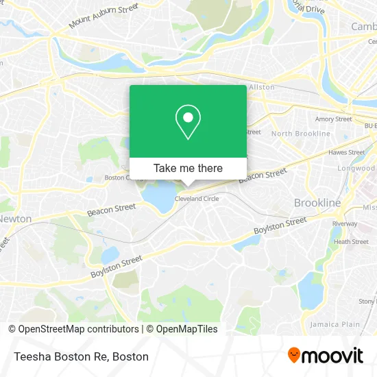
See Teesha Boston Re on the map
Public Transportation to Teesha Boston Re
Wondering how to get to Teesha Boston Re? Moovit helps you find the best way to get to Teesha Boston Re with step-by-step directions from the nearest public transit station.
Moovit provides free maps and live directions to help you navigate through your city. View schedules, routes, timetables, and find out how long does it take to get to Teesha Boston Re in real time.
Looking for the nearest stop or station to Teesha Boston Re? Check out this list of stops closest to your destination: Chestnut Hill Ave @ Englewood Ave; Cleveland Circle; Chestnut Hill Avenue - Commonwealth Ave @ Chestnut Hill Ave; Reservoir; Chestnut Hill Ave..
Bus: 51, 86, GREEN LINE C SHUTTLE, GREEN LINE C SHUTTLE, SHUTTLE, GREEN LINE B SHUTTLE, GREEN LINE B SHUTTLE, GREEN LINE B SHUTTLE, GREEN LINE B SHUTTLE, GREEN LINE B SHUTTLE.Train: FRAMINGHAM/WORCESTER.Subway: GREEN LINE C, GREEN LINE D, GREEN LINE B.
Want to see if there’s another route that gets you there at an earlier time? Moovit helps you find alternative routes or times. Get directions from and directions to Teesha Boston Re easily from the Moovit App or Website.
We make riding to Teesha Boston Re easy, which is why over 1.7 million users, including users in Boston, trust Moovit as the best app for public transit. You don’t need to download an individual bus app or train app, Moovit is your all-in-one transit app that helps you find the best bus time or train time available.
For information on prices of subway, bus and train, costs and ride fares to Teesha Boston Re, please check the Moovit app.
Use the app to navigate to popular places including to the airport, hospital, stadium, grocery store, mall, coffee shop, school, college, and university.
Teesha Boston Re Address: 370 Chestnut Hill Ave street in Boston
- Flash Printing and Copy Center,
- Preston Todd Advisors,
- Demo's,
- ASAP Locksmith Service of MA,
- New Box Studio,
- 3 C 's Convenience,
- Circle Tavern,
- Binstar,
- Citizens Bank,
- Reilly memorial rink,
- Frank R. Moy - Greenline Realty,
- Cityside Restaurant & Bar,
- Orkney EF residence,
- STARBUCKS,
- 123 Locksmith Service,
- Cleveland Circle Pool,
- 24 Hr 7 Days Locksmith Service,
- Brighton Chiropractor,
- Brighton Locksmith Shop,
- Pino's Pizza (Pinos Pizza)
Places Near Teesha Boston Re
- Wilbur Theatre, Boston,
- Prudential Center, Boston,
- Wang Theater, Boston,
- Faneuil Hall, Boston,
- Museum Of Science, Boston,
- Massachusetts General Hospital, Boston,
- Quincy Market, Boston,
- Mgm Music Hall, Boston,
- Boston Convention & Exhibition Center, Boston,
- Boston Children's Hospital, Boston,
- Boston Common, Boston,
- Seaport District, Boston,
- Boston Medical Center, Boston,
- Isabella Stewart Gardner Museum, Boston,
- Leader Bank Pavilion (Leader Bank Pavillion), Boston,
- Castle Island, Boston,
- North End, Boston,
- Td Garden, Boston,
- House Of Blues, Boston,
- Cheers, Boston
How to get to popular places in Boston with public transit
Get around Boston by public transit!
Traveling around Boston has never been so easy. See step by step directions as you travel to any attraction, street or major public transit station. View bus and train schedules, arrival times, service alerts and detailed routes on a map, so you know exactly how to get to anywhere in Boston.
When traveling to any destination around Boston use Moovit's Live Directions with Get Off Notifications to know exactly where and how far to walk, how long to wait for your line, and how many stops are left. Moovit will alert you when it's time to get off — no need to constantly re-check whether yours is the next stop.
Wondering how to use public transit in Boston or how to pay for public transit in Boston? Moovit public transit app can help you navigate your way with public transit easily, and at minimum cost. It includes public transit fees, ticket prices, and costs. Looking for a map of Boston public transit lines? Moovit public transit app shows all public transit maps in Boston with all Bus, Train, Subway and Ferry routes and stops on an interactive map.
Boston has 4 transit type(s), including: Bus, Train, Subway and Ferry, operated by several transit agencies, including MBTA, Southeastern Regional Transit Authority, MetroWest Regional Transit Authority, Rhode Island Public Transit Authority, WRTA, Lowell Regional Transit Authority, Merrimack Valley Transit, Montachusett Regional Transit Authority, Cape Cod Regional Transit Authority, Brockton Area Transit Authority, Martha's Vineyard Transit Authority, the WAVE - Nantucket Regional Transit Authority, GATRA, Cape Ann Transportation Authority and Massport