The Most Popular Urban Mobility App in Stockholm.
All local mobility options in one app
| Line | Direction | Time |
|---|---|---|
| 3 | Karolinska Sjukhuset Norra | 05:13 |
| 53 | Karolinska Institutet Västra | 05:24 |
| 3 | Karolinska Sjukhuset Norra | 05:28 |
| 3 | Södersjukhuset | 05:35 |
| 53 | Henriksdalsberget | 05:43 |
| 3 | Karolinska Sjukhuset Norra | 05:45 |
| 3 | Södersjukhuset | 05:50 |
| 53 | Karolinska Institutet Västra | 05:50 |
| 3 | Karolinska Sjukhuset Norra | 05:59 |
| 3 | Södersjukhuset | 06:03 |
| 53 | Henriksdalsberget | 06:04 |
| 3 | Södersjukhuset | 06:14 |
| 3 | Karolinska Sjukhuset Norra | 06:14 |
| 53 | Karolinska Institutet Västra | 06:19 |
| 53 | Henriksdalsberget | 06:26 |
| 3 | Södersjukhuset | 06:26 |
| 3 | Karolinska Sjukhuset Norra | 06:27 |
| 3 | Södersjukhuset | 06:36 |
| 3 | Karolinska Sjukhuset Norra | 06:39 |
| 53 | Karolinska Institutet Västra | 06:39 |
| 3 | Södersjukhuset | 06:46 |
| 53 | Henriksdalsberget | 06:46 |
| 3 | Karolinska Sjukhuset Norra | 06:50 |
| 53 | Karolinska Institutet Västra | 06:55 |
| 3 | Karolinska Sjukhuset Norra | 06:58 |
The following transit lines have routes that pass near Tegelbacken
Click on the bus route to see step by step directions with maps, line arrival times and updated time schedules.
Click on the train route to see step by step directions with maps, line arrival times and updated time schedules.
Click on the metro route to see step by step directions with maps, line arrival times and updated time schedules.
The closest stations to Tegelbacken are:
These bus lines stop near Tegelbacken: 3, 4, 57
These train lines stop near Tegelbacken: PENDELTÅG
These metro lines stop near Tegelbacken: 10, 13, 14, 17, 18
The nearest metro station to Tegelbacken in Stockholm is T-Centralen T-Bana. It’s a 5 min walk away.
The nearest train station to Tegelbacken in Stockholm is Stockholm City Station. It’s a 4 min walk away.
The nearest bus stop to Tegelbacken in Stockholm is Tegelbacken. It’s a 1 min walk away.
The nearest ferry station to Tegelbacken in Stockholm is Klara Mälarstrand. It’s a 4 min walk away.
The 7 is the first light rail that goes to Tegelbacken in Stockholm. It stops nearby at 6:10 AM.
The 7 is the last light rail that goes to Tegelbacken in Stockholm. It stops nearby at 1:30 AM.
The 11 is the first metro that goes to Tegelbacken in Stockholm. It stops nearby at 3:00 AM.
The 11 is the last metro that goes to Tegelbacken in Stockholm. It stops nearby at 1:00 AM.
The STOCKHOLM CENTRALSTATION - ARLANDA NORRA STATION is the first train that goes to Tegelbacken in Stockholm. It stops nearby at 4:20 AM.
The 346 is the last train that goes to Tegelbacken in Stockholm. It stops nearby at 10:46 AM.
The 794 is the first bus that goes to Tegelbacken in Stockholm. It stops nearby at 3:05 AM.
The 197 is the last bus that goes to Tegelbacken in Stockholm. It stops nearby at 3:50 AM.
The 89 is the first ferry that goes to Tegelbacken in Stockholm. It stops nearby at 9:55 AM.
The 89 is the last ferry that goes to Tegelbacken in Stockholm. It stops nearby at 8:00 PM.
The metro fare to Tegelbacken costs about kr39.00.
The train fare to Tegelbacken costs about kr39.00 - kr117.00.
Looking for directions to Tegelbacken in Stockholm, Sweden?
Download the Moovit App to find the current schedule and step-by-step directions for Bus, Metro or Train routes that pass through Tegelbacken.
Looking for the nearest stops closest to Tegelbacken ? Check out this list of closest stops to your destination: Tegelbacken; Centralen; Vattugatan; Klara Mälarstrand; Stockholm City Station; T-Centralen T-Bana; Stockholm Central Vasagatan; Gustav Adolfs Torg; Stockholm Centralstation; Stockholm C Klarabergsviadukte; T-Centralen; T-Centralen Spårv.
Bus:Train:Metro:Ferry:
We make riding on public transit to Tegelbacken easy, which is why over 1.5 million users, including users in Stockholm trust Moovit as the best app for public transit.
Use the app to navigate to popular places including to the airport, hospital, stadium, grocery store, mall, coffee shop, school, college, and university.
The first line to this stop is 3, at 05:13, and the last line is 3 at 00:52.
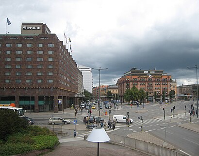
Tegelbacken, Stockholm, Sweden
This stop serves SL’s lines
Traveling around Stockholm has never been so easy. See step by step directions as you travel to any attraction, street or major public transit station. View bus and train schedules, arrival times, service alerts and detailed routes on a map, so you know exactly how to get to anywhere in Stockholm.
When traveling to any destination around Stockholm use Moovit's Live Directions with Get Off Notifications to know exactly where and how far to walk, how long to wait for your line, and how many stops are left. Moovit will alert you when it's time to get off — no need to constantly re-check whether yours is the next stop.
Wondering how to use public transit in Stockholm or how to pay for public transit in Stockholm? Moovit public transit app can help you navigate your way with public transit easily, and at minimum cost. It includes public transit fees, ticket prices, and costs. Looking for a map of Stockholm public transit lines? Moovit public transit app shows all public transit maps in Stockholm with all bus, metro or train routes and stops on an interactive map.
Stockholm has 3 transit type(s), including: bus, metro or train, operated by several transit agencies, including SL Tunnelbana, SL Spårvagn, SL Lokalbana, SL Rail, UL, Flygbussarna, Sörmlandstrafiken, X-trafik, Region Gotland, VL, Trosabussen, Vy Bus4You, Bergkvarabuss, Silverlinjen and Y-buss