See Television City, Fairfax, La, on the map
Directions to Television City (Fairfax, La) with public transportation
The following transit lines have routes that pass near Television City
 Bus:
Bus: - Subway:
How to get to Television City by bus?
Click on the bus route to see step by step directions with maps, line arrival times and updated time schedules.
Bus stations near Television City in Fairfax, La
- Fairfax / Oakwood,2 min walk,
- Fairfax Ave & Oakwood (Southbound),2 min walk,
- Beverly / Curson,4 min walk,
Subway stations near Television City in Fairfax, La
- Hollywood / Highland Station,57 min walk,
Bus lines to Television City in Fairfax, La
- 217,Eagle Rock Plaza,
- 218,Studio City,
- DASH,Eastbound,
- 14/37,Downtown LA,
What are the closest stations to Television City?
The closest stations to Television City are:
- Fairfax / Oakwood is 51 yards away, 2 min walk.
- Fairfax Ave & Oakwood (Southbound) is 66 yards away, 2 min walk.
- Beverly / Curson is 259 yards away, 4 min walk.
- Hollywood / Highland Station is 4840 yards away, 57 min walk.
Which bus lines stop near Television City?
These bus lines stop near Television City: 14/37, 217, DASH.
What’s the nearest bus stop to Television City in Fairfax, La?
The nearest bus stops to Television City in Fairfax, La are Fairfax / Oakwood and Fairfax Ave & Oakwood (Southbound). The closest one is a 2 min walk away.
What time is the first subway to Television City in Fairfax, La?
The B LINE (RED) is the first subway that goes to Television City in Fairfax, La. It stops nearby at 4:31 AM.
What time is the last subway to Television City in Fairfax, La?
The B LINE (RED) is the last subway that goes to Television City in Fairfax, La. It stops nearby at 12:22 AM.
What time is the first bus to Television City in Fairfax, La?
The 217 is the first bus that goes to Television City in Fairfax, La. It stops nearby at 3:17 AM.
What time is the last bus to Television City in Fairfax, La?
The 217 is the last bus that goes to Television City in Fairfax, La. It stops nearby at 2:57 AM.
How much is the bus fare to Television City?
The bus fare to Television City costs about $0.35 - $1.75.
How much is the subway fare to Television City?
The subway fare to Television City costs about $1.75.
See Television City, Fairfax, La, on the map
Public Transit to Television City in Fairfax, La
Wondering how to get to Television City in Fairfax, La, United States? Moovit helps you find the best way to get to Television City with step-by-step directions from the nearest public transit station.
Moovit provides free maps and live directions to help you navigate through your city. View schedules, routes, timetables, and find out how long does it take to get to Television City in real time.
Looking for the nearest stop or station to Television City? Check out this list of stops closest to your destination: Fairfax / Oakwood; Fairfax Ave & Oakwood (Southbound); Beverly / Curson; Hollywood / Highland Station.
Bus:Subway:
Want to see if there’s another route that gets you there at an earlier time? Moovit helps you find alternative routes or times. Get directions from and directions to Television City easily from the Moovit App or Website.
We make riding to Television City easy, which is why over 1.5 million users, including users in Fairfax, La, trust Moovit as the best app for public transit. You don’t need to download an individual bus app or train app, Moovit is your all-in-one transit app that helps you find the best bus time or train time available.
For information on prices of bus and subway, costs and ride fares to Television City, please check the Moovit app.
Use the app to navigate to popular places including to the airport, hospital, stadium, grocery store, mall, coffee shop, school, college, and university.
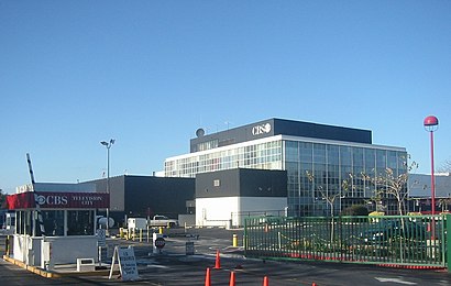
Television City Address: Beverly Boulevard street in Fairfax, La
Attractions near Television City
CBS TV Studios - Stage 33,American Idol - CBS Studios,Lemonade,CBS Television City Studios,Beverly/Fairfax Metro,Huntington Beach,Erewhon,Erewhon Natural Foods Market,Fairfax Beverly,Chipotle,Prendii Burgers,Cutbait Productions,Hirsh Family Kosher Kitchen and Cafe,My PC Guru,Aaron Patrick Freeman Photography,The Coffee Bean & Tea Leaf,Gallery Dept. Denim Services,Norm Alden's Cow Town Country,Farmers Market,American Girl Doll StoreHow to get to popular attractions in Fairfax, La with public transit
City of Calabasas, Calabasas,Huntington Beach, CA, Huntington Beach,85°C Bakery Cafe, Irvine,Citadel Outlets, Commerce,Monsters, Inc. Mike & Sulley to the Rescue!, Anaheim,The NOVO by Microsoft, Downtown, La,Diamond Jamboree Shopping Center, Irvine,World of Disney, Anaheim,Universal CityWalk Hollywood, Universal City, La,Finding Nemo Submarine Voyage, Anaheim,Costco Wholesale, Tustin,Mickey & Friends Tram, Anaheim,City of San Bernardino, San Bernardino,Temecula Promenade Mall, Temecula,Barney's Beanery, West Hollywood,SLS Hotel, a Luxury Collection Hotel, Beverly Hills, Beverly Grove, La,Fry's Electronics, Anaheim,The Boiling Crab, Koreatown, La,Torrance, CA, Torrance,The Water Garden, Santa MonicaGet around Fairfax, La by public transit!
Traveling around Fairfax, La has never been so easy. See step by step directions as you travel to any attraction, street or major public transit station. View bus and train schedules, arrival times, service alerts and detailed routes on a map, so you know exactly how to get to anywhere in Fairfax, La.
When traveling to any destination around Fairfax, La use Moovit's Live Directions with Get Off Notifications to know exactly where and how far to walk, how long to wait for your line, and how many stops are left. Moovit will alert you when it's time to get off — no need to constantly re-check whether yours is the next stop.
Wondering how to use public transit in Fairfax, La or how to pay for public transit in Fairfax, La? Moovit public transit app can help you navigate your way with public transit easily, and at minimum cost. It includes public transit fees, ticket prices, and costs. Looking for a map of Fairfax, La public transit lines? Moovit public transit app shows all public transit maps in Fairfax, La with all bus or subway routes and stops on an interactive map.
Fairfax, La has 2 transit type(s), including: bus or subway, operated by several transit agencies, including Metro - Los Angeles, Metro - Los Angeles, Metrolink Trains, METRO, Long Beach Transit, LADOT, OCTA, Foothill Transit, Big Blue Bus, Riverside Transit Agency, LAX FlyAway, Airporter Shuttle, Playa Vista Shuttle, Amtrak and OMNITRANS