Directions to Temp Pro Inc (Boston) with public transportation
The following transit lines have routes that pass near Temp Pro Inc
 Bus: 31, G73E, R44.
- Train: VERMONTER, VALLEY FLYER.
How to get to Temp Pro Inc by bus?
Click on the bus route to see step by step directions with maps, line arrival times and updated time schedules.
From Foxwoods, Worcester
185 minFrom Registry Of Motor Vehicles (Rmv) Branch Office, Worcester
184 minFrom Quinsigamond Community College, Worcester
173 minFrom Gardner, MA, Gardner
186 minFrom South High Community School, Worcester
252 minFrom Palladium, Worcester
185 minFrom Worcester, MA, Worcester
180 min
How to get to Temp Pro Inc by train?
Click on the train route to see step by step directions with maps, line arrival times and updated time schedules.
Bus stops near Temp Pro Inc in Boston
Train station near Temp Pro Inc in Boston
- Northampton, 11 min walk,VIEW
Bus lines to Temp Pro Inc in Boston
What are the closest stations to Temp Pro Inc?
The closest stations to Temp Pro Inc are:
- King St at Sakura Buffet is 764 yards away, 10 min walk.
- King / Barrett is 766 yards away, 10 min walk.
- Northampton is 888 yards away, 11 min walk.
Which bus lines stop near Temp Pro Inc?
These bus lines stop near Temp Pro Inc: 31, G73E, R44.
Which train line stops near Temp Pro Inc?
VERMONTER (St Albans)
What’s the nearest train station to Temp Pro Inc in Boston?
The nearest train station to Temp Pro Inc in Boston is Northampton. It’s a 11 min walk away.
What’s the nearest bus station to Temp Pro Inc in Boston?
The nearest bus stations to Temp Pro Inc in Boston are King St at Sakura Buffet and King / Barrett. The closest one is a 10 min walk away.
What time is the first train to Temp Pro Inc in Boston?
The VALLEY FLYER is the first train that goes to Temp Pro Inc in Boston. It stops nearby at 6:30 AM.
What time is the last train to Temp Pro Inc in Boston?
The VALLEY FLYER is the last train that goes to Temp Pro Inc in Boston. It stops nearby at 10:07 PM.
What time is the first bus to Temp Pro Inc in Boston?
The 31 is the first bus that goes to Temp Pro Inc in Boston. It stops nearby at 5:36 AM.
What time is the last bus to Temp Pro Inc in Boston?
The 31 is the last bus that goes to Temp Pro Inc in Boston. It stops nearby at 7:00 PM.
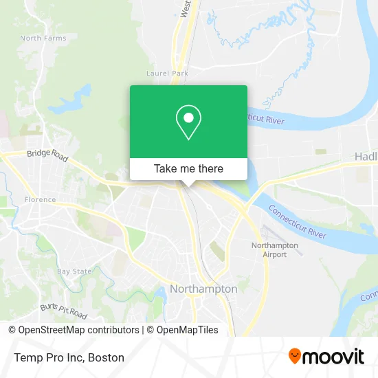
See Temp Pro Inc, Boston, on the map
Public Transit to Temp Pro Inc in Boston
Wondering how to get to Temp Pro Inc in Boston? Moovit helps you find the best way to get to Temp Pro Inc with step-by-step directions from the nearest public transit station.
Moovit provides free maps and live directions to help you navigate through your city. View schedules, routes, timetables, and find out how long does it take to get to Temp Pro Inc in real time.
Looking for the nearest stop or station to Temp Pro Inc? Check out this list of stops closest to your destination: King St at Sakura Buffet; King / Barrett; Northampton.
Bus: 31, G73E, R44.Train: VERMONTER, VALLEY FLYER.
Want to see if there’s another route that gets you there at an earlier time? Moovit helps you find alternative routes or times. Get directions from and directions to Temp Pro Inc easily from the Moovit App or Website.
We make riding to Temp Pro Inc easy, which is why over 1.7 million users, including users in Boston, trust Moovit as the best app for public transit. You don’t need to download an individual bus app or train app, Moovit is your all-in-one transit app that helps you find the best bus time or train time available.
For information on prices of bus and train, costs and ride fares to Temp Pro Inc, please check the Moovit app.
Use the app to navigate to popular places including to the airport, hospital, stadium, grocery store, mall, coffee shop, school, college, and university.
Temp Pro Inc Address: 200 Industrial Dr street in Boston
- Bradford Woodworking Cabinets,
- Northampton Community Rowing,
- Commonwealth of Massachusetts Mental Retardation Dept,
- TNM Auto,
- Dick's Sporting Goods,
- The Advertising Specialty Institute,
- EV Connect,
- Amazon Locker-Dissonance,
- Neos Northampton,
- Saint-Germain Ceramics & Plastics,
- Saint Gobain Ceramic Materials,
- Andys Carpet Cleaning,
- Little Green Dragon,
- D'Angelo,
- Firestone,
- UPS Access Point,
- Bridgestone,
- Smaall Beer Press,
- In Home Handyman Service,
- Solely Chiropractic
Places Near Temp Pro Inc (Boston)
- Boston Common, Boston,
- Boston Medical Center, Boston,
- North End, Boston,
- Td Garden, Boston,
- Boston Children's Hospital, Boston,
- Cheers, Boston,
- Seaport District, Boston,
- Museum Of Science, Boston,
- Isabella Stewart Gardner Museum, Boston,
- Faneuil Hall, Boston,
- Wang Theater, Boston,
- Prudential Center, Boston,
- Massachusetts General Hospital, Boston,
- Castle Island, Boston,
- Wilbur Theatre, Boston,
- Boston Convention & Exhibition Center, Boston,
- Mgm Music Hall, Boston,
- House Of Blues, Boston,
- Quincy Market, Boston,
- Leader Bank Pavilion (Leader Bank Pavillion), Boston
How to get to popular places in Boston with public transit
Get around Boston by public transit!
Traveling around Boston has never been so easy. See step by step directions as you travel to any attraction, street or major public transit station. View bus and train schedules, arrival times, service alerts and detailed routes on a map, so you know exactly how to get to anywhere in Boston.
When traveling to any destination around Boston use Moovit's Live Directions with Get Off Notifications to know exactly where and how far to walk, how long to wait for your line, and how many stops are left. Moovit will alert you when it's time to get off — no need to constantly re-check whether yours is the next stop.
Wondering how to use public transit in Boston or how to pay for public transit in Boston? Moovit public transit app can help you navigate your way with public transit easily, and at minimum cost. It includes public transit fees, ticket prices, and costs. Looking for a map of Boston public transit lines? Moovit public transit app shows all public transit maps in Boston with all Bus, Train, Subway and Ferry routes and stops on an interactive map.
Boston has 4 transit type(s), including: Bus, Train, Subway and Ferry, operated by several transit agencies, including MBTA, Southeastern Regional Transit Authority, MetroWest Regional Transit Authority, Rhode Island Public Transit Authority, WRTA, Lowell Regional Transit Authority, Merrimack Valley Transit, Montachusett Regional Transit Authority, Cape Cod Regional Transit Authority, Brockton Area Transit Authority, Martha's Vineyard Transit Authority, the WAVE - Nantucket Regional Transit Authority, GATRA, Cape Ann Transportation Authority and Massport