How to get to Trends by bus?
Click on the bus route to see step by step directions with maps, line arrival times and updated time schedules.
From Design Campus, Calenzano
71 minFrom Coop-Fi, Sesto Fiorentino
54 minFrom Mondo Convenienza, Prato
84 minFrom I Gigli Shopping Center, Campi Bisenzio
72 minFrom Santa Maria Annunziata (Ponte a Niccheri), Bagno a Ripoli
62 minFrom Scientific and Technological Pole, Sesto Fiorentino
59 minFrom I Ragli Farm, San Casciano In Val Di Pesa
78 minFrom Farewell Chapels of Misericordia of Antella, Bagno a Ripoli
68 minFrom Torretta Street, Florence
40 min
How to get to Trends by train?
Click on the train route to see step by step directions with maps, line arrival times and updated time schedules.
Bus stops near Trends in Florence
Light Rail stations near Trends in Florence
- Federiga, 7 min walk,VIEW
Bus lines to Trends in Florence
What are the closest stations to Trends?
The closest stations to Trends are:
- Torcicoda Geraniums is 244 meters away, 4 min walk.
- Cigoli is 256 meters away, 4 min walk.
- Foggini Talenti is 325 meters away, 5 min walk.
- Foggini Baccio Da Montelupo is 404 meters away, 6 min walk.
- La Federiga is 462 meters away, 6 min walk.
- Federiga is 469 meters away, 7 min walk.
- Pollaiolo Cortona is 525 meters away, 7 min walk.
- Talenti is 710 meters away, 10 min walk.
- Talenti Avenue is 744 meters away, 10 min walk.
Which bus lines stop near Trends?
These bus lines stop near Trends: 17, 30, 6.
Which train line stops near Trends?
R (Prato/Firenze)
Which light rail line stops near Trends?
T1 (Villa Costanza)
What’s the nearest light rail station to Trends in Florence?
The nearest light rail station to Trends in Florence is Federiga. It’s a 7 min walk away.
What’s the nearest bus station to Trends in Florence?
The nearest bus stations to Trends in Florence are Torcicoda Geraniums and Cigoli. The closest one is a 4 min walk away.
What time is the first light rail to Trends in Florence?
The T2 is the first light rail that goes to Trends in Florence. It stops nearby at 4:41 AM.
What time is the last light rail to Trends in Florence?
The T2 is the last light rail that goes to Trends in Florence. It stops nearby at 12:57 AM.
What time is the first bus to Trends in Florence?
The 77 is the first bus that goes to Trends in Florence. It stops nearby at 6:12 AM.
What time is the last bus to Trends in Florence?
The 9 is the last bus that goes to Trends in Florence. It stops nearby at 12:26 AM.
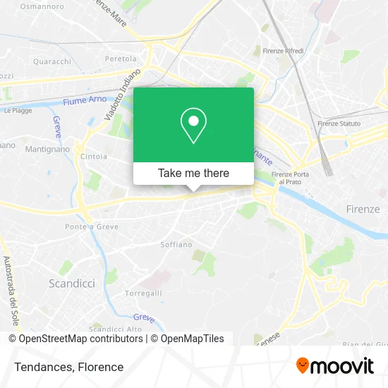
See Trends, Florence, on the map
Public Transit to Trends in Florence
Wondering how to get to Trends in Florence? Moovit helps you find the best way to get to Trends with step-by-step directions from the nearest public transit station.
Moovit provides free maps and live directions to help you navigate through your city. View schedules, routes, timetables, and find out how long does it take to get to Trends in real time.
Looking for the nearest stop or station to Trends? Check out this list of stops closest to your destination: Torcicoda Geraniums; Cigoli; Foggini Talenti; Foggini Baccio Da Montelupo; La Federiga; Federiga; Pollaiolo Cortona; Talenti; Talenti Avenue.
Bus: 17, 30, 6, 9, 9, 4, 5, 78, 77, 44, 72.Train: R.Light Rail: T1.
Want to see if there’s another route that gets you there at an earlier time? Moovit helps you find alternative routes or times. Get directions from and directions to Trends easily from the Moovit App or Website.
We make riding to Trends easy, which is why over 1.5 million users, including users in Florence, trust Moovit as the best app for public transit. You don’t need to download an individual bus app or train app, Moovit is your all-in-one transit app that helps you find the best bus time or train time available.
For information on prices of bus, light rail and train, costs and ride fares to Trends, please check the Moovit app.
Use the app to navigate to popular places including to the airport, hospital, stadium, grocery store, mall, coffee shop, school, college, and university.
Trends Address: Viale Francesco Talenti, 124 50142 Firenze street in Florence
- Korperformen,
- Assicoop Tuscany,
- C. Hydronic Systems by Di Cataldo Claudio,
- Dr. Jano M. De Cesare - Otorhinolaryngologist,
- Dr. Filippo Simonelli,
- Bper-Popular Bank of Emilia Romagna-Agency 2 of Florence,
- BPER: Bank,
- Phoenix,
- Dr. Ermini Paolo,
- Municipal Pharmacies Florence,
- Shine with Us,
- Isolotto,
- Ramen Girl,
- Snack Bar,
- Ramen Girl by Enoteca Luce,
- Sandro Montera,
- A.Erre. Photo Optics by Pelati Alessandro,
- It 168 Store,
- Sushi U&Me,
- Romano Piazzini
Places Near Trends (Florence)
- OOO, Florence,
- IKEA Florence, Sesto Fiorentino,
- Torregalli Hospital Scandicci *, Scandicci,
- Field of Mars, Florence,
- Santa Maria Novella Station, Florence,
- Michelangelo Square, Florence,
- Mandela Forum (Nelson Mandela Forum), Florence,
- Asmana, Campi Bisenzio,
- Campi Bisenzio, Campi Bisenzio,
- Visarno Arena, Florence,
- Piero Palagi Hospital Facility-Florence, Florence,
- Artemio Franchi Municipal Stadium, Florence,
- Tobacco Manufacture, Florence,
- Michelangelo Square, Florence,
- I Gigli, Campi Bisenzio,
- Santa Maria Nuova Hospital, Florence,
- Cascine Park, Florence,
- Nelson Mandela Forum, Florence,
- Visarno Hippodrome, Florence,
- Verdi Theater, Florence
How to get to popular places in Florence with public transit
Get around Florence by public transit!
Traveling around Florence has never been so easy. See step by step directions as you travel to any attraction, street or major public transit station. View bus and train schedules, arrival times, service alerts and detailed routes on a map, so you know exactly how to get to anywhere in Florence.
When traveling to any destination around Florence use Moovit's Live Directions with Get Off Notifications to know exactly where and how far to walk, how long to wait for your line, and how many stops are left. Moovit will alert you when it's time to get off — no need to constantly re-check whether yours is the next stop.
Wondering how to use public transit in Florence or how to pay for public transit in Florence? Moovit public transit app can help you navigate your way with public transit easily, and at minimum cost. It includes public transit fees, ticket prices, and costs. Looking for a map of Florence public transit lines? Moovit public transit app shows all public transit maps in Florence with all Bus, Train, Light Rail, Ferry and Funicular routes and stops on an interactive map.
Florence has 5 transit type(s), including: Bus, Train, Light Rail, Ferry and Funicular, operated by several transit agencies, including Florence Urban - Tuscan Bus Lines, GEST, Livorno and Province - Tuscan Bus Lines, Arezzo, Florence and Provinces - Tuscan Bus Lines, Prato and Province - Tuscan Bus Lines, Lucca and Province - Tuscan Bus Lines, Massa, Carrara and Province - Tuscan Bus Lines, Pisa and Province - Tuscan Bus Lines, Grosseto, Siena and Provinces - Tuscan Bus Lines, Arezzo, Siena and Provinces - Tuscan Bus Lines, Florence and Province - Tuscan Bus Lines, Pistoia and Province - Tuscan Bus Lines, Siena and Province - Tuscan Bus Lines, Arezzo and Province - Tuscan Bus Lines and Trenitalia