Directions to Tequila Rain (Boston) with public transportation
The following transit lines have routes that pass near Tequila Rain
 Bus: 1, 19, 39, 8, 85.
- Train: FRAMINGHAM/WORCESTER.
- Subway: GREEN LINE B, GREEN LINE C, GREEN LINE D.
How to get to Tequila Rain by bus?
Click on the bus route to see step by step directions with maps, line arrival times and updated time schedules.
From Doubletree-Boston Bayside, Boston
59 minFrom Milton Academy, Milton
99 minFrom Wollaston Beach, Quincy
128 minFrom Wegmans, Medford
100 minFrom Hampton Inn & Suites-Hampton Watertown Boston (Hampton Inn & Suites Watertown Boston), Watertown Town
49 minFrom West Roxbury VA Medical Center, Boston
73 minFrom Melrose Wakefield Hospital, Malden
106 minFrom VA Hospital, Boston
61 minFrom Maverick Station, Boston
58 minFrom Boston Logan International Airport (Bos), Boston
25 min
How to get to Tequila Rain by train?
Click on the train route to see step by step directions with maps, line arrival times and updated time schedules.
How to get to Tequila Rain by subway?
Click on the subway route to see step by step directions with maps, line arrival times and updated time schedules.
Bus stops near Tequila Rain in Boston
Subway stations near Tequila Rain in Boston
Train station near Tequila Rain in Boston
- Lansdowne, 7 min walk,VIEW
Bus lines to Tequila Rain in Boston
- 57, Haymarket Via Kenmore,VIEW
- 1 BU (CHARLES RIVER-MEDICAL CAMPUS), 1 BU (Charles River-Medical Campus),VIEW
- GREEN LINE B SHUTTLE, Babcock Street - Back Bay,VIEW
- GREEN LINE B SHUTTLE, Boston College - Back Bay (Shuttle),VIEW
- GREEN LINE B SHUTTLE, Babcock Street - Copley,VIEW
- GREEN LINE B SHUTTLE, Babcock Street - Back Bay via Copley (Shuttle),VIEW
- GREEN LINE B SHUTTLE, Kenmore - Back Bay via Copley (Shuttle),VIEW
- GREEN LINE B SHUTTLE, Babcock Street - Kenmore,VIEW
- GREEN LINE B SHUTTLE, Washington Street - Kenmore,VIEW
- GREEN LINE B SHUTTLE, Boston University East - Back Bay,VIEW
- GREEN LINE C SHUTTLE, Saint Mary's Street - Kenmore,VIEW
- GREEN LINE C SHUTTLE, Saint Mary's Street - Back Bay,VIEW
- GREEN LINE D SHUTTLE, Riverside - Kenmore (Shuttle),VIEW
- GREEN LINE D SHUTTLE, Reservoir - Kenmore,VIEW
- GREEN LINE D SHUTTLE, Newton Highlands - Kenmore,VIEW
- GREEN LINE D SHUTTLE, Brookline Hills - Kenmore,VIEW
- GREEN LINE D SHUTTLE, Riverside - Kenmore via Saint Mary's Street,VIEW
- GREEN LINE D SHUTTLE, Brookline Hills - Back Bay (Shuttle),VIEW
- GREEN LINE D SHUTTLE, Fenway - Kenmore,VIEW
- GREEN LINE D SHUTTLE, Newton Highlands - Kenmore via Saint Mary's Street,VIEW
What are the closest stations to Tequila Rain?
The closest stations to Tequila Rain are:
- Commonwealth Ave @ Kenmore St is 147 yards away, 2 min walk.
- Kenmore is 177 yards away, 3 min walk.
- Ipswich St @ Boylston St is 220 yards away, 3 min walk.
- Fenway is 410 yards away, 5 min walk.
- Lansdowne is 491 yards away, 7 min walk.
- Blandford Street is 815 yards away, 10 min walk.
- Hynes Convention Center is 1013 yards away, 13 min walk.
Which bus lines stop near Tequila Rain?
These bus lines stop near Tequila Rain: 1, 19, 39, 8, 85, BB.
Which train line stops near Tequila Rain?
FRAMINGHAM/WORCESTER (#521 | Worcester)
Which subway lines stop near Tequila Rain?
These subway lines stop near Tequila Rain: GREEN LINE B, GREEN LINE C, GREEN LINE D.
What’s the nearest subway station to Tequila Rain in Boston?
The nearest subway station to Tequila Rain in Boston is Fenway. It’s a 5 min walk away.
What’s the nearest train station to Tequila Rain in Boston?
The nearest train station to Tequila Rain in Boston is Lansdowne. It’s a 7 min walk away.
What’s the nearest bus station to Tequila Rain in Boston?
The nearest bus station to Tequila Rain in Boston is Commonwealth Ave @ Kenmore St. It’s a 2 min walk away.
What time is the first subway to Tequila Rain in Boston?
The GREEN LINE D is the first subway that goes to Tequila Rain in Boston. It stops nearby at 4:56 AM.
What time is the last subway to Tequila Rain in Boston?
The GREEN LINE D is the last subway that goes to Tequila Rain in Boston. It stops nearby at 2:21 AM.
What time is the first train to Tequila Rain in Boston?
The FRAMINGHAM/WORCESTER is the first train that goes to Tequila Rain in Boston. It stops nearby at 4:55 AM.
What time is the last train to Tequila Rain in Boston?
The FRAMINGHAM/WORCESTER is the last train that goes to Tequila Rain in Boston. It stops nearby at 12:06 AM.
What time is the first bus to Tequila Rain in Boston?
The 57 is the first bus that goes to Tequila Rain in Boston. It stops nearby at 4:46 AM.
What time is the last bus to Tequila Rain in Boston?
The 57 is the last bus that goes to Tequila Rain in Boston. It stops nearby at 2:09 AM.
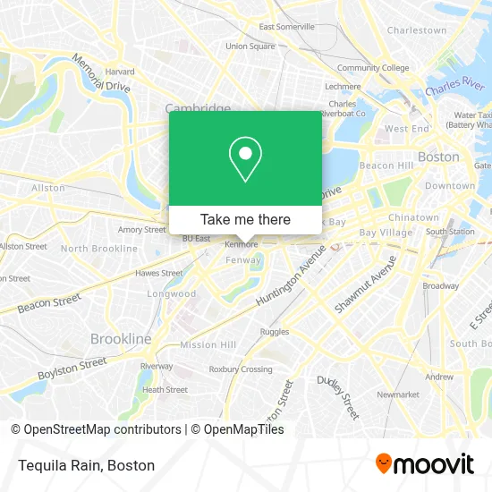
See Tequila Rain, Boston, on the map
Public Transit to Tequila Rain in Boston
Wondering how to get to Tequila Rain in Boston? Moovit helps you find the best way to get to Tequila Rain with step-by-step directions from the nearest public transit station.
Moovit provides free maps and live directions to help you navigate through your city. View schedules, routes, timetables, and find out how long does it take to get to Tequila Rain in real time.
Looking for the nearest stop or station to Tequila Rain? Check out this list of stops closest to your destination: Commonwealth Ave @ Kenmore St; Kenmore; Ipswich St @ Boylston St; Fenway; Lansdowne; Blandford Street; Hynes Convention Center.
Bus: 1, 19, 39, 8, 85, BB, 57, 1 BU (CHARLES RIVER-MEDICAL CAMPUS), GREEN LINE B SHUTTLE, GREEN LINE B SHUTTLE, GREEN LINE B SHUTTLE, GREEN LINE B SHUTTLE.Train: FRAMINGHAM/WORCESTER.Subway: GREEN LINE B, GREEN LINE C, GREEN LINE D.
Want to see if there’s another route that gets you there at an earlier time? Moovit helps you find alternative routes or times. Get directions from and directions to Tequila Rain easily from the Moovit App or Website.
We make riding to Tequila Rain easy, which is why over 1.7 million users, including users in Boston, trust Moovit as the best app for public transit. You don’t need to download an individual bus app or train app, Moovit is your all-in-one transit app that helps you find the best bus time or train time available.
For information on prices of bus, subway and train, costs and ride fares to Tequila Rain, please check the Moovit app.
Use the app to navigate to popular places including to the airport, hospital, stadium, grocery store, mall, coffee shop, school, college, and university.
Tequila Rain Address: 3 Lansdowne St street in Boston
- Cheeky Monkey Brewing Co,
- Bill's Bar,
- MGM Music Hall Rooftop Bar,
- Melt,
- MGM Music Hall at Fenway,
- Lucky Strike Lanes,
- Loretta's Last Call,
- Back Door Donuts,
- Lansdowne Street Garage,
- Lansdowne Pub (Landsdowne Irish Pub Boston),
- Jillian's & Lucky Strike,
- House of Blues Boston,
- House of Blues ,
- Sasha Alex Sloan,
- Quicksandmerch,
- Judah and the Lion,
- Beach Bunny,
- Big Head Todd & the Mo,
- Super American,
- Noah Kahan
Places Near Tequila Rain (Boston)
- Boston Medical Center, Boston,
- Wang Theater, Boston,
- North End, Boston,
- Faneuil Hall, Boston,
- Boston Convention & Exhibition Center, Boston,
- Mgm Music Hall, Boston,
- Massachusetts General Hospital, Boston,
- Td Garden, Boston,
- Prudential Center, Boston,
- House Of Blues, Boston,
- Museum Of Science, Boston,
- Boston Children's Hospital, Boston,
- Seaport District, Boston,
- Wilbur Theatre, Boston,
- Leader Bank Pavilion (Leader Bank Pavillion), Boston,
- Castle Island, Boston,
- Boston Common, Boston,
- Isabella Stewart Gardner Museum, Boston,
- Quincy Market, Boston,
- Cheers, Boston
How to get to popular places in Boston with public transit
Get around Boston by public transit!
Traveling around Boston has never been so easy. See step by step directions as you travel to any attraction, street or major public transit station. View bus and train schedules, arrival times, service alerts and detailed routes on a map, so you know exactly how to get to anywhere in Boston.
When traveling to any destination around Boston use Moovit's Live Directions with Get Off Notifications to know exactly where and how far to walk, how long to wait for your line, and how many stops are left. Moovit will alert you when it's time to get off — no need to constantly re-check whether yours is the next stop.
Wondering how to use public transit in Boston or how to pay for public transit in Boston? Moovit public transit app can help you navigate your way with public transit easily, and at minimum cost. It includes public transit fees, ticket prices, and costs. Looking for a map of Boston public transit lines? Moovit public transit app shows all public transit maps in Boston with all Bus, Train, Subway and Ferry routes and stops on an interactive map.
Boston has 4 transit type(s), including: Bus, Train, Subway and Ferry, operated by several transit agencies, including MBTA, Southeastern Regional Transit Authority, MetroWest Regional Transit Authority, Rhode Island Public Transit Authority, WRTA, Lowell Regional Transit Authority, Merrimack Valley Transit, Montachusett Regional Transit Authority, Cape Cod Regional Transit Authority, Brockton Area Transit Authority, Martha's Vineyard Transit Authority, the WAVE - Nantucket Regional Transit Authority, GATRA, Cape Ann Transportation Authority and Massport