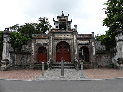
See Thành Cổ Loa, Huyện Đông Anh, on the map
Directions to Thành Cổ Loa (Huyện Đông Anh) with public transportation
The following transit lines have routes that pass near Thành Cổ Loa
 Bus:
Bus:
How to get to Thành Cổ Loa by bus?
Click on the bus route to see step by step directions with maps, line arrival times and updated time schedules.
Bus stations near Thành Cổ Loa in Huyện Đông Anh
- Trước Đường Vào Thành Cổ Loa 120m - Đường Cổ Loa,8 min walk,
Bus lines to Thành Cổ Loa in Huyện Đông Anh
- 46,(A) Bx Mỹ Đình,
What are the closest stations to Thành Cổ Loa?
The closest stations to Thành Cổ Loa are:
- Trước Đường Vào Thành Cổ Loa 120m - Đường Cổ Loa is 577 meters away, 8 min walk.
Which bus line stops near Thành Cổ Loa?
46
What’s the nearest bus stop to Thành Cổ Loa in Huyện Đông Anh?
The nearest bus stop to Thành Cổ Loa in Huyện Đông Anh is Trước Đường Vào Thành Cổ Loa 120m - Đường Cổ Loa. It’s a 8 min walk away.
What time is the first bus to Thành Cổ Loa in Huyện Đông Anh?
The 46 is the first bus that goes to Thành Cổ Loa in Huyện Đông Anh. It stops nearby at 5:05 AM.
What time is the last bus to Thành Cổ Loa in Huyện Đông Anh?
The 46 is the last bus that goes to Thành Cổ Loa in Huyện Đông Anh. It stops nearby at 9:36 PM.
See Thành Cổ Loa, Huyện Đông Anh, on the map
Public Transit to Thành Cổ Loa in Huyện Đông Anh
Wondering how to get to Thành Cổ Loa in Huyện Đông Anh, Vietnam? Moovit helps you find the best way to get to Thành Cổ Loa with step-by-step directions from the nearest public transit station.
Moovit provides free maps and live directions to help you navigate through your city. View schedules, routes, timetables, and find out how long does it take to get to Thành Cổ Loa in real time.
Looking for the nearest stop or station to Thành Cổ Loa? Check out this list of stops closest to your destination: Trước Đường Vào Thành Cổ Loa 120m - Đường Cổ Loa.
Bus:
Want to see if there’s another route that gets you there at an earlier time? Moovit helps you find alternative routes or times. Get directions from and directions to Thành Cổ Loa easily from the Moovit App or Website.
We make riding to Thành Cổ Loa easy, which is why over 1.5 million users, including users in Huyện Đông Anh, trust Moovit as the best app for public transit. You don’t need to download an individual bus app or train app, Moovit is your all-in-one transit app that helps you find the best bus time or train time available.
For information on prices of bus, costs and ride fares to Thành Cổ Loa, please check the Moovit app.
Use the app to navigate to popular places including to the airport, hospital, stadium, grocery store, mall, coffee shop, school, college, and university.
Location: Huyện Đông Anh, Hanoi
Attractions near Thành Cổ Loa
AM Mị Châu,Nhà Trưng Bày Khu Di Tích Quốc Gia Đặc Biệt Cổ Loa,Cổ Loa, Đông Anh, Hà Nội,Trường Mầm Non Cổ Loa,Beauty Salon Dũng Mạnh Nguyễn,Hồng Beauty,CS SX Nhôm Kính Miền Nam,Giải Khát Bia Hơi Bắc Sông Hồng,Tóc Uốn-Ép-Nhuộm,Cơ Sở Sản Xuất Thuấn Hoa,Giếng Trọng Thủy,Trường Thanh Chuyên Giày Da Nam-Nữ Cao Cấp,Hạnh Lâm Đường Đông Y Gia Truyền,Tân Đồ Câu,Thể Thao Thế Mừng,Trung Tâm Sửa Chữa Ô Tô Chuyên Nghiệp,Tóc Xinh,Hội Khoa Học Tâm Lý Giáo Dục Việt Nam Trung Tâm Tư Vấn Hỗ Trợ Tâm Lý Can Thiệp Sớm Nắng Mới,Thế Giới Đồ Gỗ,Vàng Bạc Tiến DũngHow to get to popular attractions in Huyện Đông Anh with public transit
VTC Academy (http: / /www.academy.vtc.vn), Quận Hai Bà Trưng,eBay Vietnam, Quận Hai Bà Trưng,Cổng Vào Đại Học Hà Nội, Phường Trung Văn,Singapore International School (SIS) - Ciputra Campus, Quận Tây Hồ,Khoa RHM - Bệnh viện ĐH Y HN, Quận Đống Đa,Bưu Điện Cầu Giấy, Quận Cầu Giấy,Đường Thụy Khuê, Quận Tây Hồ,Giang Vo Lake (Hồ Giảng Võ), Quận Ba Đình,Trà đá VtV, Phường Ngọc Khánh,Bệnh viện Nhiệt đới Trung Ương, Phường Phương Mai,Tổng cục Thuế, Quận Hai Bà Trưng,Joma Bakery Café, Quận Tây Hồ,FPT School of Business, Phường Cầu Diễn,Yakushi Center for Holistic Health, Quận Tây Hồ,Nhổn - Đại Học Công Nghiệp, Phường Minh Khai,ĐH Công Nghiệp, Phường Xuân Phương,Cầu Mai Động, Vĩnh Tuy,Thang Long Tower, Quận Thanh Xuân,Ga Giáp Bát, Thịnh Liệt,Academy of Journalism and Communication, Quận Cầu GiấyGet around Huyện Đông Anh by public transit!
Traveling around Huyện Đông Anh has never been so easy. See step by step directions as you travel to any attraction, street or major public transit station. View bus and train schedules, arrival times, service alerts and detailed routes on a map, so you know exactly how to get to anywhere in Huyện Đông Anh.
When traveling to any destination around Huyện Đông Anh use Moovit's Live Directions with Get Off Notifications to know exactly where and how far to walk, how long to wait for your line, and how many stops are left. Moovit will alert you when it's time to get off — no need to constantly re-check whether yours is the next stop.
Wondering how to use public transit in Huyện Đông Anh or how to pay for public transit in Huyện Đông Anh? Moovit public transit app can help you navigate your way with public transit easily, and at minimum cost. It includes public transit fees, ticket prices, and costs. Looking for a map of Huyện Đông Anh public transit lines? Moovit public transit app shows all public transit maps in Huyện Đông Anh with all bus routes and stops on an interactive map.
Huyện Đông Anh has 1 transit type(s), including: bus, operated by several transit agencies, including Hanoibus - Xe buýt Hà Nội, Công ty Đường sắt Hà Nội Hanoi Metro and Công ty CPVT Hà Tây