Directions to The Agency Boston with public transportation
The following transit lines have routes that pass near The Agency Boston
 Bus: 1, 39, 43, 501, BB.
- Train: ACELA, FRAMINGHAM/WORCESTER, HAVERHILL, FOXBORO EVENT SERVICE, FRANKLIN/FOXBORO.
- Subway: GREEN LINE B, GREEN LINE E, ORANGE LINE, GREEN LINE C, GREEN LINE D.
How to get to The Agency Boston by bus?
Click on the bus route to see step by step directions with maps, line arrival times and updated time schedules.
From Market Basket
77 minFrom Spaulding Rehabilitation Center
56 minFrom the mall at rockingham park mall
48 minFrom Milton, MA
74 minFrom Arsenal Mall
55 minFrom Arlington, MA
77 minFrom Medford, MA
77 minFrom Beth Israel Deaconess Hospital-Milton
85 minFrom MBTA Alewife Station
70 minFrom Melrose Wakefield Hospital
89 min
How to get to The Agency Boston by train?
Click on the train route to see step by step directions with maps, line arrival times and updated time schedules.
How to get to The Agency Boston by subway?
Click on the subway route to see step by step directions with maps, line arrival times and updated time schedules.
Bus stops near The Agency Boston
- Back Bay - Columbus Ave @ Dartmouth St, 1 min walk,VIEW
- Tremont St @ Concord Sq, 2 min walk,VIEW
- Announcement #5 - Back Bay To Airport, 2 min walk,VIEW
- Dartmouth St @ Appleton St, 2 min walk,VIEW
- Back Bay, 3 min walk,VIEW
- Dartmouth St Opp Back Bay Sta, 3 min walk,VIEW
- Huntington Ave @ Prudential Station, 6 min walk,VIEW
- Huntington Ave @ Belvidere St, 7 min walk,VIEW
Train station near The Agency Boston
- Back Bay - South End, 7 min walk,VIEW
Subway station near The Agency Boston
- Copley, 9 min walk,VIEW
Bus lines to The Agency Boston
- ORANGE LINE SHUTTLE, Ruggles (Shuttle),VIEW
- ORANGE LINE SHUTTLE, Forest Hills (Shuttle),VIEW
- ORANGE LINE SHUTTLE, Jackson Square (Shuttle),VIEW
- 43, Ruggles,VIEW
- BB, Airport,VIEW
- 10, Arlington Via South Bay Center,VIEW
- 39, Haymarket Via Forest Hills,VIEW
- WORCESTER LINE SHUTTLE, Back Bay (Shuttle),VIEW
- ORANGE LINE SHUTTLE, Forest Hills Via Copley (Shuttle),VIEW
- GREEN LINE E SHUTTLE, Prudential (Shuttle),VIEW
- GREEN LINE E SHUTTLE, Park Street (Shuttle),VIEW
- 9, Kenmore Via Boston Latin,VIEW
What are the closest stations to The Agency Boston?
The closest stations to The Agency Boston are:
- Back Bay - Columbus Ave @ Dartmouth St is 5 yards away, 1 min walk.
- Tremont St @ Concord Sq is 109 yards away, 2 min walk.
- Announcement #5 - Back Bay To Airport is 130 yards away, 2 min walk.
- Dartmouth St @ Appleton St is 144 yards away, 2 min walk.
- Back Bay is 176 yards away, 3 min walk.
- Dartmouth St Opp Back Bay Sta is 215 yards away, 3 min walk.
- Huntington Ave @ Prudential Station is 322 yards away, 6 min walk.
- Back Bay - South End is 480 yards away, 7 min walk.
- Huntington Ave @ Belvidere St is 527 yards away, 7 min walk.
- Copley is 696 yards away, 9 min walk.
Which bus lines stop near The Agency Boston?
These bus lines stop near The Agency Boston: 1, 39, 43, 501, BB.
Which train lines stop near The Agency Boston?
These train lines stop near The Agency Boston: ACELA, FRAMINGHAM/WORCESTER, HAVERHILL.
Which subway lines stop near The Agency Boston?
These subway lines stop near The Agency Boston: GREEN LINE B, GREEN LINE E, ORANGE LINE.
What’s the nearest subway station to The Agency Boston?
The nearest subway station to The Agency Boston is Copley. It’s a 9 min walk away.
What’s the nearest train station to The Agency Boston?
The nearest train station to The Agency Boston is Back Bay - South End. It’s a 7 min walk away.
What’s the nearest bus station to The Agency Boston?
The nearest bus station to The Agency Boston is Back Bay - Columbus Ave @ Dartmouth St. It’s a 1 min walk away.
What time is the first subway to The Agency Boston?
The GREEN LINE D is the first subway that goes to The Agency Boston. It stops nearby at 5:05 AM.
What time is the last subway to The Agency Boston?
The GREEN LINE D is the last subway that goes to The Agency Boston. It stops nearby at 2:13 AM.
What time is the first train to The Agency Boston?
The PROVIDENCE/STOUGHTON is the first train that goes to The Agency Boston. It stops nearby at 4:25 AM.
What time is the last train to The Agency Boston?
The LAKE SHORE LIMITED is the last train that goes to The Agency Boston. It stops nearby at 8:26 PM.
What time is the first bus to The Agency Boston?
The 39 is the first bus that goes to The Agency Boston. It stops nearby at 4:57 AM.
What time is the last bus to The Agency Boston?
The 10 is the last bus that goes to The Agency Boston. It stops nearby at 1:20 AM.
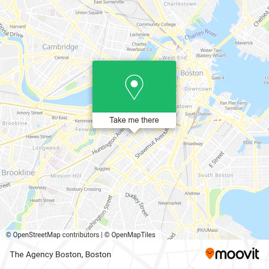
See The Agency Boston on the map
Public Transportation to The Agency Boston
Wondering how to get to The Agency Boston? Moovit helps you find the best way to get to The Agency Boston with step-by-step directions from the nearest public transit station.
Moovit provides free maps and live directions to help you navigate through your city. View schedules, routes, timetables, and find out how long does it take to get to The Agency Boston in real time.
Looking for the nearest stop or station to The Agency Boston? Check out this list of stops closest to your destination: Back Bay - Columbus Ave @ Dartmouth St; Tremont St @ Concord Sq; Announcement #5 - Back Bay To Airport; Dartmouth St @ Appleton St; Back Bay; Dartmouth St Opp Back Bay Sta; Huntington Ave @ Prudential Station; Back Bay - South End; Huntington Ave @ Belvidere St; Copley.
Bus: 1, 39, 43, 501, BB, ORANGE LINE SHUTTLE, ORANGE LINE SHUTTLE, ORANGE LINE SHUTTLE, 10.Train: ACELA, FRAMINGHAM/WORCESTER, HAVERHILL, FOXBORO EVENT SERVICE, FRANKLIN/FOXBORO, NEEDHAM, ORANGE LINE.Subway: GREEN LINE B, GREEN LINE E, ORANGE LINE, GREEN LINE C, GREEN LINE D.
Want to see if there’s another route that gets you there at an earlier time? Moovit helps you find alternative routes or times. Get directions from and directions to The Agency Boston easily from the Moovit App or Website.
We make riding to The Agency Boston easy, which is why over 1.7 million users, including users in Boston, trust Moovit as the best app for public transit. You don’t need to download an individual bus app or train app, Moovit is your all-in-one transit app that helps you find the best bus time or train time available.
For information on prices of bus, subway and train, costs and ride fares to The Agency Boston, please check the Moovit app.
Use the app to navigate to popular places including to the airport, hospital, stadium, grocery store, mall, coffee shop, school, college, and university.
The Agency Boston Address: 435 Columbus Ave street in Boston
- Romper Room Childcare Center,
- Pure Oasis,
- Garrison Square,
- The Copley House Boston,
- Copley House,
- The South End Technology Center at Tent City,
- King's Hill Church,
- Encore,
- French Cleaners (French Dry Cleaners),
- Swan Boats,
- Lucie Drink + Dine,
- The Colonnade Hotel,
- GURL (Gay Urban Running League),
- Amtrak 179 BOS - NYC,
- Clerys,
- Heartbreak Hill Running Company,
- Boston Marriott Copley Place,
- Benjamin Franklin Institute of Technology Polling Station,
- Colonnade Boston Hotel,
- Jaho Coffee Roasters (Jaho Coffee Roaster & Wine Bar)
Places Near The Agency Boston
- Boston Medical Center, Boston,
- Wilbur Theatre, Boston,
- Museum Of Science, Boston,
- Seaport District, Boston,
- Boston Common, Boston,
- Cheers, Boston,
- Leader Bank Pavilion (Leader Bank Pavillion), Boston,
- Faneuil Hall, Boston,
- Wang Theater, Boston,
- North End, Boston,
- Td Garden, Boston,
- Castle Island, Boston,
- Quincy Market, Boston,
- Mgm Music Hall, Boston,
- Prudential Center, Boston,
- Boston Children's Hospital, Boston,
- Boston Convention & Exhibition Center, Boston,
- Massachusetts General Hospital, Boston,
- House Of Blues, Boston,
- Isabella Stewart Gardner Museum, Boston
How to get to popular places in Boston with public transit
Get around Boston by public transit!
Traveling around Boston has never been so easy. See step by step directions as you travel to any attraction, street or major public transit station. View bus and train schedules, arrival times, service alerts and detailed routes on a map, so you know exactly how to get to anywhere in Boston.
When traveling to any destination around Boston use Moovit's Live Directions with Get Off Notifications to know exactly where and how far to walk, how long to wait for your line, and how many stops are left. Moovit will alert you when it's time to get off — no need to constantly re-check whether yours is the next stop.
Wondering how to use public transit in Boston or how to pay for public transit in Boston? Moovit public transit app can help you navigate your way with public transit easily, and at minimum cost. It includes public transit fees, ticket prices, and costs. Looking for a map of Boston public transit lines? Moovit public transit app shows all public transit maps in Boston with all Bus, Train, Subway and Ferry routes and stops on an interactive map.
Boston has 4 transit type(s), including: Bus, Train, Subway and Ferry, operated by several transit agencies, including MBTA, Southeastern Regional Transit Authority, MetroWest Regional Transit Authority, Rhode Island Public Transit Authority, WRTA, Lowell Regional Transit Authority, Merrimack Valley Transit, Montachusett Regional Transit Authority, Cape Cod Regional Transit Authority, Brockton Area Transit Authority, Martha's Vineyard Transit Authority, the WAVE - Nantucket Regional Transit Authority, GATRA, Cape Ann Transportation Authority and Massport