Directions to The Alvah Stone (Boston) with public transportation
The following transit lines have routes that pass near The Alvah Stone
 Bus: 23.
How to get to The Alvah Stone by bus?
Click on the bus route to see step by step directions with maps, line arrival times and updated time schedules.
Bus stop near The Alvah Stone in Boston
- Montague Center, 5 min walk,VIEW
Bus lines to The Alvah Stone in Boston
- 23, Jwo Transit Center,VIEW
What are the closest stations to The Alvah Stone?
The closest stations to The Alvah Stone are:
- Montague Center is 350 yards away, 5 min walk.
Which bus line stops near The Alvah Stone?
23 (Sugarloaf Estates)
What’s the nearest bus station to The Alvah Stone in Boston?
The nearest bus station to The Alvah Stone in Boston is Montague Center. It’s a 5 min walk away.
What time is the first bus to The Alvah Stone in Boston?
The 23 is the first bus that goes to The Alvah Stone in Boston. It stops nearby at 7:15 AM.
What time is the last bus to The Alvah Stone in Boston?
The 23 is the last bus that goes to The Alvah Stone in Boston. It stops nearby at 7:10 PM.
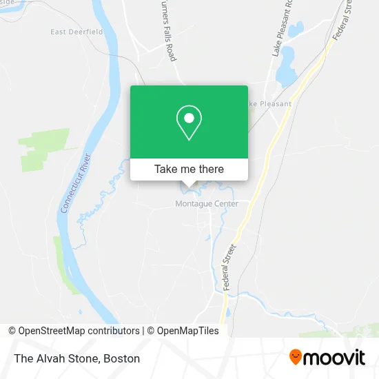
See The Alvah Stone, Boston, on the map
Public Transit to The Alvah Stone in Boston
Wondering how to get to The Alvah Stone in Boston? Moovit helps you find the best way to get to The Alvah Stone with step-by-step directions from the nearest public transit station.
Moovit provides free maps and live directions to help you navigate through your city. View schedules, routes, timetables, and find out how long does it take to get to The Alvah Stone in real time.
Looking for the nearest stop or station to The Alvah Stone? Check out this list of stops closest to your destination: Montague Center.
Bus: 23.
Want to see if there’s another route that gets you there at an earlier time? Moovit helps you find alternative routes or times. Get directions from and directions to The Alvah Stone easily from the Moovit App or Website.
We make riding to The Alvah Stone easy, which is why over 1.7 million users, including users in Boston, trust Moovit as the best app for public transit. You don’t need to download an individual bus app or train app, Moovit is your all-in-one transit app that helps you find the best bus time or train time available.
For information on prices of bus, costs and ride fares to The Alvah Stone, please check the Moovit app.
Use the app to navigate to popular places including to the airport, hospital, stadium, grocery store, mall, coffee shop, school, college, and university.
The Alvah Stone Address: 440 Greenfield Rd street in Boston
- Montague Bookmill / Lady Killigrew Cafe,
- Montague Bookmill,
- Ellen J Mitnowsky DC Chiropractor,
- Locust Hill Cemetery,
- Montague Center,
- Orange District Court,
- CJS Cafe,
- Peter L Masi Books,
- Laurie Rhoades, Licsw,
- Montague Center Library,
- Elm Grove Cemetery,
- Sawmill River Access,
- 53 Main St Parking,
- Montague Village Store,
- Montague Station,
- Montague Post Office,
- Tolland Farm Wellfield,
- Montague Fire Department,
- Mglct/Bitzer,
- Bitzer Fish Hatchery
Places Near The Alvah Stone (Boston)
- Isabella Stewart Gardner Museum, Boston,
- Seaport District, Boston,
- North End, Boston,
- Museum Of Science, Boston,
- Leader Bank Pavilion (Leader Bank Pavillion), Boston,
- House Of Blues, Boston,
- Td Garden, Boston,
- Prudential Center, Boston,
- Mgm Music Hall, Boston,
- Quincy Market, Boston,
- Faneuil Hall, Boston,
- Wilbur Theatre, Boston,
- Boston Common, Boston,
- Boston Children's Hospital, Boston,
- Boston Convention & Exhibition Center, Boston,
- Castle Island, Boston,
- Cheers, Boston,
- Wang Theater, Boston,
- Boston Medical Center, Boston,
- Massachusetts General Hospital, Boston
How to get to popular places in Boston with public transit
Get around Boston by public transit!
Traveling around Boston has never been so easy. See step by step directions as you travel to any attraction, street or major public transit station. View bus and train schedules, arrival times, service alerts and detailed routes on a map, so you know exactly how to get to anywhere in Boston.
When traveling to any destination around Boston use Moovit's Live Directions with Get Off Notifications to know exactly where and how far to walk, how long to wait for your line, and how many stops are left. Moovit will alert you when it's time to get off — no need to constantly re-check whether yours is the next stop.
Wondering how to use public transit in Boston or how to pay for public transit in Boston? Moovit public transit app can help you navigate your way with public transit easily, and at minimum cost. It includes public transit fees, ticket prices, and costs. Looking for a map of Boston public transit lines? Moovit public transit app shows all public transit maps in Boston with all Bus, Train, Subway and Ferry routes and stops on an interactive map.
Boston has 4 transit type(s), including: Bus, Train, Subway and Ferry, operated by several transit agencies, including MBTA, Southeastern Regional Transit Authority, MetroWest Regional Transit Authority, Rhode Island Public Transit Authority, WRTA, Lowell Regional Transit Authority, Merrimack Valley Transit, Montachusett Regional Transit Authority, Cape Cod Regional Transit Authority, Brockton Area Transit Authority, Martha's Vineyard Transit Authority, the WAVE - Nantucket Regional Transit Authority, GATRA, Cape Ann Transportation Authority and Massport