Directions to The Astor (Manhattan) with public transportation
The following transit lines have routes that pass near The Astor
How to get to The Astor by bus?
Click on the bus route to see step by step directions with maps, line arrival times and updated time schedules.
How to get to The Astor by train?
Click on the train route to see step by step directions with maps, line arrival times and updated time schedules.
How to get to The Astor by subway?
Click on the subway route to see step by step directions with maps, line arrival times and updated time schedules.
Bus stations near The Astor in Manhattan
- Broadway/W 76 St, 1 min walk,
- Amsterdam Av/W 75 St, 3 min walk,
- W 79 St/Broadway, 4 min walk,
- W 72 St/Broadway, 4 min walk,
- Broadway & 79 St, 5 min walk,
- Amsterdam Av/W 72 St, 5 min walk,
Subway stations near The Astor in Manhattan
- 66 St-Lincoln Center, 2 min walk,
- 72 St, 8 min walk,
Bus lines to The Astor in Manhattan
- M104, 41 St Via Broadway/7 Av,
- M7, Harlem 147 St Via 6 Av Via Amsterdam,
- M11, Riverbank 145 St Via 10 Av,
- M79-SBS, Select Bus Yrkvlle East End Av Crosstown,
- M5, Limited Washington Heights Gw Bridge,
- M57, West Side Broadway-72 St Crosstown,
- M72, East Side York Av Crosstown,
- HAMPTON JITNEY MONTAUK, Manhattan,
- BXM2, Riverdale 263 St Via H. Hudson Pky,
What are the closest stations to The Astor?
The closest stations to The Astor are:
- Broadway/W 76 St is 24 yards away, 1 min walk.
- 66 St-Lincoln Center is 107 yards away, 2 min walk.
- Amsterdam Av/W 75 St is 221 yards away, 3 min walk.
- W 79 St/Broadway is 316 yards away, 4 min walk.
- W 72 St/Broadway is 324 yards away, 4 min walk.
- Broadway & 79 St is 332 yards away, 5 min walk.
- Amsterdam Av/W 72 St is 361 yards away, 5 min walk.
- 72 St is 652 yards away, 8 min walk.
Which bus lines stop near The Astor?
These bus lines stop near The Astor: M104, M57, M66, M7, M79-SBS.
Which train lines stop near The Astor?
These train lines stop near The Astor: HEMPSTEAD BRANCH, PATH.
Which subway lines stop near The Astor?
These subway lines stop near The Astor: 1, 2, 3.
What’s the nearest subway station to The Astor in Manhattan?
The nearest subway station to The Astor in Manhattan is 66 St-Lincoln Center. It’s a 2 min walk away.
What’s the nearest bus stop to The Astor in Manhattan?
The nearest bus stop to The Astor in Manhattan is Broadway/W 76 St. It’s a 1 min walk away.
What time is the first subway to The Astor in Manhattan?
The 3 is the first subway that goes to The Astor in Manhattan. It stops nearby at 3:02 AM.
What time is the last subway to The Astor in Manhattan?
The A is the last subway that goes to The Astor in Manhattan. It stops nearby at 4:00 AM.
What time is the first bus to The Astor in Manhattan?
The M79-SBS is the first bus that goes to The Astor in Manhattan. It stops nearby at 3:17 AM.
What time is the last bus to The Astor in Manhattan?
The M7 is the last bus that goes to The Astor in Manhattan. It stops nearby at 2:57 AM.
How much is the bus fare to The Astor?
The bus fare to The Astor costs about $2.90.
How much is the subway fare to The Astor?
The subway fare to The Astor costs about $2.90.
How much is the train fare to The Astor?
The train fare to The Astor costs about $2.75.
See The Astor, Manhattan, on the map
Public Transit to The Astor in Manhattan
Wondering how to get to The Astor in Manhattan, United States? Moovit helps you find the best way to get to The Astor with step-by-step directions from the nearest public transit station.
Moovit provides free maps and live directions to help you navigate through your city. View schedules, routes, timetables, and find out how long does it take to get to The Astor in real time.
Looking for the nearest stop or station to The Astor? Check out this list of stops closest to your destination: Broadway/W 76 St; 66 St-Lincoln Center; Amsterdam Av/W 75 St; W 79 St/Broadway; W 72 St/Broadway; Broadway & 79 St; Amsterdam Av/W 72 St; 72 St.
Bus: M104, M57, M66, M7, M79-SBS, M11.Train: HEMPSTEAD BRANCH, PATH.Subway: 1, 2, 3, A, B, C.
Want to see if there’s another route that gets you there at an earlier time? Moovit helps you find alternative routes or times. Get directions from and directions to The Astor easily from the Moovit App or Website.
We make riding to The Astor easy, which is why over 1.5 million users, including users in Manhattan, trust Moovit as the best app for public transit. You don’t need to download an individual bus app or train app, Moovit is your all-in-one transit app that helps you find the best bus time or train time available.
For information on prices of subway, bus and train, costs and ride fares to The Astor, please check the Moovit app.
Use the app to navigate to popular places including to the airport, hospital, stadium, grocery store, mall, coffee shop, school, college, and university.
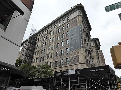
The Astor Address: 235 W 75th St (Broadway) street in Manhattan
Attractions near The Astor
260 Sample Sale,Broadway 75th,W 75th St (west 75th street broadway),Broadway (broadway and 76th),Broadway & West 76th Street,90 Riverside Drive,Nadia Dilendorf - Compass,Beth Sievers - Compass,Le Pain Quotidien,Saranac Waterfront Lodge,The Wallace,Lush Cosmetics NYC - Upper West Side,Hotel Beacon,RedFarm,Hotel Beacon New York,Beacon Hotel,Hotel Beacon NYC (Beacon Theatre New York City),Fairway Market,Beacon,Amsterdam & 77 StreetHow to get to popular attractions in Manhattan with public transit
Greenwich Village, Manhattan,Nypd 111 Pct, Queens,95-25 Queens Boulevard, Queens,High Line, Manhattan,500 Pearl Street, Manhattan,General Consulate Guatemala, Manhattan,Union County College - Cranford Campus, Cranford, Nj,1365 Jerome Avenue, Bronx,51 W 51st St, Manhattan,MTA Subway - Atlantic Ave / Barclays Center (B / D/N / Q/R / 2/3 / 4/5),Chinatown, Manhattan,Lafayette Street, Manhattan,Lodi, NJ, Lodi, Nj,Lehman College, Bronx,St Nicholas Ave, Manhattan,LIRR - Jamaica Station, Queens,225 Broadway, Manhattan,Prince Street, Manhattan,Astoria, Queens,JFK airport, ManhattanGet around New York - New Jersey by public transit!
Traveling around New York - New Jersey has never been so easy. See step by step directions as you travel to any attraction, street or major public transit station. View bus and train schedules, arrival times, service alerts and detailed routes on a map, so you know exactly how to get to anywhere in New York - New Jersey.
When traveling to any destination around New York - New Jersey use Moovit's Live Directions with Get Off Notifications to know exactly where and how far to walk, how long to wait for your line, and how many stops are left. Moovit will alert you when it's time to get off — no need to constantly re-check whether yours is the next stop.
Wondering how to use public transit in New York - New Jersey or how to pay for public transit in New York - New Jersey? Moovit public transit app can help you navigate your way with public transit easily, and at minimum cost. It includes public transit fees, ticket prices, and costs. Looking for a map of New York - New Jersey public transit lines? Moovit public transit app shows all public transit maps in New York - New Jersey with all Bus, Train, Subway, Light Rail, Ferry and Cable Car routes and stops on an interactive map.
New York - New Jersey has 6 transit type(s), including: Bus, Train, Subway, Light Rail, Ferry and Cable Car, operated by several transit agencies, including MTA Subway, Metro-North Railroad, LIRR, PATH, Shore Line East, MTA Bus Company, MTA New York City Transit - Express routes, MTA Bus, NJ Transit, NYC Ferry, NICE bus, Bee-Line Bus, NJ Transit Rail, Norwalk Transit District, CTTransit - Waterbury-Meriden