How to get to The Bagel Table by bus?
Click on the bus route to see step by step directions with maps, line arrival times and updated time schedules.
From Regent Theatre, Arlington
36 minFrom AWACS (Bldg 1612), Hanscom Afb
88 minFrom McLean Hospital, Belmont
96 minFrom The Westin Waltham Boston, Waltham
203 minFrom Winchester, MA, Winchester
51 minFrom Crowne Plaza Boston - Woburn, Woburn
62 minFrom Arlington, MA, Arlington
41 minFrom Middlesex Superior Court, Woburn
62 min
Bus stops near The Bagel Table in Burlington
- 53 Third Ave, 3 min walk,VIEW
Bus lines to The Bagel Table in Burlington
What are the closest stations to The Bagel Table?
The closest stations to The Bagel Table are:
- 53 Third Ave is 237 yards away, 3 min walk.
Which bus lines stop near The Bagel Table?
These bus lines stop near The Bagel Table: 350, 354.
What’s the nearest bus station to The Bagel Table in Burlington?
The nearest bus station to The Bagel Table in Burlington is 53 Third Ave. It’s a 3 min walk away.
What time is the first bus to The Bagel Table in Burlington?
The 350 is the first bus that goes to The Bagel Table in Burlington. It stops nearby at 6:06 AM.
What time is the last bus to The Bagel Table in Burlington?
The 350 is the last bus that goes to The Bagel Table in Burlington. It stops nearby at 10:56 PM.
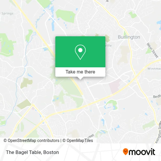
See The Bagel Table, Burlington, on the map
Public Transit to The Bagel Table in Burlington
Wondering how to get to The Bagel Table in Burlington? Moovit helps you find the best way to get to The Bagel Table with step-by-step directions from the nearest public transit station.
Moovit provides free maps and live directions to help you navigate through your city. View schedules, routes, timetables, and find out how long does it take to get to The Bagel Table in real time.
Looking for the nearest stop or station to The Bagel Table? Check out this list of stops closest to your destination: 53 Third Ave.
Bus: 350, 354, 14, 351.
Want to see if there’s another route that gets you there at an earlier time? Moovit helps you find alternative routes or times. Get directions from and directions to The Bagel Table easily from the Moovit App or Website.
We make riding to The Bagel Table easy, which is why over 1.7 million users, including users in Burlington, trust Moovit as the best app for public transit. You don’t need to download an individual bus app or train app, Moovit is your all-in-one transit app that helps you find the best bus time or train time available.
For information on prices of bus, subway and train, costs and ride fares to The Bagel Table, please check the Moovit app.
Use the app to navigate to popular places including to the airport, hospital, stadium, grocery store, mall, coffee shop, school, college, and university.
The Bagel Table Address: 19 3rd Ave street in Burlington
- Amazon Locker-Nacho,
- Rocco's Doughnut Company,
- 3rd Ave Burlington,
- Keyspan Air Conditioning & Heating Equipment Services & Sales,
- Kendall Company Freight Payment Inquiries,
- Bank of Boston,
- Archer Hotel Burlington,
- Life Time Athletic Burlington Preview Center,
- Olga's Kitchen,
- Oki Poke,
- Archer Hotel Boston Burlington,
- Belle Vista Nail Studio - Burlington,
- Wegmans,
- Oushak Collection,
- Shell Recharge,
- Shell,
- Z Printer,
- Erland Construction,
- Hayner/Swanson Inc.,
- Sonesta Simply Suites-Sonesta Simply Boston Burlington
Places Near The Bagel Table (Burlington)
- Td Garden, Boston,
- Prudential Center, Boston,
- Boston Medical Center, Boston,
- Quincy Market, Boston,
- Boston Convention & Exhibition Center, Boston,
- Castle Island, Boston,
- Boston Children's Hospital, Boston,
- Faneuil Hall, Boston,
- Seaport District, Boston,
- Leader Bank Pavilion (Leader Bank Pavillion), Boston,
- North End, Boston,
- Mgm Music Hall, Boston,
- Cheers, Boston,
- Wang Theater, Boston,
- Isabella Stewart Gardner Museum, Boston,
- Boston Common, Boston,
- Wilbur Theatre, Boston,
- Massachusetts General Hospital, Boston,
- House Of Blues, Boston,
- Museum Of Science, Boston
How to get to popular places in Boston with public transit
Get around Burlington by public transit!
Traveling around Burlington has never been so easy. See step by step directions as you travel to any attraction, street or major public transit station. View bus and train schedules, arrival times, service alerts and detailed routes on a map, so you know exactly how to get to anywhere in Burlington.
When traveling to any destination around Burlington use Moovit's Live Directions with Get Off Notifications to know exactly where and how far to walk, how long to wait for your line, and how many stops are left. Moovit will alert you when it's time to get off — no need to constantly re-check whether yours is the next stop.
Wondering how to use public transit in Burlington or how to pay for public transit in Burlington? Moovit public transit app can help you navigate your way with public transit easily, and at minimum cost. It includes public transit fees, ticket prices, and costs. Looking for a map of Burlington public transit lines? Moovit public transit app shows all public transit maps in Burlington with all Bus, Train, Subway and Ferry routes and stops on an interactive map.
Boston has 4 transit type(s), including: Bus, Train, Subway and Ferry, operated by several transit agencies, including MBTA, Southeastern Regional Transit Authority, MetroWest Regional Transit Authority, Rhode Island Public Transit Authority, WRTA, Lowell Regional Transit Authority, Merrimack Valley Transit, Montachusett Regional Transit Authority, Cape Cod Regional Transit Authority, Brockton Area Transit Authority, Martha's Vineyard Transit Authority, the WAVE - Nantucket Regional Transit Authority, GATRA, Cape Ann Transportation Authority and Massport