Directions to The Berkeley (Boston) with public transportation
The following transit lines have routes that pass near The Berkeley
 Bus: 19, 39, 426, 450, 501.
- Train: HAVERHILL, NEEDHAM, NEWBURYPORT/ROCKPORT, NORTHEAST REGIONAL, FOXBORO EVENT SERVICE.
- Subway: GREEN LINE B, ORANGE LINE, GREEN LINE C, GREEN LINE D, GREEN LINE E.
How to get to The Berkeley by bus?
Click on the bus route to see step by step directions with maps, line arrival times and updated time schedules.
From Franklin Park Zoo, Boston
46 minFrom Market Basket, Revere
64 minFrom Four Points by Sheraton Boston Logan Airport, Revere
81 minFrom Milton Academy, Milton
101 minFrom Arlington, MA, Arlington
94 minFrom West Roxbury, Boston
62 minFrom Marina Bay, Quincy
135 minFrom DoubleTree by Hilton Boston Logan Airport Chelsea, Chelsea
58 minFrom St. Elizabeth's, Boston
46 minFrom Melrose Wakefield Hospital, Malden
86 min
How to get to The Berkeley by train?
Click on the train route to see step by step directions with maps, line arrival times and updated time schedules.
How to get to The Berkeley by subway?
Click on the subway route to see step by step directions with maps, line arrival times and updated time schedules.
Bus stops near The Berkeley in Boston
- Saint James Ave @ Arlington St, 1 min walk,VIEW
- Arlington St @ Saint James Ave, 2 min walk,VIEW
- Back Bay - 167 Dartmouth St, 3 min walk,VIEW
- Stuart St @ Dartmouth St, 3 min walk,VIEW
- Boston, MA - Copley Square (Corner Of Clarendon St. & St. James Ave. In Front Of Trinity Church), 5 min walk,VIEW
- Boylston St @ Clarendon St, 6 min walk,VIEW
- Copley - Saint James Ave @ Trinity Pl, 6 min walk,VIEW
- Copley - Opp 575 Boylston St, 7 min walk,VIEW
Subway station near The Berkeley in Boston
- Arlington, 2 min walk,VIEW
Train station near The Berkeley in Boston
- Back Bay - South End, 7 min walk,VIEW
Bus lines to The Berkeley in Boston
- 10, Arlington via South Bay Center - City Point via South Bay Center,VIEW
- 39, Back Bay - Forest Hills,VIEW
- 55, Arlington - West Fenway,VIEW
- 57, Kenmore - Watertown Yard,VIEW
- 501, Downtown via Copley (Express) - Brighton via Copley (Express),VIEW
- 504, Downtown via Copley (Express) - Watertown via Copley and Newton Corner (Express),VIEW
- GREEN LINE E SHUTTLE, Heath Street - Park Street,VIEW
- GREEN LINE SHUTTLE, Boston University East - Park Street,VIEW
- 9, Kenmore Via Boston Latin,VIEW
- GREEN LINE SHUTTLE, Back Bay (Shuttle),VIEW
- GREEN LINE B SHUTTLE, Babcock Street - Back Bay,VIEW
- GREEN LINE B SHUTTLE, Boston College - Back Bay (Shuttle),VIEW
- GREEN LINE B SHUTTLE, Kenmore - Back Bay via Copley (Shuttle),VIEW
- GREEN LINE B SHUTTLE, Babcock Street - Back Bay via Copley (Shuttle),VIEW
- GREEN LINE D SHUTTLE, Brookline Hills - Back Bay (Shuttle),VIEW
- GREEN LINE SHUTTLE, Kenmore - Back Bay,VIEW
- BB, Back Bay,VIEW
- ACTON/CONCORD COMMUTER, Acton,VIEW
- GREEN LINE D SHUTTLE, Riverside (Shuttle),VIEW
- ORANGE LINE SHUTTLE, Back Bay Via Copley (Shuttle),VIEW
What are the closest stations to The Berkeley?
The closest stations to The Berkeley are:
- Saint James Ave @ Arlington St is 66 yards away, 1 min walk.
- Arlington St @ Saint James Ave is 81 yards away, 2 min walk.
- Arlington is 152 yards away, 2 min walk.
- Back Bay - 167 Dartmouth St is 163 yards away, 3 min walk.
- Stuart St @ Dartmouth St is 189 yards away, 3 min walk.
- Boston, MA - Copley Square (Corner Of Clarendon St. & St. James Ave. In Front Of Trinity Church) is 373 yards away, 5 min walk.
- Boylston St @ Clarendon St is 443 yards away, 6 min walk.
- Copley - Saint James Ave @ Trinity Pl is 451 yards away, 6 min walk.
- Copley - Opp 575 Boylston St is 538 yards away, 7 min walk.
- Back Bay - South End is 571 yards away, 7 min walk.
Which bus lines stop near The Berkeley?
These bus lines stop near The Berkeley: 19, 39, 426, 450, 501, 9, BB.
Which train lines stop near The Berkeley?
These train lines stop near The Berkeley: HAVERHILL, NEEDHAM, NEWBURYPORT/ROCKPORT, NORTHEAST REGIONAL.
Which subway lines stop near The Berkeley?
These subway lines stop near The Berkeley: GREEN LINE B, ORANGE LINE.
What’s the nearest subway station to The Berkeley in Boston?
The nearest subway station to The Berkeley in Boston is Arlington. It’s a 2 min walk away.
What’s the nearest train station to The Berkeley in Boston?
The nearest train station to The Berkeley in Boston is Back Bay - South End. It’s a 7 min walk away.
What’s the nearest bus station to The Berkeley in Boston?
The nearest bus station to The Berkeley in Boston is Saint James Ave @ Arlington St. It’s a 1 min walk away.
What time is the first subway to The Berkeley in Boston?
The GREEN LINE D is the first subway that goes to The Berkeley in Boston. It stops nearby at 5:05 AM.
What time is the last subway to The Berkeley in Boston?
The GREEN LINE E is the last subway that goes to The Berkeley in Boston. It stops nearby at 2:16 AM.
What time is the first train to The Berkeley in Boston?
The PROVIDENCE/STOUGHTON is the first train that goes to The Berkeley in Boston. It stops nearby at 4:25 AM.
What time is the last train to The Berkeley in Boston?
The LAKE SHORE LIMITED is the last train that goes to The Berkeley in Boston. It stops nearby at 8:26 PM.
What time is the first bus to The Berkeley in Boston?
The 57 is the first bus that goes to The Berkeley in Boston. It stops nearby at 4:54 AM.
What time is the last bus to The Berkeley in Boston?
The 10 is the last bus that goes to The Berkeley in Boston. It stops nearby at 1:19 AM.
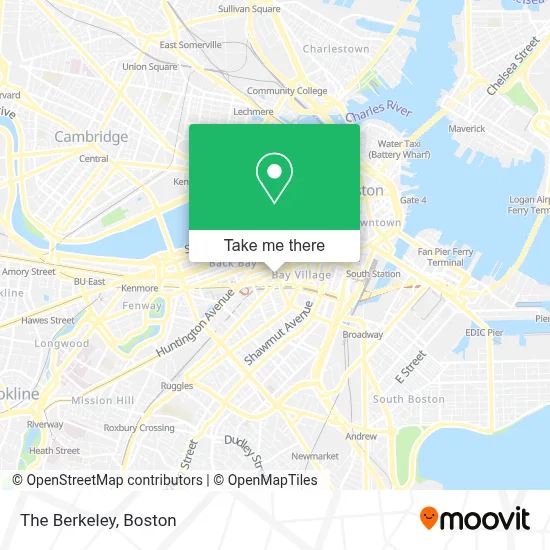
See The Berkeley, Boston, on the map
Public Transit to The Berkeley in Boston
Wondering how to get to The Berkeley in Boston? Moovit helps you find the best way to get to The Berkeley with step-by-step directions from the nearest public transit station.
Moovit provides free maps and live directions to help you navigate through your city. View schedules, routes, timetables, and find out how long does it take to get to The Berkeley in real time.
Looking for the nearest stop or station to The Berkeley? Check out this list of stops closest to your destination: Saint James Ave @ Arlington St; Arlington St @ Saint James Ave; Arlington; Back Bay - 167 Dartmouth St; Stuart St @ Dartmouth St; Boston, MA - Copley Square (Corner Of Clarendon St. & St. James Ave. In Front Of Trinity Church); Boylston St @ Clarendon St; Copley - Saint James Ave @ Trinity Pl; Copley - Opp 575 Boylston St; Back Bay - South End.
Bus: 19, 39, 426, 450, 501, 9, BB, 10, 55, 57, GREEN LINE SHUTTLE, GREEN LINE B SHUTTLE, GREEN LINE B SHUTTLE, GREEN LINE B SHUTTLE, GREEN LINE B SHUTTLE, GREEN LINE D SHUTTLE.Train: HAVERHILL, NEEDHAM, NEWBURYPORT/ROCKPORT, NORTHEAST REGIONAL, FOXBORO EVENT SERVICE, FRAMINGHAM/WORCESTER, FRANKLIN/FOXBORO, ORANGE LINE.Subway: GREEN LINE B, ORANGE LINE, GREEN LINE C, GREEN LINE D, GREEN LINE E.
Want to see if there’s another route that gets you there at an earlier time? Moovit helps you find alternative routes or times. Get directions from and directions to The Berkeley easily from the Moovit App or Website.
We make riding to The Berkeley easy, which is why over 1.7 million users, including users in Boston, trust Moovit as the best app for public transit. You don’t need to download an individual bus app or train app, Moovit is your all-in-one transit app that helps you find the best bus time or train time available.
For information on prices of bus, subway and train, costs and ride fares to The Berkeley, please check the Moovit app.
Use the app to navigate to popular places including to the airport, hospital, stadium, grocery store, mall, coffee shop, school, college, and university.
The Berkeley Address: 154 Berkeley St street in Boston
- Backbay Hotel (The Back Bay Hotel),
- Precinct Kitchen + Bar,
- MBTA | Worcester-Boston Commuter Rail,
- Grill 23 & Bar,
- Citrus & Salt,
- Hotel Aka Back Bay ,
- Liberty Mutual Insurance,
- Comparion Insurance Agency,
- Metropolitan Health Club,
- Liberty Mutual,
- Dorothy Quincy Suite,
- Wework 200 Berkeley,
- Deloitte,
- John Hancock Hall,
- Friendly Toast,
- The Friendly Toast,
- Liberty Mutual Insurance Company,
- The Banks Fish House,
- Post 390 (Banks Fish House),
- Slate Casting
Places Near The Berkeley (Boston)
- Faneuil Hall, Boston,
- Boston Medical Center, Boston,
- Museum Of Science, Boston,
- Td Garden, Boston,
- Castle Island, Boston,
- Mgm Music Hall, Boston,
- Prudential Center, Boston,
- Leader Bank Pavilion (Leader Bank Pavillion), Boston,
- Boston Children's Hospital, Boston,
- North End, Boston,
- Seaport District, Boston,
- Quincy Market, Boston,
- Cheers, Boston,
- Wang Theater, Boston,
- Isabella Stewart Gardner Museum, Boston,
- Wilbur Theatre, Boston,
- Massachusetts General Hospital, Boston,
- House Of Blues, Boston,
- Boston Common, Boston,
- Boston Convention & Exhibition Center, Boston
How to get to popular places in Boston with public transit
Get around Boston by public transit!
Traveling around Boston has never been so easy. See step by step directions as you travel to any attraction, street or major public transit station. View bus and train schedules, arrival times, service alerts and detailed routes on a map, so you know exactly how to get to anywhere in Boston.
When traveling to any destination around Boston use Moovit's Live Directions with Get Off Notifications to know exactly where and how far to walk, how long to wait for your line, and how many stops are left. Moovit will alert you when it's time to get off — no need to constantly re-check whether yours is the next stop.
Wondering how to use public transit in Boston or how to pay for public transit in Boston? Moovit public transit app can help you navigate your way with public transit easily, and at minimum cost. It includes public transit fees, ticket prices, and costs. Looking for a map of Boston public transit lines? Moovit public transit app shows all public transit maps in Boston with all Bus, Train, Subway and Ferry routes and stops on an interactive map.
Boston has 4 transit type(s), including: Bus, Train, Subway and Ferry, operated by several transit agencies, including MBTA, Southeastern Regional Transit Authority, MetroWest Regional Transit Authority, Rhode Island Public Transit Authority, WRTA, Lowell Regional Transit Authority, Merrimack Valley Transit, Montachusett Regional Transit Authority, Cape Cod Regional Transit Authority, Brockton Area Transit Authority, Martha's Vineyard Transit Authority, the WAVE - Nantucket Regional Transit Authority, GATRA, Cape Ann Transportation Authority and Massport