Directions to The Blue Butterfly (Belmont) with public transportation
The following transit lines have routes that pass near The Blue Butterfly
 Bus: 73.
- Train: FITCHBURG, FRAMINGHAM/WORCESTER.
- Subway: RED LINE.
How to get to The Blue Butterfly by bus?
Click on the bus route to see step by step directions with maps, line arrival times and updated time schedules.
From Jamaica Plain VA Medical Center (VA Hospital), Boston
67 minFrom SoWa Vintage Market, Boston
63 minFrom The Verb Hotel, Boston
58 minFrom Pine Street Inn, Boston
69 minFrom Bunker Hill Community College, Boston
69 minFrom TD Garden (Boston Garden), Boston
74 minFrom Boston University Henry M. Goldman School of Dental Medicine, Boston
64 minFrom Boston Marriott Cambridge, Cambridge
47 minFrom Whole Foods, Boston
65 minFrom Canopy by Hilton Boston Downtown, Boston
81 min
How to get to The Blue Butterfly by train?
Click on the train route to see step by step directions with maps, line arrival times and updated time schedules.
Bus stop near The Blue Butterfly in Belmont
- Belmont St @ Oakley Rd, 2 min walk,VIEW
Train stations near The Blue Butterfly in Belmont
Subway station near The Blue Butterfly in Belmont
- Alewife, 60 min walk,VIEW
Bus lines to The Blue Butterfly in Belmont
- 73, Waverley,VIEW
What are the closest stations to The Blue Butterfly?
The closest stations to The Blue Butterfly are:
- Belmont St @ Oakley Rd is 95 yards away, 2 min walk.
- Newtonville is 3178 yards away, 38 min walk.
- Waverley is 3322 yards away, 39 min walk.
- Alewife is 5117 yards away, 60 min walk.
Which bus line stops near The Blue Butterfly?
73 (Waverley)
Which train line stops near The Blue Butterfly?
FITCHBURG (#409 | Wachusett)
What’s the nearest bus station to The Blue Butterfly in Belmont?
The nearest bus station to The Blue Butterfly in Belmont is Belmont St @ Oakley Rd. It’s a 2 min walk away.
What time is the first subway to The Blue Butterfly in Belmont?
The RED LINE is the first subway that goes to The Blue Butterfly in Belmont. It stops nearby at 5:15 AM.
What time is the last subway to The Blue Butterfly in Belmont?
The RED LINE is the last subway that goes to The Blue Butterfly in Belmont. It stops nearby at 2:06 AM.
What time is the first train to The Blue Butterfly in Belmont?
The FRAMINGHAM/WORCESTER is the first train that goes to The Blue Butterfly in Belmont. It stops nearby at 5:25 AM.
What time is the last train to The Blue Butterfly in Belmont?
The FRAMINGHAM/WORCESTER is the last train that goes to The Blue Butterfly in Belmont. It stops nearby at 12:17 AM.
What time is the first bus to The Blue Butterfly in Belmont?
The 73 is the first bus that goes to The Blue Butterfly in Belmont. It stops nearby at 4:55 AM.
What time is the last bus to The Blue Butterfly in Belmont?
The 73 is the last bus that goes to The Blue Butterfly in Belmont. It stops nearby at 1:21 AM.
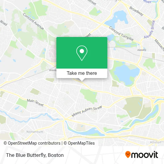
See The Blue Butterfly, Belmont, on the map
Public Transit to The Blue Butterfly in Belmont
Wondering how to get to The Blue Butterfly in Belmont? Moovit helps you find the best way to get to The Blue Butterfly with step-by-step directions from the nearest public transit station.
Moovit provides free maps and live directions to help you navigate through your city. View schedules, routes, timetables, and find out how long does it take to get to The Blue Butterfly in real time.
Looking for the nearest stop or station to The Blue Butterfly? Check out this list of stops closest to your destination: Belmont St @ Oakley Rd; Newtonville; Waverley; Alewife.
Bus: 73.Train: FITCHBURG, FRAMINGHAM/WORCESTER.Subway: RED LINE.
Want to see if there’s another route that gets you there at an earlier time? Moovit helps you find alternative routes or times. Get directions from and directions to The Blue Butterfly easily from the Moovit App or Website.
We make riding to The Blue Butterfly easy, which is why over 1.7 million users, including users in Belmont, trust Moovit as the best app for public transit. You don’t need to download an individual bus app or train app, Moovit is your all-in-one transit app that helps you find the best bus time or train time available.
For information on prices of bus, subway and train, costs and ride fares to The Blue Butterfly, please check the Moovit app.
Use the app to navigate to popular places including to the airport, hospital, stadium, grocery store, mall, coffee shop, school, college, and university.
The Blue Butterfly Address: 113 Trapelo Rd street in Belmont
- Ovenbird Cafe,
- Want List Records,
- New England Golf Guide,
- Simply the Best Dogs,
- Cameron Building & Design,
- Shaseleen Skin Care Salon & Day Spa,
- Stretchmed Belmont,
- Donata Barber, Realtor,
- Big Picture Framing,
- Shred Nations,
- Action Bus,
- The Locksmith Shop,
- Cambridge City Water Department,
- Pequossette Playground,
- Hanami Sushi Bar and Grill,
- Physical Therapy Orthopedic Surgery,
- The Toland Team,
- 24 Hour Emergency Locksmith,
- Belmont Auto Exchange,
- Kirwan Jessica
Places Near The Blue Butterfly (Belmont)
- Boston Convention & Exhibition Center, Boston,
- Castle Island, Boston,
- Museum Of Science, Boston,
- Wilbur Theatre, Boston,
- Seaport District, Boston,
- Quincy Market, Boston,
- House Of Blues, Boston,
- Cheers, Boston,
- Prudential Center, Boston,
- Massachusetts General Hospital, Boston,
- Isabella Stewart Gardner Museum, Boston,
- Boston Common, Boston,
- Boston Children's Hospital, Boston,
- North End, Boston,
- Td Garden, Boston,
- Wang Theater, Boston,
- Faneuil Hall, Boston,
- Mgm Music Hall, Boston,
- Boston Medical Center, Boston,
- Leader Bank Pavilion (Leader Bank Pavillion), Boston
How to get to popular places in Boston with public transit
Get around Belmont by public transit!
Traveling around Belmont has never been so easy. See step by step directions as you travel to any attraction, street or major public transit station. View bus and train schedules, arrival times, service alerts and detailed routes on a map, so you know exactly how to get to anywhere in Belmont.
When traveling to any destination around Belmont use Moovit's Live Directions with Get Off Notifications to know exactly where and how far to walk, how long to wait for your line, and how many stops are left. Moovit will alert you when it's time to get off — no need to constantly re-check whether yours is the next stop.
Wondering how to use public transit in Belmont or how to pay for public transit in Belmont? Moovit public transit app can help you navigate your way with public transit easily, and at minimum cost. It includes public transit fees, ticket prices, and costs. Looking for a map of Belmont public transit lines? Moovit public transit app shows all public transit maps in Belmont with all Bus, Train, Subway and Ferry routes and stops on an interactive map.
Boston has 4 transit type(s), including: Bus, Train, Subway and Ferry, operated by several transit agencies, including MBTA, Southeastern Regional Transit Authority, MetroWest Regional Transit Authority, Rhode Island Public Transit Authority, WRTA, Lowell Regional Transit Authority, Merrimack Valley Transit, Montachusett Regional Transit Authority, Cape Cod Regional Transit Authority, Brockton Area Transit Authority, Martha's Vineyard Transit Authority, the WAVE - Nantucket Regional Transit Authority, GATRA, Cape Ann Transportation Authority and Massport