Directions to The Blue Elephant (Somerville) with public transportation
The following transit lines have routes that pass near The Blue Elephant
 Bus: 80, 89, 96, 89/93, 94.
- Train: FITCHBURG.
- Subway: GREEN LINE E, RED LINE, GREEN LINE B, GREEN LINE C.
How to get to The Blue Elephant by bus?
Click on the bus route to see step by step directions with maps, line arrival times and updated time schedules.
From Franklin Park, Boston
95 minFrom The Wilbur, Boston
94 minFrom Prometric Testing Center, Boston
53 minFrom The Monument, Boston
88 minFrom The Strand Theater, Boston
91 minFrom Kenmore Square, Boston
57 minFrom Suffolk Downs, Boston
77 minFrom The Mall At Chestnut Hill, Newton
93 minFrom The Banshee Bar, Boston
83 minFrom Charles Playhouse, Boston
64 min
How to get to The Blue Elephant by subway?
Click on the subway route to see step by step directions with maps, line arrival times and updated time schedules.
From Franklin Park, Boston
54 minFrom The Wilbur, Boston
58 minFrom Prometric Testing Center, Boston
58 minFrom The Monument, Boston
54 minFrom The Strand Theater, Boston
64 minFrom Kenmore Square, Boston
43 minFrom Suffolk Downs, Boston
56 minFrom The Mall At Chestnut Hill, Newton
85 minFrom The Banshee Bar, Boston
47 minFrom Charles Playhouse, Boston
35 min
Bus stops near The Blue Elephant in Somerville
Subway stations near The Blue Elephant in Somerville
Train station near The Blue Elephant in Somerville
- Porter, 13 min walk,VIEW
Bus lines to The Blue Elephant in Somerville
- 80, Lechmere,VIEW
- 89, Sullivan,VIEW
- 89/93, Haymarket Via Sullivan,VIEW
- 94, Davis,VIEW
- 96, Medford Square,VIEW
- GREEN LINE E SHUTTLE, Medford/Tufts - East Somerville,VIEW
- GREEN LINE E SHUTTLE, Government Center - Medford/Tufts (Shuttle),VIEW
- GREEN LINE E SHUTTLE, North Station - Medford/Tufts (Shuttle),VIEW
- GREEN LINE SHUTTLE, Medford/Tufts - Government Center via Union Square,VIEW
- GREEN LINE E SHUTTLE, North Station (Shuttle),VIEW
What are the closest stations to The Blue Elephant?
The closest stations to The Blue Elephant are:
- Broadway @ Alfred St is 163 yards away, 2 min walk.
- Broadway @ Cedar St is 176 yards away, 3 min walk.
- College Ave @ Broadway is 191 yards away, 3 min walk.
- Davis Sq. is 250 yards away, 4 min walk.
- Broadway @ Josephine Ave - Ball Sq is 424 yards away, 6 min walk.
- Ball Square - Boston Ave @ Broadway is 433 yards away, 6 min walk.
- Porter is 1055 yards away, 13 min walk.
- Ball Square Station is 1519 yards away, 19 min walk.
Which bus lines stop near The Blue Elephant?
These bus lines stop near The Blue Elephant: 80, 89, 96.
Which subway line stops near The Blue Elephant?
GREEN LINE E (Lechmere)
What’s the nearest subway station to The Blue Elephant in Somerville?
The nearest subway station to The Blue Elephant in Somerville is Davis Sq.. It’s a 4 min walk away.
What’s the nearest train station to The Blue Elephant in Somerville?
The nearest train station to The Blue Elephant in Somerville is Porter. It’s a 13 min walk away.
What’s the nearest bus station to The Blue Elephant in Somerville?
The nearest bus station to The Blue Elephant in Somerville is Broadway @ Alfred St. It’s a 2 min walk away.
What time is the first subway to The Blue Elephant in Somerville?
The GREEN LINE E is the first subway that goes to The Blue Elephant in Somerville. It stops nearby at 4:53 AM.
What time is the last subway to The Blue Elephant in Somerville?
The GREEN LINE E is the last subway that goes to The Blue Elephant in Somerville. It stops nearby at 2:41 AM.
What time is the first train to The Blue Elephant in Somerville?
The FITCHBURG is the first train that goes to The Blue Elephant in Somerville. It stops nearby at 5:47 AM.
What time is the last train to The Blue Elephant in Somerville?
The FITCHBURG is the last train that goes to The Blue Elephant in Somerville. It stops nearby at 12:17 AM.
What time is the first bus to The Blue Elephant in Somerville?
The 89/93 is the first bus that goes to The Blue Elephant in Somerville. It stops nearby at 4:33 AM.
What time is the last bus to The Blue Elephant in Somerville?
The 89 is the last bus that goes to The Blue Elephant in Somerville. It stops nearby at 1:41 AM.
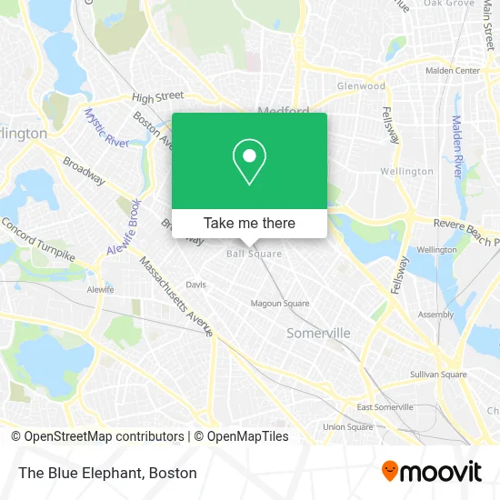
See The Blue Elephant, Somerville, on the map
Public Transit to The Blue Elephant in Somerville
Wondering how to get to The Blue Elephant in Somerville? Moovit helps you find the best way to get to The Blue Elephant with step-by-step directions from the nearest public transit station.
Moovit provides free maps and live directions to help you navigate through your city. View schedules, routes, timetables, and find out how long does it take to get to The Blue Elephant in real time.
Looking for the nearest stop or station to The Blue Elephant? Check out this list of stops closest to your destination: Broadway @ Alfred St; Broadway @ Cedar St; College Ave @ Broadway; Davis Sq.; Broadway @ Josephine Ave - Ball Sq; Ball Square - Boston Ave @ Broadway; Porter; Ball Square Station.
Bus: 80, 89, 96, 89/93, 94.Train: FITCHBURG.Subway: GREEN LINE E, RED LINE, GREEN LINE B, GREEN LINE C.
Want to see if there’s another route that gets you there at an earlier time? Moovit helps you find alternative routes or times. Get directions from and directions to The Blue Elephant easily from the Moovit App or Website.
We make riding to The Blue Elephant easy, which is why over 1.7 million users, including users in Somerville, trust Moovit as the best app for public transit. You don’t need to download an individual bus app or train app, Moovit is your all-in-one transit app that helps you find the best bus time or train time available.
For information on prices of subway and bus, costs and ride fares to The Blue Elephant, please check the Moovit app.
Use the app to navigate to popular places including to the airport, hospital, stadium, grocery store, mall, coffee shop, school, college, and university.
The Blue Elephant Address: 719 Broadway street in Somerville
- Ball Square Fine Wines,
- Ball Square,
- Alpha Dental,
- Supreme Paint & Wallpaper,
- Sassafras,
- Homestead,
- Rubin Saul Woodworking,
- Aaaa Landscapes by George,
- Semolina Kitchen & Bar,
- Family Pride Services,
- Dave's Fresh Pasta,
- Semolina Kitchen,
- Alpha Fire Sprinkler Corp.,
- Adbelem Boston,
- Tufts Park (Tufts Pool - Medford Community Pool),
- Trum Field,
- Medford High School (Medford School District),
- Am Music Group,
- Ellis Oval and Zimman Field, Tufts University,
- Alegria Bowls
Places Near The Blue Elephant (Somerville)
- House Of Blues, Boston,
- Isabella Stewart Gardner Museum, Boston,
- North End, Boston,
- Prudential Center, Boston,
- Td Garden, Boston,
- Mgm Music Hall, Boston,
- Wilbur Theatre, Boston,
- Boston Common, Boston,
- Boston Medical Center, Boston,
- Boston Children's Hospital, Boston,
- Wang Theater, Boston,
- Massachusetts General Hospital, Boston,
- Castle Island, Boston,
- Faneuil Hall, Boston,
- Boston Convention & Exhibition Center, Boston,
- Seaport District, Boston,
- Cheers, Boston,
- Museum Of Science, Boston,
- Quincy Market, Boston,
- Leader Bank Pavilion (Leader Bank Pavillion), Boston
How to get to popular places in Boston with public transit
Get around Somerville by public transit!
Traveling around Somerville has never been so easy. See step by step directions as you travel to any attraction, street or major public transit station. View bus and train schedules, arrival times, service alerts and detailed routes on a map, so you know exactly how to get to anywhere in Somerville.
When traveling to any destination around Somerville use Moovit's Live Directions with Get Off Notifications to know exactly where and how far to walk, how long to wait for your line, and how many stops are left. Moovit will alert you when it's time to get off — no need to constantly re-check whether yours is the next stop.
Wondering how to use public transit in Somerville or how to pay for public transit in Somerville? Moovit public transit app can help you navigate your way with public transit easily, and at minimum cost. It includes public transit fees, ticket prices, and costs. Looking for a map of Somerville public transit lines? Moovit public transit app shows all public transit maps in Somerville with all Bus, Train, Subway and Ferry routes and stops on an interactive map.
Boston has 4 transit type(s), including: Bus, Train, Subway and Ferry, operated by several transit agencies, including MBTA, Southeastern Regional Transit Authority, MetroWest Regional Transit Authority, Rhode Island Public Transit Authority, WRTA, Lowell Regional Transit Authority, Merrimack Valley Transit, Montachusett Regional Transit Authority, Cape Cod Regional Transit Authority, Brockton Area Transit Authority, Martha's Vineyard Transit Authority, the WAVE - Nantucket Regional Transit Authority, GATRA, Cape Ann Transportation Authority and Massport