Directions to The Bon by Morro (Boston) with public transportation
The following transit lines have routes that pass near The Bon by Morro
 Bus: 1, 39, 8, 85, 19.
- Train: FRAMINGHAM/WORCESTER, NEEDHAM.
- Subway: GREEN LINE B, GREEN LINE C, GREEN LINE D, ORANGE LINE, GREEN LINE E.
How to get to The Bon by Morro by bus?
Click on the bus route to see step by step directions with maps, line arrival times and updated time schedules.
From Beth Israel Deaconess Hospital-Milton, Milton
87 minFrom Arnold Arboretum, Boston
48 minFrom Harpoon Brewery, Boston
56 minFrom Melrose Wakefield Hospital, Malden
107 minFrom Malden Catholic High School, Malden
84 minFrom Wellington Station, Medford
76 minFrom Danehy Park, Cambridge
56 minFrom Milton, MA, Milton
76 minFrom Hampton Inn & Suites-Hampton Watertown Boston (Hampton Inn & Suites Watertown Boston), Watertown Town
51 minFrom Wollaston Beach, Quincy
120 min
How to get to The Bon by Morro by train?
Click on the train route to see step by step directions with maps, line arrival times and updated time schedules.
How to get to The Bon by Morro by subway?
Click on the subway route to see step by step directions with maps, line arrival times and updated time schedules.
Bus stops near The Bon by Morro in Boston
Train station near The Bon by Morro in Boston
- Lansdowne, 3 min walk,VIEW
Subway stations near The Bon by Morro in Boston
Bus lines to The Bon by Morro in Boston
What are the closest stations to The Bon by Morro?
The closest stations to The Bon by Morro are:
- Brookline Ave Opp Jersey St is 54 yards away, 1 min walk.
- Brookline Ave @ Jersey St is 81 yards away, 1 min walk.
- Lansdowne is 221 yards away, 3 min walk.
- Boylston St @ Jersey St is 358 yards away, 5 min walk.
- Kenmore is 371 yards away, 5 min walk.
- Northeastern University is 1425 yards away, 17 min walk.
Which bus lines stop near The Bon by Morro?
These bus lines stop near The Bon by Morro: 1, 39, 8, 85.
Which train lines stop near The Bon by Morro?
These train lines stop near The Bon by Morro: FRAMINGHAM/WORCESTER, NEEDHAM.
Which subway lines stop near The Bon by Morro?
These subway lines stop near The Bon by Morro: GREEN LINE B, GREEN LINE C, GREEN LINE D, ORANGE LINE.
What’s the nearest subway station to The Bon by Morro in Boston?
The nearest subway station to The Bon by Morro in Boston is Kenmore. It’s a 5 min walk away.
What’s the nearest train station to The Bon by Morro in Boston?
The nearest train station to The Bon by Morro in Boston is Lansdowne. It’s a 3 min walk away.
What’s the nearest bus station to The Bon by Morro in Boston?
The nearest bus stations to The Bon by Morro in Boston are Brookline Ave Opp Jersey St and Brookline Ave @ Jersey St. The closest one is a 1 min walk away.
What time is the first subway to The Bon by Morro in Boston?
The GREEN LINE D is the first subway that goes to The Bon by Morro in Boston. It stops nearby at 4:56 AM.
What time is the last subway to The Bon by Morro in Boston?
The GREEN LINE D is the last subway that goes to The Bon by Morro in Boston. It stops nearby at 2:21 AM.
What time is the first train to The Bon by Morro in Boston?
The FRAMINGHAM/WORCESTER is the first train that goes to The Bon by Morro in Boston. It stops nearby at 4:55 AM.
What time is the last train to The Bon by Morro in Boston?
The FRAMINGHAM/WORCESTER is the last train that goes to The Bon by Morro in Boston. It stops nearby at 12:06 AM.
What time is the first bus to The Bon by Morro in Boston?
The 60 is the first bus that goes to The Bon by Morro in Boston. It stops nearby at 5:21 AM.
What time is the last bus to The Bon by Morro in Boston?
The 8 is the last bus that goes to The Bon by Morro in Boston. It stops nearby at 12:58 AM.
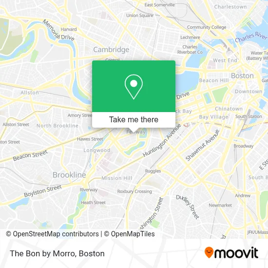
See The Bon by Morro, Boston, on the map
Public Transit to The Bon by Morro in Boston
Wondering how to get to The Bon by Morro in Boston? Moovit helps you find the best way to get to The Bon by Morro with step-by-step directions from the nearest public transit station.
Moovit provides free maps and live directions to help you navigate through your city. View schedules, routes, timetables, and find out how long does it take to get to The Bon by Morro in real time.
Looking for the nearest stop or station to The Bon by Morro? Check out this list of stops closest to your destination: Brookline Ave Opp Jersey St; Brookline Ave @ Jersey St; Lansdowne; Boylston St @ Jersey St; Kenmore; Northeastern University.
Bus: 1, 39, 8, 85, 19, 60, 65, 9, 55.Train: FRAMINGHAM/WORCESTER, NEEDHAM.Subway: GREEN LINE B, GREEN LINE C, GREEN LINE D, ORANGE LINE, GREEN LINE E.
Want to see if there’s another route that gets you there at an earlier time? Moovit helps you find alternative routes or times. Get directions from and directions to The Bon by Morro easily from the Moovit App or Website.
We make riding to The Bon by Morro easy, which is why over 1.7 million users, including users in Boston, trust Moovit as the best app for public transit. You don’t need to download an individual bus app or train app, Moovit is your all-in-one transit app that helps you find the best bus time or train time available.
For information on prices of subway, bus and train, costs and ride fares to The Bon by Morro, please check the Moovit app.
Use the app to navigate to popular places including to the airport, hospital, stadium, grocery store, mall, coffee shop, school, college, and university.
The Bon by Morro Address: 1260 Boylston St street in Boston
- Carbon Health Urgent Care Boston - Fenway,
- Sojuba,
- The Baseball Tavern,
- Jerry Remy's Sports Bar & Grill (Tony C's Sports Bar & Grill),
- Tony C's Sports Bar & Grill Fenway,
- The Verb Hotel,
- The Viridian Garage,
- Chfeur - Chauffeur Service,
- 1282 Boylston برج العرب,
- Sunoco,
- 43670 Roofing,
- Siena at Ink Block,
- Vernick & Gopal,
- Growth,
- Guitar Center,
- Jack Richman Od,
- Devon Locksmith,
- Tour Boston's Rock & Roll Past & Present by Soundscape Tours,
- Back Bay Fens,
- CITGO
Places Near The Bon by Morro (Boston)
- House Of Blues, Boston,
- Prudential Center, Boston,
- Boston Convention & Exhibition Center, Boston,
- Wang Theater, Boston,
- Seaport District, Boston,
- Td Garden, Boston,
- Leader Bank Pavilion (Leader Bank Pavillion), Boston,
- Museum Of Science, Boston,
- North End, Boston,
- Castle Island, Boston,
- Boston Medical Center, Boston,
- Boston Children's Hospital, Boston,
- Boston Common, Boston,
- Quincy Market, Boston,
- Massachusetts General Hospital, Boston,
- Faneuil Hall, Boston,
- Wilbur Theatre, Boston,
- Cheers, Boston,
- Isabella Stewart Gardner Museum, Boston,
- Mgm Music Hall, Boston
How to get to popular places in Boston with public transit
Get around Boston by public transit!
Traveling around Boston has never been so easy. See step by step directions as you travel to any attraction, street or major public transit station. View bus and train schedules, arrival times, service alerts and detailed routes on a map, so you know exactly how to get to anywhere in Boston.
When traveling to any destination around Boston use Moovit's Live Directions with Get Off Notifications to know exactly where and how far to walk, how long to wait for your line, and how many stops are left. Moovit will alert you when it's time to get off — no need to constantly re-check whether yours is the next stop.
Wondering how to use public transit in Boston or how to pay for public transit in Boston? Moovit public transit app can help you navigate your way with public transit easily, and at minimum cost. It includes public transit fees, ticket prices, and costs. Looking for a map of Boston public transit lines? Moovit public transit app shows all public transit maps in Boston with all Bus, Train, Subway and Ferry routes and stops on an interactive map.
Boston has 4 transit type(s), including: Bus, Train, Subway and Ferry, operated by several transit agencies, including MBTA, Southeastern Regional Transit Authority, MetroWest Regional Transit Authority, Rhode Island Public Transit Authority, WRTA, Lowell Regional Transit Authority, Merrimack Valley Transit, Montachusett Regional Transit Authority, Cape Cod Regional Transit Authority, Brockton Area Transit Authority, Martha's Vineyard Transit Authority, the WAVE - Nantucket Regional Transit Authority, GATRA, Cape Ann Transportation Authority and Massport