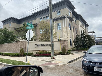
Directions to The Briar Club (Houston) with public transportation
The following transit lines have routes that pass near The Briar Club
How to get to The Briar Club by bus?
Click on the bus route to see step by step directions with maps, line arrival times and updated time schedules.
Bus stations near The Briar Club in Houston
- Westheimer Rd @ Timmons Ln, 3 min walk,
- Weslayan St @ Westheimer Rd, 9 min walk,
Bus lines to The Briar Club in Houston
- 82, Downtown - Eastbound,
- 84, Northwest Tc - Northbound,
What are the closest stations to The Briar Club?
The closest stations to The Briar Club are:
- Westheimer Rd @ Timmons Ln is 129 yards away, 3 min walk.
- Weslayan St @ Westheimer Rd is 610 yards away, 9 min walk.
Which bus line stops near The Briar Club?
82
What’s the nearest bus stop to The Briar Club in Houston?
The nearest bus stop to The Briar Club in Houston is Westheimer Rd @ Timmons Ln. It’s a 3 min walk away.
What time is the first bus to The Briar Club in Houston?
The 82 is the first bus that goes to The Briar Club in Houston. It stops nearby at 4:42 AM.
What time is the last bus to The Briar Club in Houston?
The 82 is the last bus that goes to The Briar Club in Houston. It stops nearby at 1:44 AM.
How much is the light rail fare to The Briar Club?
The light rail fare to The Briar Club costs about $1.25.
How much is the bus fare to The Briar Club?
The bus fare to The Briar Club costs about $1.25.
See The Briar Club, Houston, on the map
Public Transit to The Briar Club in Houston
Wondering how to get to The Briar Club in Houston, United States? Moovit helps you find the best way to get to The Briar Club with step-by-step directions from the nearest public transit station.
Moovit provides free maps and live directions to help you navigate through your city. View schedules, routes, timetables, and find out how long does it take to get to The Briar Club in real time.
Looking for the nearest stop or station to The Briar Club? Check out this list of stops closest to your destination: Westheimer Rd @ Timmons Ln; Weslayan St @ Westheimer Rd.
Bus: 82, 84.
Want to see if there’s another route that gets you there at an earlier time? Moovit helps you find alternative routes or times. Get directions from and directions to The Briar Club easily from the Moovit App or Website.
We make riding to The Briar Club easy, which is why over 1.5 million users, including users in Houston, trust Moovit as the best app for public transit. You don’t need to download an individual bus app or train app, Moovit is your all-in-one transit app that helps you find the best bus time or train time available.
For information on prices of bus and light rail, costs and ride fares to The Briar Club, please check the Moovit app.
Use the app to navigate to popular places including to the airport, hospital, stadium, grocery store, mall, coffee shop, school, college, and university.
The Briar Club Address: Westheimer Road street in Houston
Attractions near The Briar Club
The Briar Club,Whataburger,Post Office,Pillar To Post Home Inspectors - Jennifer Bell,United States Post Office,River Oaks Community Center,St. Luke's United Methodist Church,Bizcaboom - Houston,The Story,The River Oaks,Wynn Blanton Memorial Building (Boy Scouts),Practice Facility Building C,Chateau Carnarvon,Renova Laser Hair Removal & MedSpa,Ronald Parris, MD,National Appraisal Partners Llp,Christian Community Service Center,2929 Weslayan,Sunita's Houston Ayurveda Center,Wells FargoHow to get to popular attractions in Houston with public transit
Westpark Tollway & Beltway 8, Houston,Intersection of I-10 and N Wayside Dr, Houston,FM 1960 at Kuykendahl, Houston,EZ Tag Store, Houston,I-45 North and Gulf Bank, Houston,IH 10 at Wilcrest, Houston,METRO Downtown Operations Facility (Midday Lot), Houston,I-45 Freeway & Tx 249 Tomball Parkway, Houston,Intersection of I-45 and W Little York Rd, Houston,Cinemark 19 And XD, Houston,Energy Corridor, Houston,METRO Cypress Park & Ride,SHEPHERD AND LITTLE YORK, Houston,Lola, Houston,Pappadeaux Seafood Kitchen, Houston,Fiesta,FKM, Houston,Mambo Seafood, Houston,610 & Wallisville, Houston,Baytown, TX, BaytownGet around Houston by public transit!
Traveling around Houston has never been so easy. See step by step directions as you travel to any attraction, street or major public transit station. View bus and train schedules, arrival times, service alerts and detailed routes on a map, so you know exactly how to get to anywhere in Houston.
When traveling to any destination around Houston use Moovit's Live Directions with Get Off Notifications to know exactly where and how far to walk, how long to wait for your line, and how many stops are left. Moovit will alert you when it's time to get off — no need to constantly re-check whether yours is the next stop.
Wondering how to use public transit in Houston or how to pay for public transit in Houston? Moovit public transit app can help you navigate your way with public transit easily, and at minimum cost. It includes public transit fees, ticket prices, and costs. Looking for a map of Houston public transit lines? Moovit public transit app shows all public transit maps in Houston with all Bus and Light Rail routes and stops on an interactive map.
Houston has 2 transit type(s), including: Bus and Light Rail, operated by several transit agencies, including METRO, Greyhound-us, FlixBus-us, Megabus