See The Children's Museum of Atlanta on the map
Directions to The Children's Museum of Atlanta with public transportation
The following transit lines have routes that pass near The Children's Museum of Atlanta
 Bus:
Bus: - Subway:
How to get to The Children's Museum of Atlanta by bus?
Click on the bus route to see step by step directions with maps, line arrival times and updated time schedules.
How to get to The Children's Museum of Atlanta by subway?
Click on the subway route to see step by step directions with maps, line arrival times and updated time schedules.
Bus stations near The Children's Museum of Atlanta
- Spring St at John Portman Blvd,1 min walk,
- John Portman Blvd at Peachtree St,2 min walk,
- Peachtree St @ John Portman Blvd,2 min walk,
- Peachtree St & Baker St (Suntrust Bldg),4 min walk,
- Centennial Olympic Park Dr @ Mills St,5 min walk,
- Marietta St @ Baker St NW,6 min walk,
Light Rail stations near The Children's Museum of Atlanta
- Luckie St @ Cone St,6 min walk,
Subway stations near The Children's Museum of Atlanta
- Peachtree Center Transit Station,6 min walk,
Bus lines to The Children's Museum of Atlanta
- 100,Busbee Park & Ride,
- 101,Marietta Transfer Center,
- 413,413 Downtown,
- 480,480 Acworth / Town Center,
- 485,485 Downtown,
- 490,490 Downtown,
- 40,West End Station,
- 101,I-985 P&R - Downtown Atlanta,
- 102,Indian Trail P&R - Downtown Atlanta,
- 103,Sugarloaf Mills P&R - Downtown Atlanta,
- 103A,Rev Commute Atlanta - Sugarloaf Mills,
- 400,Cumming - Downtown,
- 416,Dacula - Downtown,
- 419,Snellville/Hewatt/Stone Mtn - DT,
- 426,E Conyer/W Conyer/Panola - DT,
- 430,McDonough - Downtown,
- 432,BrandsMart/Stockbridge - DT,
- 440,Hampton/Jonesboro - DT/MT,
- 441,Jonesboro - Downtown/Midtown,
- 442,Riverdale - Downtown,
What are the closest stations to The Children's Museum of Atlanta?
The closest stations to The Children's Museum of Atlanta are:
- Spring St at John Portman Blvd is 42 yards away, 1 min walk.
- John Portman Blvd at Peachtree St is 79 yards away, 2 min walk.
- Peachtree St @ John Portman Blvd is 131 yards away, 2 min walk.
- Peachtree St & Baker St (Suntrust Bldg) is 306 yards away, 4 min walk.
- Centennial Olympic Park Dr @ Mills St is 363 yards away, 5 min walk.
- Luckie St @ Cone St is 464 yards away, 6 min walk.
- Peachtree Center Transit Station is 469 yards away, 6 min walk.
- Marietta St @ Baker St NW is 474 yards away, 6 min walk.
Which bus lines stop near The Children's Museum of Atlanta?
These bus lines stop near The Children's Museum of Atlanta: 101, 26, 40, 476, 51, 816.
Which subway lines stop near The Children's Museum of Atlanta?
These subway lines stop near The Children's Museum of Atlanta: GOLD, RED.
What’s the nearest light rail station to The Children's Museum of Atlanta?
The nearest light rail station to The Children's Museum of Atlanta is Luckie St @ Cone St. It’s a 6 min walk away.
What’s the nearest subway station to The Children's Museum of Atlanta?
The nearest subway station to The Children's Museum of Atlanta is Peachtree Center Transit Station. It’s a 6 min walk away.
What’s the nearest bus stop to The Children's Museum of Atlanta?
The nearest bus stop to The Children's Museum of Atlanta is Spring St at John Portman Blvd. It’s a 1 min walk away.
What time is the first light rail to The Children's Museum of Atlanta?
The ATLSC is the first light rail that goes to The Children's Museum of Atlanta. It stops nearby at 8:27 AM.
What time is the last light rail to The Children's Museum of Atlanta?
The ATLSC is the last light rail that goes to The Children's Museum of Atlanta. It stops nearby at 11:04 PM.
What time is the first subway to The Children's Museum of Atlanta?
The GOLD is the first subway that goes to The Children's Museum of Atlanta. It stops nearby at 4:58 AM.
What time is the last subway to The Children's Museum of Atlanta?
The GOLD is the last subway that goes to The Children's Museum of Atlanta. It stops nearby at 1:39 AM.
What time is the first bus to The Children's Museum of Atlanta?
The 51 is the first bus that goes to The Children's Museum of Atlanta. It stops nearby at 4:58 AM.
What time is the last bus to The Children's Museum of Atlanta?
The 26 is the last bus that goes to The Children's Museum of Atlanta. It stops nearby at 12:33 AM.
How much is the subway fare to The Children's Museum of Atlanta?
The subway fare to The Children's Museum of Atlanta costs about $2.50.
How much is the bus fare to The Children's Museum of Atlanta?
The bus fare to The Children's Museum of Atlanta costs about $2.50.
See The Children's Museum of Atlanta on the map
Public Transportation to The Children's Museum of Atlanta
Wondering how to get to The Children's Museum of Atlanta, United States? Moovit helps you find the best way to get to The Children's Museum of Atlanta with step-by-step directions from the nearest public transit station.
Moovit provides free maps and live directions to help you navigate through your city. View schedules, routes, timetables, and find out how long does it take to get to The Children's Museum of Atlanta in real time.
Looking for the nearest stop or station to The Children's Museum of Atlanta? Check out this list of stops closest to your destination: Spring St at John Portman Blvd; John Portman Blvd at Peachtree St; Peachtree St @ John Portman Blvd; Peachtree St & Baker St (Suntrust Bldg); Centennial Olympic Park Dr @ Mills St; Luckie St @ Cone St; Peachtree Center Transit Station; Marietta St @ Baker St NW.
Bus:Subway:
Want to see if there’s another route that gets you there at an earlier time? Moovit helps you find alternative routes or times. Get directions from and directions to The Children's Museum of Atlanta easily from the Moovit App or Website.
We make riding to The Children's Museum of Atlanta easy, which is why over 1.5 million users, including users in Atlanta, trust Moovit as the best app for public transit. You don’t need to download an individual bus app or train app, Moovit is your all-in-one transit app that helps you find the best bus time or train time available.
For information on prices of bus and subway, costs and ride fares to The Children's Museum of Atlanta, please check the Moovit app.
Use the app to navigate to popular places including to the airport, hospital, stadium, grocery store, mall, coffee shop, school, college, and university.
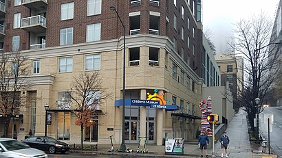
The Children's Museum of Atlanta Address: 275 Centennial Olympic Park Dr NW street in Atlanta
Attractions near The Children's Museum of Atlanta
Royal Entertainment,Avalon Wellness,Dr Bubble Carpet Cleaning,Navy Federal Credit Union,Bottle Cap Cafe,King and Queen Travel Society,Hotlanta Half Marath,Atlanta Charter Bus Company,Imagine It the CHLDRN's Msm Of,Imagine It the Children Museum,World Of Coca-Cola,Urgent Care 24/7 Atlanta,Digital Video & Data,Okehi Arts,Coca-Cola Red Bus - WoCC Stop,Atlanta Police Department Zone 5 Precinct,Interpark 236 Williams Self Park Garage and Lot,ATM Coca-Cola Federal Credit Union,Coca-Cola Bottling,250-Unit 1 / 250 Williams StHow to get to popular attractions in Atlanta with public transit
Candler Rd exit off I-20, Candler-Mcafee,Historic Downtown Roswell, Roswell,10 10th Street, Atlanta, GA, Atlanta,Buford Hwy. And Langford Road, Gwinnett,Strayer University Cobb County Campus, Cobb,MLK & Ashby, Atlanta,MARTA Headquarters, Atlanta,Kroger, Dekalb,Southlake Mall, Morrow,I-285 Exit 18 Paces Ferry Rd, Vinings,I-285 & Donald Lee Hollowell Pkwy NW, Atlanta,CNN Center Lower Parking Deck, Atlanta,Mall of Georgia Boulevard, Gwinnett,MATC- MARTA Annex, Atlanta,I-85 @ Steve Reynolds Blvd., Gwinnett,Gwinnett County Recorder's Court, Lawrenceville,Stockbridge Exit 228, Henry,Peachtree Summit Federal Building, Atlanta,Cascade Road & Fulton Industrial Blvd, Fulton,138/75 exit 228, HenryGet around Atlanta by public transit!
Traveling around Atlanta has never been so easy. See step by step directions as you travel to any attraction, street or major public transit station. View bus and train schedules, arrival times, service alerts and detailed routes on a map, so you know exactly how to get to anywhere in Atlanta.
When traveling to any destination around Atlanta use Moovit's Live Directions with Get Off Notifications to know exactly where and how far to walk, how long to wait for your line, and how many stops are left. Moovit will alert you when it's time to get off — no need to constantly re-check whether yours is the next stop.
Wondering how to use public transit in Atlanta or how to pay for public transit in Atlanta? Moovit public transit app can help you navigate your way with public transit easily, and at minimum cost. It includes public transit fees, ticket prices, and costs. Looking for a map of Atlanta public transit lines? Moovit public transit app shows all public transit maps in Atlanta with all bus or subway routes and stops on an interactive map.
Atlanta has 2 transit type(s), including: bus or subway, operated by several transit agencies, including MARTA, MARTA, Metropolitan Atlanta Rapid Transit Authority, Xpress, Atlantic Station Shuttle, CobbLinc, Ride Gwinnett, Connect Douglas, Amtrak, Stinger Bus and Tech Trolley, Emory University Transportation , Panther Express, Atlanta University Center Shuttle , Rome Transit Department and FlixBus-us