Directions to The Clam Box (Quincy) with public transportation
The following transit lines have routes that pass near The Clam Box
 Bus: 210, 217.
- Train: FALL RIVER/NEW BEDFORD, GREENBUSH.
- Subway: RED LINE.
- Ferry: QUINCY FERRY, WINTHROP/QUINCY FERRY.
How to get to The Clam Box by bus?
Click on the bus route to see step by step directions with maps, line arrival times and updated time schedules.
From Mandarin Oriental, Boston, Boston
119 minFrom Fogo De Chão, Boston
114 minFrom Massachusetts College Of Pharmacy And Health Science, Boston
87 minFrom The Freedom Trail, Boston
111 minFrom Encompass Health Rehabilitation Hospital of Braintree, Braintree Town
74 minFrom Rochambeau, Boston
102 minFrom Abe & Louie's, Boston
119 minFrom Omni Parker House, Boston
113 minFrom Hampton Inn Boston Seaport District (Hampton Inn-Hampton Inn Boston), Boston
100 minFrom St. Cecilia's Catholic Church, Boston
98 min
How to get to The Clam Box by train?
Click on the train route to see step by step directions with maps, line arrival times and updated time schedules.
From Mandarin Oriental, Boston, Boston
82 minFrom Fogo De Chão, Boston
76 minFrom Massachusetts College Of Pharmacy And Health Science, Boston
93 minFrom The Freedom Trail, Boston
72 minFrom Rochambeau, Boston
85 minFrom Abe & Louie's, Boston
82 minFrom Omni Parker House, Boston
72 minFrom Hampton Inn Boston Seaport District (Hampton Inn-Hampton Inn Boston), Boston
82 minFrom St. Cecilia's Catholic Church, Boston
87 min
How to get to The Clam Box by subway?
Click on the subway route to see step by step directions with maps, line arrival times and updated time schedules.
From Mandarin Oriental, Boston, Boston
58 minFrom Fogo De Chão, Boston
51 minFrom Massachusetts College Of Pharmacy And Health Science, Boston
72 minFrom The Freedom Trail, Boston
45 minFrom Rochambeau, Boston
66 minFrom Abe & Louie's, Boston
58 minFrom Omni Parker House, Boston
46 minFrom Hampton Inn Boston Seaport District (Hampton Inn-Hampton Inn Boston), Boston
62 minFrom St. Cecilia's Catholic Church, Boston
61 min
Bus stop near The Clam Box in Quincy
- Billings Rd @ W Elm Ave, 1 min walk,VIEW
Subway station near The Clam Box in Quincy
- North Quincy, 17 min walk,VIEW
Ferry station near The Clam Box in Quincy
- Quincy, 32 min walk,VIEW
Bus lines to The Clam Box in Quincy
- 217, Ashmont Via North Quincy,VIEW
What are the closest stations to The Clam Box?
The closest stations to The Clam Box are:
- Billings Rd @ W Elm Ave is 23 yards away, 1 min walk.
- North Quincy is 1398 yards away, 17 min walk.
- Quincy is 2711 yards away, 32 min walk.
Which bus line stops near The Clam Box?
210 (Quincy Center)
Which train lines stop near The Clam Box?
These train lines stop near The Clam Box: FALL RIVER/NEW BEDFORD, GREENBUSH.
Which subway line stops near The Clam Box?
RED LINE (Ashmont/Braintree)
What’s the nearest subway station to The Clam Box in Quincy?
The nearest subway station to The Clam Box in Quincy is North Quincy. It’s a 17 min walk away.
What’s the nearest bus station to The Clam Box in Quincy?
The nearest bus station to The Clam Box in Quincy is Billings Rd @ W Elm Ave. It’s a 1 min walk away.
What time is the first subway to The Clam Box in Quincy?
The RED LINE is the first subway that goes to The Clam Box in Quincy. It stops nearby at 5:18 AM.
What time is the last subway to The Clam Box in Quincy?
The RED LINE is the last subway that goes to The Clam Box in Quincy. It stops nearby at 1:49 AM.
What time is the first bus to The Clam Box in Quincy?
The 217 is the first bus that goes to The Clam Box in Quincy. It stops nearby at 5:59 AM.
What time is the last bus to The Clam Box in Quincy?
The 217 is the last bus that goes to The Clam Box in Quincy. It stops nearby at 6:48 PM.
What time is the first ferry to The Clam Box in Quincy?
The QUINCY FERRY is the first ferry that goes to The Clam Box in Quincy. It stops nearby at 6:15 AM.
What time is the last ferry to The Clam Box in Quincy?
The QUINCY FERRY is the last ferry that goes to The Clam Box in Quincy. It stops nearby at 8:55 PM.
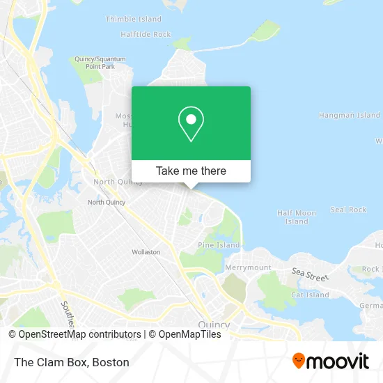
See The Clam Box, Quincy, on the map
Public Transit to The Clam Box in Quincy
Wondering how to get to The Clam Box in Quincy? Moovit helps you find the best way to get to The Clam Box with step-by-step directions from the nearest public transit station.
Moovit provides free maps and live directions to help you navigate through your city. View schedules, routes, timetables, and find out how long does it take to get to The Clam Box in real time.
Looking for the nearest stop or station to The Clam Box? Check out this list of stops closest to your destination: Billings Rd @ W Elm Ave; North Quincy; Quincy.
Bus: 210, 217.Train: FALL RIVER/NEW BEDFORD, GREENBUSH.Subway: RED LINE.Ferry: QUINCY FERRY, WINTHROP/QUINCY FERRY.
Want to see if there’s another route that gets you there at an earlier time? Moovit helps you find alternative routes or times. Get directions from and directions to The Clam Box easily from the Moovit App or Website.
We make riding to The Clam Box easy, which is why over 1.7 million users, including users in Quincy, trust Moovit as the best app for public transit. You don’t need to download an individual bus app or train app, Moovit is your all-in-one transit app that helps you find the best bus time or train time available.
For information on prices of subway, bus and train, costs and ride fares to The Clam Box, please check the Moovit app.
Use the app to navigate to popular places including to the airport, hospital, stadium, grocery store, mall, coffee shop, school, college, and university.
The Clam Box Address: 789 Quincy Shore Dr street in Quincy
- Carpets Today,
- Wollaston Beach (Wollaston Yacht Club),
- Wollaston Beach,
- Star Five Oil,
- Premier Masonry,
- Extreme Locksmith of Quincy,
- Canterbury Hall,
- Wollaston Beach,
- Urposse,
- Edith Cove Fine Arts Center ,
- Angellash,
- Christian Mana Church,
- Fuji at Assembly,
- Lianxing Corporation,
- Emergency A Locksmith,
- QC gym,
- Jimmys Five Star Painting,
- Ace Waterproofing,
- TLC Details,
- Emily's Dog Care
Places Near The Clam Box (Quincy)
- Boston Children's Hospital, Boston,
- Massachusetts General Hospital, Boston,
- House Of Blues, Boston,
- Td Garden, Boston,
- North End, Boston,
- Boston Common, Boston,
- Boston Medical Center, Boston,
- Wang Theater, Boston,
- Castle Island, Boston,
- Museum Of Science, Boston,
- Boston Convention & Exhibition Center, Boston,
- Mgm Music Hall, Boston,
- Isabella Stewart Gardner Museum, Boston,
- Prudential Center, Boston,
- Seaport District, Boston,
- Faneuil Hall, Boston,
- Cheers, Boston,
- Leader Bank Pavilion (Leader Bank Pavillion), Boston,
- Wilbur Theatre, Boston,
- Quincy Market, Boston
How to get to popular places in Boston with public transit
Get around Quincy by public transit!
Traveling around Quincy has never been so easy. See step by step directions as you travel to any attraction, street or major public transit station. View bus and train schedules, arrival times, service alerts and detailed routes on a map, so you know exactly how to get to anywhere in Quincy.
When traveling to any destination around Quincy use Moovit's Live Directions with Get Off Notifications to know exactly where and how far to walk, how long to wait for your line, and how many stops are left. Moovit will alert you when it's time to get off — no need to constantly re-check whether yours is the next stop.
Wondering how to use public transit in Quincy or how to pay for public transit in Quincy? Moovit public transit app can help you navigate your way with public transit easily, and at minimum cost. It includes public transit fees, ticket prices, and costs. Looking for a map of Quincy public transit lines? Moovit public transit app shows all public transit maps in Quincy with all Bus, Train, Subway and Ferry routes and stops on an interactive map.
Boston has 4 transit type(s), including: Bus, Train, Subway and Ferry, operated by several transit agencies, including MBTA, Southeastern Regional Transit Authority, MetroWest Regional Transit Authority, Rhode Island Public Transit Authority, WRTA, Lowell Regional Transit Authority, Merrimack Valley Transit, Montachusett Regional Transit Authority, Cape Cod Regional Transit Authority, Brockton Area Transit Authority, Martha's Vineyard Transit Authority, the WAVE - Nantucket Regional Transit Authority, GATRA, Cape Ann Transportation Authority and Massport