How to get to The Coffee Mug Restaurant by bus?
Click on the bus route to see step by step directions with maps, line arrival times and updated time schedules.
Bus stops near The Coffee Mug Restaurant in Boston
Bus lines to The Coffee Mug Restaurant in Boston
What are the closest stations to The Coffee Mug Restaurant?
The closest stations to The Coffee Mug Restaurant are:
- Southbridge St at Auburn St is 747 yards away, 9 min walk.
- Southbridge St + Swanson St is 851 yards away, 10 min walk.
Which bus lines stop near The Coffee Mug Restaurant?
These bus lines stop near The Coffee Mug Restaurant: 27, 42.
What’s the nearest bus station to The Coffee Mug Restaurant in Boston?
The nearest bus station to The Coffee Mug Restaurant in Boston is Southbridge St at Auburn St. It’s a 9 min walk away.
What time is the first bus to The Coffee Mug Restaurant in Boston?
The 27 is the first bus that goes to The Coffee Mug Restaurant in Boston. It stops nearby at 5:28 AM.
What time is the last bus to The Coffee Mug Restaurant in Boston?
The 27 is the last bus that goes to The Coffee Mug Restaurant in Boston. It stops nearby at 9:50 PM.
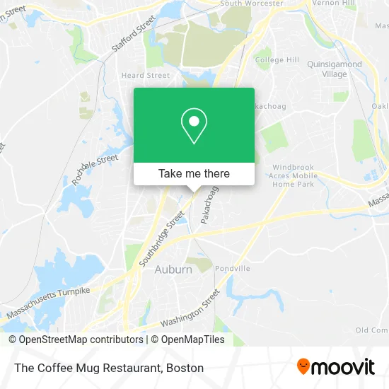
See The Coffee Mug Restaurant, Boston, on the map
Public Transit to The Coffee Mug Restaurant in Boston
Wondering how to get to The Coffee Mug Restaurant in Boston? Moovit helps you find the best way to get to The Coffee Mug Restaurant with step-by-step directions from the nearest public transit station.
Moovit provides free maps and live directions to help you navigate through your city. View schedules, routes, timetables, and find out how long does it take to get to The Coffee Mug Restaurant in real time.
Looking for the nearest stop or station to The Coffee Mug Restaurant? Check out this list of stops closest to your destination: Southbridge St at Auburn St; Southbridge St + Swanson St.
Bus: 27, 42, 29.
Want to see if there’s another route that gets you there at an earlier time? Moovit helps you find alternative routes or times. Get directions from and directions to The Coffee Mug Restaurant easily from the Moovit App or Website.
We make riding to The Coffee Mug Restaurant easy, which is why over 1.7 million users, including users in Boston, trust Moovit as the best app for public transit. You don’t need to download an individual bus app or train app, Moovit is your all-in-one transit app that helps you find the best bus time or train time available.
For information on prices of bus and train, costs and ride fares to The Coffee Mug Restaurant, please check the Moovit app.
Use the app to navigate to popular places including to the airport, hospital, stadium, grocery store, mall, coffee shop, school, college, and university.
The Coffee Mug Restaurant Address: 286 Southbridge St street in Boston
- Caliber Electrical Contractors,
- Retirement Money Matters,
- Swimming Puddles,
- Rose Clayton Clayton Law Offices,
- Brent Dawson at Comparion Insurance Agency,
- BP,
- 60 Auburn St Parking,
- FedEx Drop Box,
- LG Appliance Repair,
- Auburn Therapeutic Massage,
- Central Mass Orthodont,
- Amy Diggins Spirit Medium,
- Cellular Sales, Verizon Wireless Authorized Retailer,
- Sullivan Patricia M Podiatrst,
- Goddard Memorial Park,
- Auburn Westboro Ey,
- Town of Auburn Fire Dept,
- Sandoli Marie,
- Capitol Gutter Service,
- William Jumbo Donuts
Places Near The Coffee Mug Restaurant (Boston)
- Td Garden, Boston,
- Castle Island, Boston,
- Wilbur Theatre, Boston,
- Prudential Center, Boston,
- North End, Boston,
- Faneuil Hall, Boston,
- Massachusetts General Hospital, Boston,
- Seaport District, Boston,
- Boston Medical Center, Boston,
- House Of Blues, Boston,
- Boston Common, Boston,
- Boston Convention & Exhibition Center, Boston,
- Museum Of Science, Boston,
- Cheers, Boston,
- Boston Children's Hospital, Boston,
- Mgm Music Hall, Boston,
- Quincy Market, Boston,
- Isabella Stewart Gardner Museum, Boston,
- Wang Theater, Boston,
- Leader Bank Pavilion (Leader Bank Pavillion), Boston
How to get to popular places in Boston with public transit
Get around Boston by public transit!
Traveling around Boston has never been so easy. See step by step directions as you travel to any attraction, street or major public transit station. View bus and train schedules, arrival times, service alerts and detailed routes on a map, so you know exactly how to get to anywhere in Boston.
When traveling to any destination around Boston use Moovit's Live Directions with Get Off Notifications to know exactly where and how far to walk, how long to wait for your line, and how many stops are left. Moovit will alert you when it's time to get off — no need to constantly re-check whether yours is the next stop.
Wondering how to use public transit in Boston or how to pay for public transit in Boston? Moovit public transit app can help you navigate your way with public transit easily, and at minimum cost. It includes public transit fees, ticket prices, and costs. Looking for a map of Boston public transit lines? Moovit public transit app shows all public transit maps in Boston with all Bus, Train, Subway and Ferry routes and stops on an interactive map.
Boston has 4 transit type(s), including: Bus, Train, Subway and Ferry, operated by several transit agencies, including MBTA, Southeastern Regional Transit Authority, MetroWest Regional Transit Authority, Rhode Island Public Transit Authority, WRTA, Lowell Regional Transit Authority, Merrimack Valley Transit, Montachusett Regional Transit Authority, Cape Cod Regional Transit Authority, Brockton Area Transit Authority, Martha's Vineyard Transit Authority, the WAVE - Nantucket Regional Transit Authority, GATRA, Cape Ann Transportation Authority and Massport