Directions to The Commons - Gloucester with public transportation
The following transit lines have routes that pass near The Commons - Gloucester
How to get to The Commons - Gloucester by bus?
Click on the bus route to see step by step directions with maps, line arrival times and updated time schedules.
How to get to The Commons - Gloucester by train?
Click on the train route to see step by step directions with maps, line arrival times and updated time schedules.
Bus stop near The Commons - Gloucester
- Shaw's Supermarket, 6 min walk,VIEW
Train station near The Commons - Gloucester
- Rockport, 10 min walk,VIEW
Bus lines to The Commons - Gloucester
What are the closest stations to The Commons - Gloucester?
The closest stations to The Commons - Gloucester are:
- Shaw's Supermarket is 455 yards away, 6 min walk.
- Rockport is 833 yards away, 10 min walk.
Which bus line stops near The Commons - Gloucester?
GLOUCESTER - ROCKPORT VIA EASTERN AVE (Rose Baker Senior Center→Rockport Market)
Which train line stops near The Commons - Gloucester?
NEWBURYPORT/ROCKPORT (#21 | Rockport)
What’s the nearest train station to The Commons - Gloucester?
The nearest train station to The Commons - Gloucester is Rockport. It’s a 10 min walk away.
What’s the nearest bus station to The Commons - Gloucester?
The nearest bus station to The Commons - Gloucester is Shaw's Supermarket. It’s a 6 min walk away.
What time is the first train to The Commons - Gloucester?
The NEWBURYPORT/ROCKPORT is the first train that goes to The Commons - Gloucester. It stops nearby at 5:06 AM.
What time is the last train to The Commons - Gloucester?
The NEWBURYPORT/ROCKPORT is the last train that goes to The Commons - Gloucester. It stops nearby at 1:01 AM.
What time is the first bus to The Commons - Gloucester?
The GLOUCESTER - ROCKPORT VIA EASTERN AVE is the first bus that goes to The Commons - Gloucester. It stops nearby at 7:40 AM.
What time is the last bus to The Commons - Gloucester?
The GLOUCESTER - ROCKPORT VIA EASTERN AVE is the last bus that goes to The Commons - Gloucester. It stops nearby at 6:07 PM.
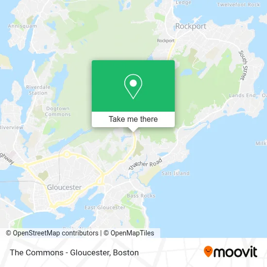
See The Commons - Gloucester on the map
Public Transportation to The Commons - Gloucester
Wondering how to get to The Commons - Gloucester? Moovit helps you find the best way to get to The Commons - Gloucester with step-by-step directions from the nearest public transit station.
Moovit provides free maps and live directions to help you navigate through your city. View schedules, routes, timetables, and find out how long does it take to get to The Commons - Gloucester in real time.
Looking for the nearest stop or station to The Commons - Gloucester? Check out this list of stops closest to your destination: Shaw's Supermarket; Rockport.
Bus: GLOUCESTER - ROCKPORT VIA EASTERN AVE, GLOUCESTER - ROCKPORT VIA THATCHER ROAD.Train: NEWBURYPORT/ROCKPORT.
Want to see if there’s another route that gets you there at an earlier time? Moovit helps you find alternative routes or times. Get directions from and directions to The Commons - Gloucester easily from the Moovit App or Website.
We make riding to The Commons - Gloucester easy, which is why over 1.7 million users, including users in Gloucester, trust Moovit as the best app for public transit. You don’t need to download an individual bus app or train app, Moovit is your all-in-one transit app that helps you find the best bus time or train time available.
For information on prices of bus and train, costs and ride fares to The Commons - Gloucester, please check the Moovit app.
Use the app to navigate to popular places including to the airport, hospital, stadium, grocery store, mall, coffee shop, school, college, and university.
The Commons - Gloucester Address: 214 Eastern Ave street in Gloucester
- Direct SAT TV,
- Ark Insurance,
- Sanfilippo Eye Care,
- Uncle Franks Pizza and Subs,
- Gloucester Health Board,
- Rosen Method Bodywork,
- Community Dev Grants Div,
- ADT Alarm & A D T Security,
- Nugent Stretch,
- Iglesia de Cristo Palabra de Vida Ebenezer,
- Ministoreos Vision,
- Bub S Tool Consignment,
- Super Cute Boutique,
- Government Offices City Administration Office,
- Cape Ann Auto Sales,
- Leading Edge Crystal Technologies,
- Insurance for Family Plans,
- Avh Realty, Inc.,
- Catholic Cemetery Association of the Archdiocese O Gloucester Area,
- Sincere Global Charities
Places Near The Commons - Gloucester
- House Of Blues, Boston,
- Seaport District, Boston,
- Leader Bank Pavilion (Leader Bank Pavillion), Boston,
- Td Garden, Boston,
- North End, Boston,
- Castle Island, Boston,
- Boston Common, Boston,
- Boston Medical Center, Boston,
- Museum Of Science, Boston,
- Massachusetts General Hospital, Boston,
- Isabella Stewart Gardner Museum, Boston,
- Prudential Center, Boston,
- Wang Theater, Boston,
- Wilbur Theatre, Boston,
- Boston Convention & Exhibition Center, Boston,
- Faneuil Hall, Boston,
- Boston Children's Hospital, Boston,
- Mgm Music Hall, Boston,
- Quincy Market, Boston,
- Cheers, Boston
How to get to popular places in Boston with public transit
Get around Gloucester by public transit!
Traveling around Gloucester has never been so easy. See step by step directions as you travel to any attraction, street or major public transit station. View bus and train schedules, arrival times, service alerts and detailed routes on a map, so you know exactly how to get to anywhere in Gloucester.
When traveling to any destination around Gloucester use Moovit's Live Directions with Get Off Notifications to know exactly where and how far to walk, how long to wait for your line, and how many stops are left. Moovit will alert you when it's time to get off — no need to constantly re-check whether yours is the next stop.
Wondering how to use public transit in Gloucester or how to pay for public transit in Gloucester? Moovit public transit app can help you navigate your way with public transit easily, and at minimum cost. It includes public transit fees, ticket prices, and costs. Looking for a map of Gloucester public transit lines? Moovit public transit app shows all public transit maps in Gloucester with all Bus, Train, Subway and Ferry routes and stops on an interactive map.
Boston has 4 transit type(s), including: Bus, Train, Subway and Ferry, operated by several transit agencies, including MBTA, Southeastern Regional Transit Authority, MetroWest Regional Transit Authority, Rhode Island Public Transit Authority, WRTA, Lowell Regional Transit Authority, Merrimack Valley Transit, Montachusett Regional Transit Authority, Cape Cod Regional Transit Authority, Brockton Area Transit Authority, Martha's Vineyard Transit Authority, the WAVE - Nantucket Regional Transit Authority, GATRA, Cape Ann Transportation Authority and Massport