Directions to The Community Compost Depot, Inc. (Boston) with public transportation
The following transit lines have routes that pass near The Community Compost Depot, Inc.
 Bus: 1, 56, 57, 50.
- Train: PROVIDENCE/STOUGHTON, ACELA, NORTHEAST REGIONAL, PROVIDENCE LINE SHUTTLE, PROVIDENCE LINE SHUTTLE.
How to get to The Community Compost Depot, Inc. by bus?
Click on the bus route to see step by step directions with maps, line arrival times and updated time schedules.
How to get to The Community Compost Depot, Inc. by train?
Click on the train route to see step by step directions with maps, line arrival times and updated time schedules.
Bus stops near The Community Compost Depot, Inc. in Boston
Train stations near The Community Compost Depot, Inc. in Boston
- Providence, 33 min walk,VIEW
Bus lines to The Community Compost Depot, Inc. in Boston
What are the closest stations to The Community Compost Depot, Inc.?
The closest stations to The Community Compost Depot, Inc. are:
- Smith After Frederick is 245 yards away, 4 min walk.
- Chalkstone Opposite Ayrault is 292 yards away, 4 min walk.
- Douglas & Eaton (Opposite Suffolk) is 434 yards away, 6 min walk.
- Providence is 2750 yards away, 33 min walk.
Which bus lines stop near The Community Compost Depot, Inc.?
These bus lines stop near The Community Compost Depot, Inc.: 1, 56, 57.
Which train line stops near The Community Compost Depot, Inc.?
PROVIDENCE/STOUGHTON (#827 | Wickford Junction)
What’s the nearest bus station to The Community Compost Depot, Inc. in Boston?
The nearest bus stations to The Community Compost Depot, Inc. in Boston are Smith After Frederick and Chalkstone Opposite Ayrault. The closest one is a 4 min walk away.
What time is the first train to The Community Compost Depot, Inc. in Boston?
The PROVIDENCE/STOUGHTON is the first train that goes to The Community Compost Depot, Inc. in Boston. It stops nearby at 4:10 AM.
What time is the last train to The Community Compost Depot, Inc. in Boston?
The NORTHEAST REGIONAL is the last train that goes to The Community Compost Depot, Inc. in Boston. It stops nearby at 9:17 AM.
What time is the first bus to The Community Compost Depot, Inc. in Boston?
The 50 is the first bus that goes to The Community Compost Depot, Inc. in Boston. It stops nearby at 5:27 AM.
What time is the last bus to The Community Compost Depot, Inc. in Boston?
The 50 is the last bus that goes to The Community Compost Depot, Inc. in Boston. It stops nearby at 11:28 PM.
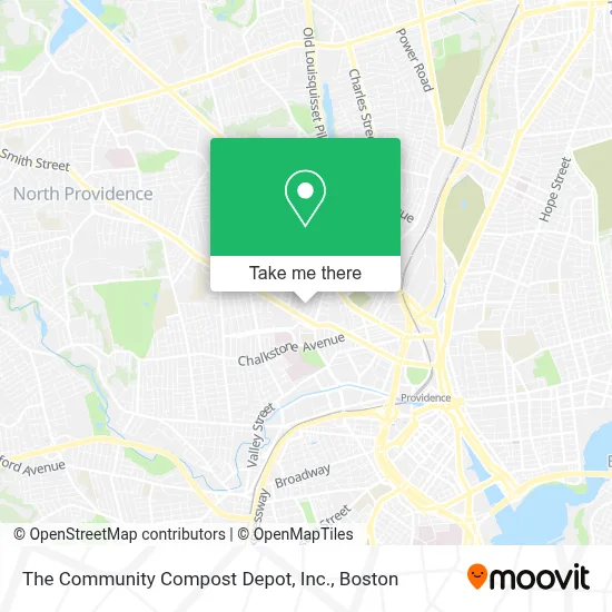
See The Community Compost Depot, Inc., Boston, on the map
Public Transit to The Community Compost Depot, Inc. in Boston
Wondering how to get to The Community Compost Depot, Inc. in Boston? Moovit helps you find the best way to get to The Community Compost Depot, Inc. with step-by-step directions from the nearest public transit station.
Moovit provides free maps and live directions to help you navigate through your city. View schedules, routes, timetables, and find out how long does it take to get to The Community Compost Depot, Inc. in real time.
Looking for the nearest stop or station to The Community Compost Depot, Inc.? Check out this list of stops closest to your destination: Smith After Frederick; Chalkstone Opposite Ayrault; Douglas & Eaton (Opposite Suffolk); Providence.
Bus: 1, 56, 57, 50.Train: PROVIDENCE/STOUGHTON, ACELA, NORTHEAST REGIONAL, PROVIDENCE LINE SHUTTLE, PROVIDENCE LINE SHUTTLE, PROVIDENCE LINE SHUTTLE, FOXBORO EVENT SERVICE.
Want to see if there’s another route that gets you there at an earlier time? Moovit helps you find alternative routes or times. Get directions from and directions to The Community Compost Depot, Inc. easily from the Moovit App or Website.
We make riding to The Community Compost Depot, Inc. easy, which is why over 1.7 million users, including users in Boston, trust Moovit as the best app for public transit. You don’t need to download an individual bus app or train app, Moovit is your all-in-one transit app that helps you find the best bus time or train time available.
For information on prices of bus and train, costs and ride fares to The Community Compost Depot, Inc., please check the Moovit app.
Use the app to navigate to popular places including to the airport, hospital, stadium, grocery store, mall, coffee shop, school, college, and university.
The Community Compost Depot, Inc. Address: 50 Radcliffe Ave street in Boston
- Earth,
- Gouyad,
- Elmhurst Rehabilitation & Healthcare Center,
- TDXXX,
- Robert Rutley,
- Charles Dowler House,
- Ulysses Loken,
- Harmony Hospice,
- Smithill Physical Therapy,
- Ocean State Movers & Loaders,
- Popeyes LOUISIANA KITCHEN,
- ALDI SÜD,
- Ponnandai Somasundar MD,
- Uber Greenlight Hub,
- University Medical Group 50 Maude St Providence, RI,
- Red Door Rentals,
- Providence College Galleries,
- Rebecca Brown MD,
- Partners in Prime,
- PP Roofing & Exteriors
Places Near The Community Compost Depot, Inc. (Boston)
- Prudential Center, Boston,
- Td Garden, Boston,
- Boston Medical Center, Boston,
- House Of Blues, Boston,
- North End, Boston,
- Mgm Music Hall, Boston,
- Wang Theater, Boston,
- Boston Common, Boston,
- Boston Convention & Exhibition Center, Boston,
- Quincy Market, Boston,
- Cheers, Boston,
- Castle Island, Boston,
- Wilbur Theatre, Boston,
- Isabella Stewart Gardner Museum, Boston,
- Leader Bank Pavilion (Leader Bank Pavillion), Boston,
- Museum Of Science, Boston,
- Faneuil Hall, Boston,
- Seaport District, Boston,
- Boston Children's Hospital, Boston,
- Massachusetts General Hospital, Boston
How to get to popular places in Boston with public transit
Get around Boston by public transit!
Traveling around Boston has never been so easy. See step by step directions as you travel to any attraction, street or major public transit station. View bus and train schedules, arrival times, service alerts and detailed routes on a map, so you know exactly how to get to anywhere in Boston.
When traveling to any destination around Boston use Moovit's Live Directions with Get Off Notifications to know exactly where and how far to walk, how long to wait for your line, and how many stops are left. Moovit will alert you when it's time to get off — no need to constantly re-check whether yours is the next stop.
Wondering how to use public transit in Boston or how to pay for public transit in Boston? Moovit public transit app can help you navigate your way with public transit easily, and at minimum cost. It includes public transit fees, ticket prices, and costs. Looking for a map of Boston public transit lines? Moovit public transit app shows all public transit maps in Boston with all Bus, Train, Subway and Ferry routes and stops on an interactive map.
Boston has 4 transit type(s), including: Bus, Train, Subway and Ferry, operated by several transit agencies, including MBTA, Southeastern Regional Transit Authority, MetroWest Regional Transit Authority, Rhode Island Public Transit Authority, WRTA, Lowell Regional Transit Authority, Merrimack Valley Transit, Montachusett Regional Transit Authority, Cape Cod Regional Transit Authority, Brockton Area Transit Authority, Martha's Vineyard Transit Authority, the WAVE - Nantucket Regional Transit Authority, GATRA, Cape Ann Transportation Authority and Massport