How to get to The Corner Cafe by bus?
Click on the bus route to see step by step directions with maps, line arrival times and updated time schedules.
How to get to The Corner Cafe by train?
Click on the train route to see step by step directions with maps, line arrival times and updated time schedules.
Bus stops near The Corner Cafe in Lowell
Train station near The Corner Cafe in Lowell
- North Billerica, 40 min walk,VIEW
Bus lines to The Corner Cafe in Lowell
What are the closest stations to The Corner Cafe?
The closest stations to The Corner Cafe are:
- Lawrence St And Woburn St is 27 yards away, 1 min walk.
- Rogers at Fire Station is 1368 yards away, 16 min walk.
- North Billerica is 3434 yards away, 40 min walk.
Which bus line stops near The Corner Cafe?
3 (North Billerica Train Station)
Which train line stops near The Corner Cafe?
LOWELL (#331 | Lowell)
What’s the nearest bus station to The Corner Cafe in Lowell?
The nearest bus station to The Corner Cafe in Lowell is Lawrence St And Woburn St. It’s a 1 min walk away.
What time is the first train to The Corner Cafe in Lowell?
The LOWELL is the first train that goes to The Corner Cafe in Lowell. It stops nearby at 5:08 AM.
What time is the last train to The Corner Cafe in Lowell?
The LOWELL is the last train that goes to The Corner Cafe in Lowell. It stops nearby at 12:20 AM.
What time is the first bus to The Corner Cafe in Lowell?
The 3 is the first bus that goes to The Corner Cafe in Lowell. It stops nearby at 6:06 AM.
What time is the last bus to The Corner Cafe in Lowell?
The 12 is the last bus that goes to The Corner Cafe in Lowell. It stops nearby at 7:51 PM.
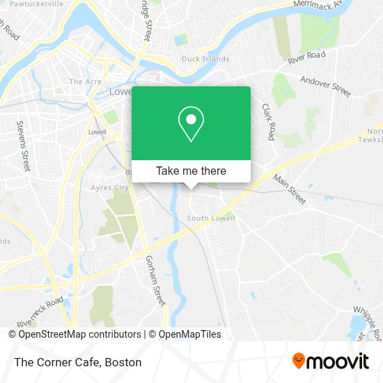
See The Corner Cafe, Lowell, on the map
Public Transit to The Corner Cafe in Lowell
Wondering how to get to The Corner Cafe in Lowell? Moovit helps you find the best way to get to The Corner Cafe with step-by-step directions from the nearest public transit station.
Moovit provides free maps and live directions to help you navigate through your city. View schedules, routes, timetables, and find out how long does it take to get to The Corner Cafe in real time.
Looking for the nearest stop or station to The Corner Cafe? Check out this list of stops closest to your destination: Lawrence St And Woburn St; Rogers at Fire Station; North Billerica.
Bus: 3, 2, 12.Train: LOWELL.
Want to see if there’s another route that gets you there at an earlier time? Moovit helps you find alternative routes or times. Get directions from and directions to The Corner Cafe easily from the Moovit App or Website.
We make riding to The Corner Cafe easy, which is why over 1.7 million users, including users in Lowell, trust Moovit as the best app for public transit. You don’t need to download an individual bus app or train app, Moovit is your all-in-one transit app that helps you find the best bus time or train time available.
For information on prices of bus and train, costs and ride fares to The Corner Cafe, please check the Moovit app.
Use the app to navigate to popular places including to the airport, hospital, stadium, grocery store, mall, coffee shop, school, college, and university.
The Corner Cafe Address: 1164 Lawrence St street in Lowell
- Western Union,
- Mazete Service,
- HG Contractor Corp,
- Stratham Field,
- Wamesit Entertainme,
- Econo-Mart Convenience Store,
- Family Style Restaurant,
- Rath's Beef Chips,
- Pyne Arts School,
- Joseph G. Pyne Arts Elementary School,
- Hampton Beach Hampton Nh,
- Frank Gonsalves Masonry,
- Steve's Kitchen & Catering,
- Mr Jack's Catering Services,
- Shedd Park Woods,
- Chart Holdings,
- Lucky Bee Gulf,
- Plaza Limousine Ltd,
- Media-One,
- All Mass Camps
Places Near The Corner Cafe (Lowell)
- Seaport District, Boston,
- Faneuil Hall, Boston,
- Castle Island, Boston,
- Boston Medical Center, Boston,
- Boston Children's Hospital, Boston,
- Quincy Market, Boston,
- Boston Convention & Exhibition Center, Boston,
- Wilbur Theatre, Boston,
- Prudential Center, Boston,
- Boston Common, Boston,
- Leader Bank Pavilion (Leader Bank Pavillion), Boston,
- Wang Theater, Boston,
- Cheers, Boston,
- Massachusetts General Hospital, Boston,
- Mgm Music Hall, Boston,
- Td Garden, Boston,
- Isabella Stewart Gardner Museum, Boston,
- Museum Of Science, Boston,
- House Of Blues, Boston,
- North End, Boston
How to get to popular places in Boston with public transit
Get around Lowell by public transit!
Traveling around Lowell has never been so easy. See step by step directions as you travel to any attraction, street or major public transit station. View bus and train schedules, arrival times, service alerts and detailed routes on a map, so you know exactly how to get to anywhere in Lowell.
When traveling to any destination around Lowell use Moovit's Live Directions with Get Off Notifications to know exactly where and how far to walk, how long to wait for your line, and how many stops are left. Moovit will alert you when it's time to get off — no need to constantly re-check whether yours is the next stop.
Wondering how to use public transit in Lowell or how to pay for public transit in Lowell? Moovit public transit app can help you navigate your way with public transit easily, and at minimum cost. It includes public transit fees, ticket prices, and costs. Looking for a map of Lowell public transit lines? Moovit public transit app shows all public transit maps in Lowell with all Bus, Train, Subway and Ferry routes and stops on an interactive map.
Boston has 4 transit type(s), including: Bus, Train, Subway and Ferry, operated by several transit agencies, including MBTA, Southeastern Regional Transit Authority, MetroWest Regional Transit Authority, Rhode Island Public Transit Authority, WRTA, Lowell Regional Transit Authority, Merrimack Valley Transit, Montachusett Regional Transit Authority, Cape Cod Regional Transit Authority, Brockton Area Transit Authority, Martha's Vineyard Transit Authority, the WAVE - Nantucket Regional Transit Authority, GATRA, Cape Ann Transportation Authority and Massport