Directions to The Custom Shop (Watertown Town) with public transportation
The following transit lines have routes that pass near The Custom Shop
 Bus: 71, 70.
- Train: FITCHBURG, FRAMINGHAM/WORCESTER.
- Subway: GREEN LINE B.
How to get to The Custom Shop by bus?
Click on the bus route to see step by step directions with maps, line arrival times and updated time schedules.
From Hynes Convention Center MBTA Station, Boston
48 minFrom Hyatt Centric Faneuil, Boston
47 minFrom 98 Binney St, Boston
49 minFrom City Hall Plaza, Boston
51 minFrom Club Quarters, Boston
45 minFrom Union Oyster House, Boston
51 minFrom KNL, Cambridge
43 minFrom Cheers Beacon Hill, Boston
41 minFrom John Hancock Tower, Boston
38 minFrom Uss Constitution, Boston
82 min
How to get to The Custom Shop by train?
Click on the train route to see step by step directions with maps, line arrival times and updated time schedules.
From Hynes Convention Center MBTA Station, Boston
72 minFrom Hyatt Centric Faneuil, Boston
73 minFrom 98 Binney St, Boston
72 minFrom City Hall Plaza, Boston
70 minFrom Club Quarters, Boston
74 minFrom Union Oyster House, Boston
69 minFrom Cheers Beacon Hill, Boston
80 minFrom John Hancock Tower, Boston
66 minFrom Uss Constitution, Boston
79 min
Bus stops near The Custom Shop in Watertown Town
Train stations near The Custom Shop in Watertown Town
Subway station near The Custom Shop in Watertown Town
- Boston College, 32 min walk,VIEW
What are the closest stations to The Custom Shop?
The closest stations to The Custom Shop are:
- Mt Auburn St @ Main St is 217 yards away, 3 min walk.
- Arsenal St @ Irving St is 344 yards away, 5 min walk.
- Newtonville is 1727 yards away, 21 min walk.
- Boston College is 2649 yards away, 32 min walk.
- Waverley is 4514 yards away, 53 min walk.
Which bus line stops near The Custom Shop?
71 (Watertown Square)
Which train lines stop near The Custom Shop?
These train lines stop near The Custom Shop: FITCHBURG, FRAMINGHAM/WORCESTER.
What’s the nearest train station to The Custom Shop in Watertown Town?
The nearest train station to The Custom Shop in Watertown Town is Newtonville. It’s a 21 min walk away.
What’s the nearest bus station to The Custom Shop in Watertown Town?
The nearest bus station to The Custom Shop in Watertown Town is Mt Auburn St @ Main St. It’s a 3 min walk away.
What time is the first subway to The Custom Shop in Watertown Town?
The GREEN LINE B is the first subway that goes to The Custom Shop in Watertown Town. It stops nearby at 5:01 AM.
What time is the last subway to The Custom Shop in Watertown Town?
The GREEN LINE B is the last subway that goes to The Custom Shop in Watertown Town. It stops nearby at 2:39 AM.
What time is the first train to The Custom Shop in Watertown Town?
The FRAMINGHAM/WORCESTER is the first train that goes to The Custom Shop in Watertown Town. It stops nearby at 5:25 AM.
What time is the last train to The Custom Shop in Watertown Town?
The FRAMINGHAM/WORCESTER is the last train that goes to The Custom Shop in Watertown Town. It stops nearby at 12:17 AM.
What time is the first bus to The Custom Shop in Watertown Town?
The 70 is the first bus that goes to The Custom Shop in Watertown Town. It stops nearby at 4:38 AM.
What time is the last bus to The Custom Shop in Watertown Town?
The 71 is the last bus that goes to The Custom Shop in Watertown Town. It stops nearby at 1:27 AM.
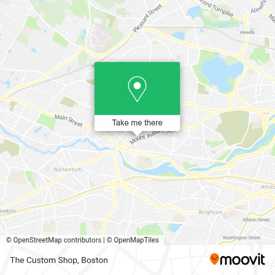
See The Custom Shop, Watertown Town, on the map
Public Transit to The Custom Shop in Watertown Town
Wondering how to get to The Custom Shop in Watertown Town? Moovit helps you find the best way to get to The Custom Shop with step-by-step directions from the nearest public transit station.
Moovit provides free maps and live directions to help you navigate through your city. View schedules, routes, timetables, and find out how long does it take to get to The Custom Shop in real time.
Looking for the nearest stop or station to The Custom Shop? Check out this list of stops closest to your destination: Mt Auburn St @ Main St; Arsenal St @ Irving St; Newtonville; Boston College; Waverley.
Bus: 71, 70.Train: FITCHBURG, FRAMINGHAM/WORCESTER.Subway: GREEN LINE B.
Want to see if there’s another route that gets you there at an earlier time? Moovit helps you find alternative routes or times. Get directions from and directions to The Custom Shop easily from the Moovit App or Website.
We make riding to The Custom Shop easy, which is why over 1.7 million users, including users in Watertown Town, trust Moovit as the best app for public transit. You don’t need to download an individual bus app or train app, Moovit is your all-in-one transit app that helps you find the best bus time or train time available.
For information on prices of bus, subway and train, costs and ride fares to The Custom Shop, please check the Moovit app.
Use the app to navigate to popular places including to the airport, hospital, stadium, grocery store, mall, coffee shop, school, college, and university.
The Custom Shop Address: 137 Mt Auburn St street in Watertown Town
- Chit Cha,
- Boston Commercial Real Estate,
- Thayer Morgan,
- Renaissance Masonry,
- Soosutra Mobile Bodywork for Women & Couples,
- Kay's Hair Lab,
- Easy Choice Masonry and Chimney,
- Just Breathe Dog Training,
- Valerie Smith, Lic AC, M AC,
- Secret Sauce,
- Allset Moving Company,
- A Quiet Canine,
- C&E General Services,
- Wild Acre and Mental Health Solutions,
- Feeley Hvac,
- Sisters of Saint Joseph,
- Dino Tangredi,
- Phillips Congregational Church,
- Eilers Furgal Perichole L,
- Watertown Council on Aging / Senior Center
Places Near The Custom Shop (Watertown Town)
- Faneuil Hall, Boston,
- Mgm Music Hall, Boston,
- Leader Bank Pavilion (Leader Bank Pavillion), Boston,
- Castle Island, Boston,
- Museum Of Science, Boston,
- Prudential Center, Boston,
- Cheers, Boston,
- Td Garden, Boston,
- Isabella Stewart Gardner Museum, Boston,
- Boston Children's Hospital, Boston,
- Boston Medical Center, Boston,
- North End, Boston,
- House Of Blues, Boston,
- Wilbur Theatre, Boston,
- Seaport District, Boston,
- Wang Theater, Boston,
- Boston Convention & Exhibition Center, Boston,
- Massachusetts General Hospital, Boston,
- Quincy Market, Boston,
- Boston Common, Boston
How to get to popular places in Boston with public transit
Get around Watertown Town by public transit!
Traveling around Watertown Town has never been so easy. See step by step directions as you travel to any attraction, street or major public transit station. View bus and train schedules, arrival times, service alerts and detailed routes on a map, so you know exactly how to get to anywhere in Watertown Town.
When traveling to any destination around Watertown Town use Moovit's Live Directions with Get Off Notifications to know exactly where and how far to walk, how long to wait for your line, and how many stops are left. Moovit will alert you when it's time to get off — no need to constantly re-check whether yours is the next stop.
Wondering how to use public transit in Watertown Town or how to pay for public transit in Watertown Town? Moovit public transit app can help you navigate your way with public transit easily, and at minimum cost. It includes public transit fees, ticket prices, and costs. Looking for a map of Watertown Town public transit lines? Moovit public transit app shows all public transit maps in Watertown Town with all Bus, Train, Subway and Ferry routes and stops on an interactive map.
Boston has 4 transit type(s), including: Bus, Train, Subway and Ferry, operated by several transit agencies, including MBTA, Southeastern Regional Transit Authority, MetroWest Regional Transit Authority, Rhode Island Public Transit Authority, WRTA, Lowell Regional Transit Authority, Merrimack Valley Transit, Montachusett Regional Transit Authority, Cape Cod Regional Transit Authority, Brockton Area Transit Authority, Martha's Vineyard Transit Authority, the WAVE - Nantucket Regional Transit Authority, GATRA, Cape Ann Transportation Authority and Massport