Directions to The Cyc Of Millbury (Boston) with public transportation
The following transit lines have routes that pass near The Cyc Of Millbury
 Bus: 4.
How to get to The Cyc Of Millbury by bus?
Click on the bus route to see step by step directions with maps, line arrival times and updated time schedules.
From Palladium, Worcester
42 minFrom Registry Of Motor Vehicles (Rmv) Branch Office, Worcester
41 minFrom Umass Memorial Medical Center, Worcester
48 minFrom Foxwoods, Worcester
57 minFrom Quinsigamond Community College, Worcester
75 minFrom South High Community School, Worcester
78 minFrom Dcu Center, Worcester
42 min
Bus stop near The Cyc Of Millbury in Boston
- N Main & Canal St Ib Millbury, 5 min walk,VIEW
Bus lines to The Cyc Of Millbury in Boston
- 4, Shoppes at Blackstone Valley,VIEW
What are the closest stations to The Cyc Of Millbury?
The closest stations to The Cyc Of Millbury are:
- N Main & Canal St Ib Millbury is 400 yards away, 5 min walk.
Which bus line stops near The Cyc Of Millbury?
4 (Central Hub→Shoppes at Blackstone Valley)
What’s the nearest bus station to The Cyc Of Millbury in Boston?
The nearest bus station to The Cyc Of Millbury in Boston is N Main & Canal St Ib Millbury. It’s a 5 min walk away.
What time is the first bus to The Cyc Of Millbury in Boston?
The 4 is the first bus that goes to The Cyc Of Millbury in Boston. It stops nearby at 6:56 AM.
What time is the last bus to The Cyc Of Millbury in Boston?
The 4 is the last bus that goes to The Cyc Of Millbury in Boston. It stops nearby at 9:54 PM.
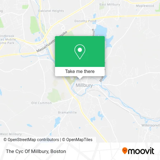
See The Cyc Of Millbury, Boston, on the map
Public Transit to The Cyc Of Millbury in Boston
Wondering how to get to The Cyc Of Millbury in Boston? Moovit helps you find the best way to get to The Cyc Of Millbury with step-by-step directions from the nearest public transit station.
Moovit provides free maps and live directions to help you navigate through your city. View schedules, routes, timetables, and find out how long does it take to get to The Cyc Of Millbury in real time.
Looking for the nearest stop or station to The Cyc Of Millbury? Check out this list of stops closest to your destination: N Main & Canal St Ib Millbury.
Bus: 4.
Want to see if there’s another route that gets you there at an earlier time? Moovit helps you find alternative routes or times. Get directions from and directions to The Cyc Of Millbury easily from the Moovit App or Website.
We make riding to The Cyc Of Millbury easy, which is why over 1.7 million users, including users in Boston, trust Moovit as the best app for public transit. You don’t need to download an individual bus app or train app, Moovit is your all-in-one transit app that helps you find the best bus time or train time available.
For information on prices of bus, costs and ride fares to The Cyc Of Millbury, please check the Moovit app.
Use the app to navigate to popular places including to the airport, hospital, stadium, grocery store, mall, coffee shop, school, college, and university.
The Cyc Of Millbury Address: 59 N Main St street in Boston
- Millbury, MA,
- Sunrise Detox - Millbury,
- Lisa Peterson DMD,
- Sasset's Creations,
- Mlby Baptist Church Parsonage,
- Simply Stunning Nail & Skin Care,
- Millbury Textile Recycling,
- Atlas Event Group,
- Millbury, Massachusetts,
- Cobblestone Village Apartments,
- 110 Grill,
- Claire's,
- Tgi Friday's Millbury,
- Oat & Olive,
- Blue Rhino Propane Exchange,
- Carter's,
- Xtramart Millbury,
- Cvs Pharmacy,
- Target,
- Capital One Atm
Places Near The Cyc Of Millbury (Boston)
- House Of Blues, Boston,
- Prudential Center, Boston,
- Boston Convention & Exhibition Center, Boston,
- Wang Theater, Boston,
- Seaport District, Boston,
- Td Garden, Boston,
- Leader Bank Pavilion (Leader Bank Pavillion), Boston,
- Museum Of Science, Boston,
- North End, Boston,
- Castle Island, Boston,
- Boston Medical Center, Boston,
- Boston Children's Hospital, Boston,
- Boston Common, Boston,
- Quincy Market, Boston,
- Massachusetts General Hospital, Boston,
- Faneuil Hall, Boston,
- Wilbur Theatre, Boston,
- Cheers, Boston,
- Isabella Stewart Gardner Museum, Boston,
- Mgm Music Hall, Boston
How to get to popular places in Boston with public transit
Get around Boston by public transit!
Traveling around Boston has never been so easy. See step by step directions as you travel to any attraction, street or major public transit station. View bus and train schedules, arrival times, service alerts and detailed routes on a map, so you know exactly how to get to anywhere in Boston.
When traveling to any destination around Boston use Moovit's Live Directions with Get Off Notifications to know exactly where and how far to walk, how long to wait for your line, and how many stops are left. Moovit will alert you when it's time to get off — no need to constantly re-check whether yours is the next stop.
Wondering how to use public transit in Boston or how to pay for public transit in Boston? Moovit public transit app can help you navigate your way with public transit easily, and at minimum cost. It includes public transit fees, ticket prices, and costs. Looking for a map of Boston public transit lines? Moovit public transit app shows all public transit maps in Boston with all Bus, Train, Subway and Ferry routes and stops on an interactive map.
Boston has 4 transit type(s), including: Bus, Train, Subway and Ferry, operated by several transit agencies, including MBTA, Southeastern Regional Transit Authority, MetroWest Regional Transit Authority, Rhode Island Public Transit Authority, WRTA, Lowell Regional Transit Authority, Merrimack Valley Transit, Montachusett Regional Transit Authority, Cape Cod Regional Transit Authority, Brockton Area Transit Authority, Martha's Vineyard Transit Authority, the WAVE - Nantucket Regional Transit Authority, GATRA, Cape Ann Transportation Authority and Massport