Directions to The Deck (Salisbury) with public transportation
The following transit lines have routes that pass near The Deck
 Bus: 11, 20, 19.
- Train: NEWBURYPORT/ROCKPORT.
How to get to The Deck by bus?
Click on the bus route to see step by step directions with maps, line arrival times and updated time schedules.
How to get to The Deck by train?
Click on the train route to see step by step directions with maps, line arrival times and updated time schedules.
Bus stop near The Deck in Salisbury
- Federal Street & Liberty Street, 3 min walk,VIEW
Train station near The Deck in Salisbury
- Newburyport, 3 min walk,VIEW
What are the closest stations to The Deck?
The closest stations to The Deck are:
- Federal Street & Liberty Street is 180 yards away, 3 min walk.
- Newburyport is 225 yards away, 3 min walk.
Which bus lines stop near The Deck?
These bus lines stop near The Deck: 11, 20.
Which train line stops near The Deck?
NEWBURYPORT/ROCKPORT (#131 | Newburyport)
What’s the nearest train station to The Deck in Salisbury?
The nearest train station to The Deck in Salisbury is Newburyport. It’s a 3 min walk away.
What’s the nearest bus station to The Deck in Salisbury?
The nearest bus station to The Deck in Salisbury is Federal Street & Liberty Street. It’s a 3 min walk away.
What time is the first train to The Deck in Salisbury?
The NEWBURYPORT/ROCKPORT is the first train that goes to The Deck in Salisbury. It stops nearby at 4:48 AM.
What time is the last train to The Deck in Salisbury?
The NEWBURYPORT/ROCKPORT is the last train that goes to The Deck in Salisbury. It stops nearby at 1:03 AM.
What time is the first bus to The Deck in Salisbury?
The 20 is the first bus that goes to The Deck in Salisbury. It stops nearby at 5:20 AM.
What time is the last bus to The Deck in Salisbury?
The 20 is the last bus that goes to The Deck in Salisbury. It stops nearby at 7:25 PM.
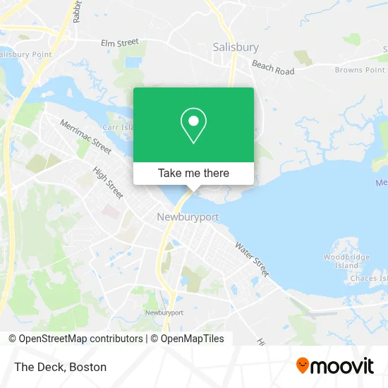
See The Deck, Salisbury, on the map
Public Transit to The Deck in Salisbury
Wondering how to get to The Deck in Salisbury? Moovit helps you find the best way to get to The Deck with step-by-step directions from the nearest public transit station.
Moovit provides free maps and live directions to help you navigate through your city. View schedules, routes, timetables, and find out how long does it take to get to The Deck in real time.
Looking for the nearest stop or station to The Deck? Check out this list of stops closest to your destination: Federal Street & Liberty Street; Newburyport.
Bus: 11, 20, 19.Train: NEWBURYPORT/ROCKPORT.
Want to see if there’s another route that gets you there at an earlier time? Moovit helps you find alternative routes or times. Get directions from and directions to The Deck easily from the Moovit App or Website.
We make riding to The Deck easy, which is why over 1.7 million users, including users in Salisbury, trust Moovit as the best app for public transit. You don’t need to download an individual bus app or train app, Moovit is your all-in-one transit app that helps you find the best bus time or train time available.
For information on prices of bus and train, costs and ride fares to The Deck, please check the Moovit app.
Use the app to navigate to popular places including to the airport, hospital, stadium, grocery store, mall, coffee shop, school, college, and university.
The Deck Address: 179 Bridge Rd street in Salisbury
- Clipper Fleet Deep Sea Fishing,
- Slip,
- Strippers Grill & Inn,
- Salisbury's Old Eastern Marsh Trail,
- Salisbury Petroleum,
- The Yankee Homecoming Fireworks,
- Salisbury Beach State Reservation Campground,
- River Electric,
- Andrew J. Gillis. Memorial Bridge,
- Allmerica Financial,
- Salisbury Roofing & Gutter Installation,
- The Boardwalk,
- Innate Chiropractic Salisbury,
- Lisa M Richmond - Fairway Independent Mortgage Corporation Branch Operations Manager,
- Newburyport Development,
- Plum Island Coffee,
- The East Imports,
- Pop Crowley Condos,
- Off-Leash Dog Park,
- Marathon Sports NE
Places Near The Deck (Salisbury)
- Faneuil Hall, Boston,
- Boston Medical Center, Boston,
- Museum Of Science, Boston,
- Td Garden, Boston,
- Castle Island, Boston,
- Mgm Music Hall, Boston,
- Prudential Center, Boston,
- Leader Bank Pavilion (Leader Bank Pavillion), Boston,
- Boston Children's Hospital, Boston,
- North End, Boston,
- Seaport District, Boston,
- Quincy Market, Boston,
- Cheers, Boston,
- Wang Theater, Boston,
- Isabella Stewart Gardner Museum, Boston,
- Wilbur Theatre, Boston,
- Massachusetts General Hospital, Boston,
- House Of Blues, Boston,
- Boston Common, Boston,
- Boston Convention & Exhibition Center, Boston
How to get to popular places in Boston with public transit
Get around Salisbury by public transit!
Traveling around Salisbury has never been so easy. See step by step directions as you travel to any attraction, street or major public transit station. View bus and train schedules, arrival times, service alerts and detailed routes on a map, so you know exactly how to get to anywhere in Salisbury.
When traveling to any destination around Salisbury use Moovit's Live Directions with Get Off Notifications to know exactly where and how far to walk, how long to wait for your line, and how many stops are left. Moovit will alert you when it's time to get off — no need to constantly re-check whether yours is the next stop.
Wondering how to use public transit in Salisbury or how to pay for public transit in Salisbury? Moovit public transit app can help you navigate your way with public transit easily, and at minimum cost. It includes public transit fees, ticket prices, and costs. Looking for a map of Salisbury public transit lines? Moovit public transit app shows all public transit maps in Salisbury with all Bus, Train, Subway and Ferry routes and stops on an interactive map.
Boston has 4 transit type(s), including: Bus, Train, Subway and Ferry, operated by several transit agencies, including MBTA, Southeastern Regional Transit Authority, MetroWest Regional Transit Authority, Rhode Island Public Transit Authority, WRTA, Lowell Regional Transit Authority, Merrimack Valley Transit, Montachusett Regional Transit Authority, Cape Cod Regional Transit Authority, Brockton Area Transit Authority, Martha's Vineyard Transit Authority, the WAVE - Nantucket Regional Transit Authority, GATRA, Cape Ann Transportation Authority and Massport