Directions to The Diamond Group (Cambridge) with public transportation
The following transit lines have routes that pass near The Diamond Group
 Bus: 109, 66, 96, 71, 73.
- Train: FITCHBURG, FRAMINGHAM/WORCESTER.
- Subway: RED LINE, GREEN LINE D, GREEN LINE E, GREEN LINE B.
How to get to The Diamond Group by bus?
Click on the bus route to see step by step directions with maps, line arrival times and updated time schedules.
From New England Aquarium, Boston
53 minFrom Melrose, MA, Melrose
90 minFrom Peter Pan Bus Lines at South Station, Boston
42 minFrom Castle Island, Boston
86 minFrom Hampton Inn Boston Logan Airport, Revere
91 minFrom Long Wharf Station, Boston
55 minFrom Codman Square, Boston
89 minFrom North End, Boston
61 minFrom Fort Independence, Boston
89 minFrom Angell Animal Medical Center (Mspca Angell), Boston
56 min
How to get to The Diamond Group by train?
Click on the train route to see step by step directions with maps, line arrival times and updated time schedules.
How to get to The Diamond Group by subway?
Click on the subway route to see step by step directions with maps, line arrival times and updated time schedules.
From New England Aquarium, Boston
36 minFrom Peter Pan Bus Lines at South Station, Boston
21 minFrom Hampton Inn Boston Logan Airport, Revere
64 minFrom Long Wharf Station, Boston
36 minFrom Codman Square, Boston
49 minFrom North End, Boston
31 minFrom Angell Animal Medical Center (Mspca Angell), Boston
61 min
Bus stops near The Diamond Group in Cambridge
- Mt Auburn St @ Story St, 1 min walk,VIEW
- Mt Auburn St @ University Rd, 2 min walk,VIEW
- Waterhouse St @ Massachusetts Ave, 3 min walk,VIEW
- Eliot St @ Bennett St, 4 min walk,VIEW
- Massachusetts Ave @ Johnston Gate, 6 min walk,VIEW
- Massachusetts Ave Opp Holyoke St, 8 min walk,VIEW
- Harvard - Brattle St @ Palmer St, 9 min walk,VIEW
Subway stations near The Diamond Group in Cambridge
Train station near The Diamond Group in Cambridge
- Porter, 17 min walk,VIEW
Bus lines to The Diamond Group in Cambridge
- 71, Watertown Square,VIEW
- 73, Waverley,VIEW
- 66, Harvard Via Allston,VIEW
- 86, Reservoir,VIEW
- 74, Harvard,VIEW
- 75, Belmont Center,VIEW
- 78, Harvard,VIEW
- 77, Harvard,VIEW
- 96, Medford Square,VIEW
- 109, Linden Square Via Sullivan,VIEW
- 68, Kendall/MIT,VIEW
- 69, Harvard,VIEW
- 1, Nubian - Harvard,VIEW
- RED LINE SHUTTLE, Harvard - Kendall/MIT (Loop),VIEW
- RED LINE SHUTTLE, Harvard - JFK/UMass via Congress Street,VIEW
- RED LINE SHUTTLE, Alewife - Harvard via Brattle Street,VIEW
- RED LINE SHUTTLE, Harvard - South Station,VIEW
- RED LINE SHUTTLE, Alewife - Harvard via Holyoke Street,VIEW
- RED LINE SHUTTLE, Harvard - Park Street,VIEW
- RED LINE SHUTTLE, Harvard - Broadway,VIEW
What are the closest stations to The Diamond Group?
The closest stations to The Diamond Group are:
- Mt Auburn St @ Story St is 32 yards away, 1 min walk.
- Mt Auburn St @ University Rd is 141 yards away, 2 min walk.
- Waterhouse St @ Massachusetts Ave is 163 yards away, 3 min walk.
- Eliot St @ Bennett St is 249 yards away, 4 min walk.
- Massachusetts Ave @ Johnston Gate is 443 yards away, 6 min walk.
- Harvard Square is 492 yards away, 6 min walk.
- Massachusetts Ave Opp Holyoke St is 610 yards away, 8 min walk.
- Harvard - Brattle St @ Palmer St is 696 yards away, 9 min walk.
- Porter is 1353 yards away, 17 min walk.
- Union Square is 2674 yards away, 32 min walk.
- Packards Corner is 3855 yards away, 46 min walk.
Which bus lines stop near The Diamond Group?
These bus lines stop near The Diamond Group: 109, 66, 96.
Which train lines stop near The Diamond Group?
These train lines stop near The Diamond Group: FITCHBURG, FRAMINGHAM/WORCESTER.
Which subway line stops near The Diamond Group?
RED LINE (Alewife)
What’s the nearest subway station to The Diamond Group in Cambridge?
The nearest subway station to The Diamond Group in Cambridge is Harvard Square. It’s a 6 min walk away.
What’s the nearest train station to The Diamond Group in Cambridge?
The nearest train station to The Diamond Group in Cambridge is Porter. It’s a 17 min walk away.
What’s the nearest bus station to The Diamond Group in Cambridge?
The nearest bus station to The Diamond Group in Cambridge is Mt Auburn St @ Story St. It’s a 1 min walk away.
What time is the first subway to The Diamond Group in Cambridge?
The GREEN LINE E is the first subway that goes to The Diamond Group in Cambridge. It stops nearby at 4:50 AM.
What time is the last subway to The Diamond Group in Cambridge?
The GREEN LINE B is the last subway that goes to The Diamond Group in Cambridge. It stops nearby at 2:22 AM.
What time is the first train to The Diamond Group in Cambridge?
The FITCHBURG is the first train that goes to The Diamond Group in Cambridge. It stops nearby at 5:47 AM.
What time is the last train to The Diamond Group in Cambridge?
The FITCHBURG is the last train that goes to The Diamond Group in Cambridge. It stops nearby at 12:17 AM.
What time is the first bus to The Diamond Group in Cambridge?
The 73 is the first bus that goes to The Diamond Group in Cambridge. It stops nearby at 4:45 AM.
What time is the last bus to The Diamond Group in Cambridge?
The 66 is the last bus that goes to The Diamond Group in Cambridge. It stops nearby at 2:36 AM.
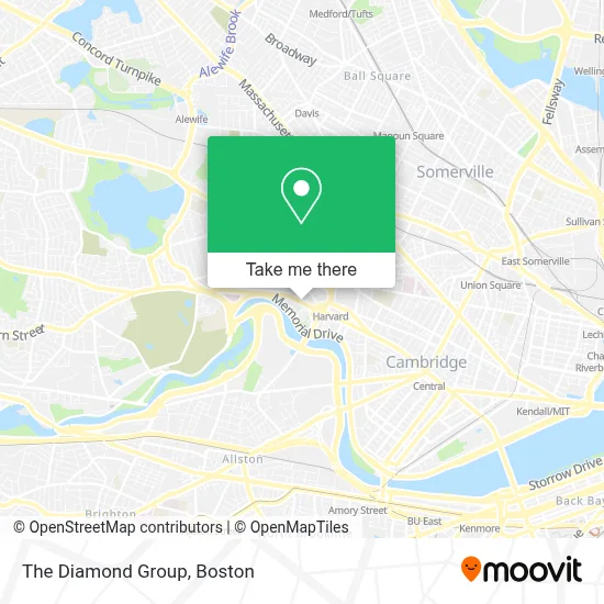
See The Diamond Group, Cambridge, on the map
Public Transit to The Diamond Group in Cambridge
Wondering how to get to The Diamond Group in Cambridge? Moovit helps you find the best way to get to The Diamond Group with step-by-step directions from the nearest public transit station.
Moovit provides free maps and live directions to help you navigate through your city. View schedules, routes, timetables, and find out how long does it take to get to The Diamond Group in real time.
Looking for the nearest stop or station to The Diamond Group? Check out this list of stops closest to your destination: Mt Auburn St @ Story St; Mt Auburn St @ University Rd; Waterhouse St @ Massachusetts Ave; Eliot St @ Bennett St; Massachusetts Ave @ Johnston Gate; Harvard Square; Massachusetts Ave Opp Holyoke St; Harvard - Brattle St @ Palmer St; Porter; Union Square; Packards Corner.
Bus: 109, 66, 96, 71, 73, 86.Train: FITCHBURG, FRAMINGHAM/WORCESTER.Subway: RED LINE, GREEN LINE D, GREEN LINE E, GREEN LINE B.
Want to see if there’s another route that gets you there at an earlier time? Moovit helps you find alternative routes or times. Get directions from and directions to The Diamond Group easily from the Moovit App or Website.
We make riding to The Diamond Group easy, which is why over 1.7 million users, including users in Cambridge, trust Moovit as the best app for public transit. You don’t need to download an individual bus app or train app, Moovit is your all-in-one transit app that helps you find the best bus time or train time available.
For information on prices of subway, bus and train, costs and ride fares to The Diamond Group, please check the Moovit app.
Use the app to navigate to popular places including to the airport, hospital, stadium, grocery store, mall, coffee shop, school, college, and university.
The Diamond Group Address: 17 Story St street in Cambridge
- Nadja B. Gould, Licsw,
- Loeb Drama Center,
- American Repertory Theater,
- The Charles Hotel in Harvard Square Cambridge,
- Charles Hotel,
- The Charles Hotel,
- Regattabar at The Charles Hotel,
- Eye Q Optical - Harvard Square,
- Gutman Conference Center,
- Society Of St. John the Evangelist,
- Visionworks,
- Harvard Square Hotel,
- King Bhumibol Adulyadej Square,
- Patagonia,
- harvard square lower busway,
- Charlie's Kitchen,
- B.Good,
- CarGurus,
- Gyu-Kaku Japanese BBQ,
- Shake Shack
Places Near The Diamond Group (Cambridge)
- Wilbur Theatre, Boston,
- Boston Convention & Exhibition Center, Boston,
- Castle Island, Boston,
- Cheers, Boston,
- Boston Common, Boston,
- Isabella Stewart Gardner Museum, Boston,
- Museum Of Science, Boston,
- Td Garden, Boston,
- House Of Blues, Boston,
- Boston Medical Center, Boston,
- North End, Boston,
- Quincy Market, Boston,
- Faneuil Hall, Boston,
- Prudential Center, Boston,
- Mgm Music Hall, Boston,
- Seaport District, Boston,
- Boston Children's Hospital, Boston,
- Wang Theater, Boston,
- Massachusetts General Hospital, Boston,
- Leader Bank Pavilion (Leader Bank Pavillion), Boston
How to get to popular places in Boston with public transit
Get around Cambridge by public transit!
Traveling around Cambridge has never been so easy. See step by step directions as you travel to any attraction, street or major public transit station. View bus and train schedules, arrival times, service alerts and detailed routes on a map, so you know exactly how to get to anywhere in Cambridge.
When traveling to any destination around Cambridge use Moovit's Live Directions with Get Off Notifications to know exactly where and how far to walk, how long to wait for your line, and how many stops are left. Moovit will alert you when it's time to get off — no need to constantly re-check whether yours is the next stop.
Wondering how to use public transit in Cambridge or how to pay for public transit in Cambridge? Moovit public transit app can help you navigate your way with public transit easily, and at minimum cost. It includes public transit fees, ticket prices, and costs. Looking for a map of Cambridge public transit lines? Moovit public transit app shows all public transit maps in Cambridge with all Bus, Train, Subway and Ferry routes and stops on an interactive map.
Boston has 4 transit type(s), including: Bus, Train, Subway and Ferry, operated by several transit agencies, including MBTA, Southeastern Regional Transit Authority, MetroWest Regional Transit Authority, Rhode Island Public Transit Authority, WRTA, Lowell Regional Transit Authority, Merrimack Valley Transit, Montachusett Regional Transit Authority, Cape Cod Regional Transit Authority, Brockton Area Transit Authority, Martha's Vineyard Transit Authority, the WAVE - Nantucket Regional Transit Authority, GATRA, Cape Ann Transportation Authority and Massport