Directions to The Dock (Medford) with public transportation
The following transit lines have routes that pass near The Dock
 Bus: 110, 85, 100, 108, 134.
- Subway: ORANGE LINE, GREEN LINE B, GREEN LINE C, GREEN LINE E.
How to get to The Dock by bus?
Click on the bus route to see step by step directions with maps, line arrival times and updated time schedules.
From Alumni Stadium, Boston
110 minFrom Warren St, Boston
73 minFrom FOUR POINTS BY SHERATON Boston Newton, Newton
85 minFrom TJ Maxx, Boston
58 minFrom Boston College, Boston
111 minFrom John F. Kennedy Presidential Library And Museum, Boston
114 minFrom Courtyard Tea Room (The Courtyard Restaurant), Boston
83 minFrom JFK Library, Boston
113 minFrom Outlets at Assembly Row, Boston
56 minFrom Boston University Track and Tennis Center, Boston
64 min
How to get to The Dock by subway?
Click on the subway route to see step by step directions with maps, line arrival times and updated time schedules.
From Alumni Stadium, Boston
71 minFrom Warren St, Boston
60 minFrom TJ Maxx, Boston
34 minFrom Boston College, Boston
77 minFrom John F. Kennedy Presidential Library And Museum, Boston
54 minFrom Courtyard Tea Room (The Courtyard Restaurant), Boston
28 minFrom JFK Library, Boston
54 minFrom Outlets at Assembly Row, Boston
22 minFrom Boston University Track and Tennis Center, Boston
58 min
Bus stops near The Dock in Medford
Bus lines to The Dock in Medford
- 100, Elm St,VIEW
- 108, Wellington,VIEW
- 134, North Woburn Via Veterans Senior Center,VIEW
- 85, Ruggles,VIEW
- 90, Assembly,VIEW
- ORANGE LINE SHUTTLE, Wellington (Local Shuttle),VIEW
- ORANGE LINE SHUTTLE, North Station (Local Shuttle),VIEW
- 95, Arlington Center,VIEW
- 97, Wellington - Malden,VIEW
- 99, Wellington - Woodland Rd,VIEW
- 106, Wellington - Lebanon Loop,VIEW
- 110, Wellington - Wonderland,VIEW
- 112, Wood Island via Market Basket & Admiral's Hill - Wellington via Admiral's Hill & Market Basket,VIEW
- ORANGE LINE SHUTTLE, Wellington (Express Shuttle),VIEW
What are the closest stations to The Dock?
The closest stations to The Dock are:
- Fellsway @ Middlesex Ave - Wellington Circle is 334 yards away, 4 min walk.
- Grand Union Blvd Opp Artisan Way is 338 yards away, 5 min walk.
- Grand Union Blvd @ Foley St is 545 yards away, 7 min walk.
- Mystic Ave @ Temple Rd is 739 yards away, 9 min walk.
- Gilman Square is 1153 yards away, 14 min walk.
- Assembly is 1246 yards away, 15 min walk.
- Corporation Way is 1492 yards away, 18 min walk.
- Wellington is 1893 yards away, 23 min walk.
Which bus lines stop near The Dock?
These bus lines stop near The Dock: 110, 85.
Which subway line stops near The Dock?
ORANGE LINE (Oak Grove)
What’s the nearest subway station to The Dock in Medford?
The nearest subway station to The Dock in Medford is Gilman Square. It’s a 14 min walk away.
What’s the nearest bus station to The Dock in Medford?
The nearest bus station to The Dock in Medford is Fellsway @ Middlesex Ave - Wellington Circle. It’s a 4 min walk away.
What time is the first subway to The Dock in Medford?
The GREEN LINE E is the first subway that goes to The Dock in Medford. It stops nearby at 4:51 AM.
What time is the last subway to The Dock in Medford?
The GREEN LINE E is the last subway that goes to The Dock in Medford. It stops nearby at 2:38 AM.
What time is the first bus to The Dock in Medford?
The 95 is the first bus that goes to The Dock in Medford. It stops nearby at 4:48 AM.
What time is the last bus to The Dock in Medford?
The 110 is the last bus that goes to The Dock in Medford. It stops nearby at 2:09 AM.
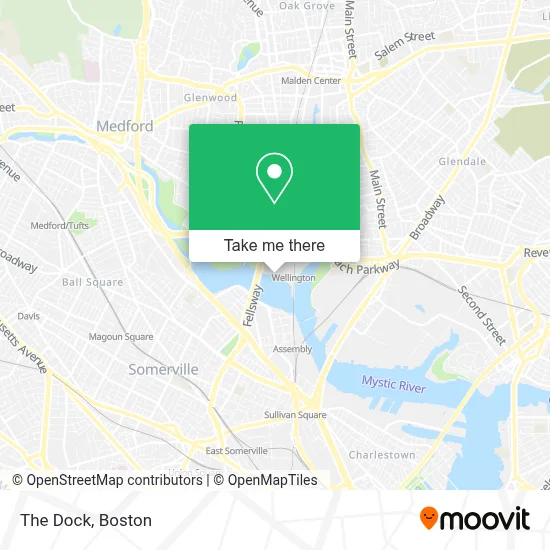
See The Dock, Medford, on the map
Public Transit to The Dock in Medford
Wondering how to get to The Dock in Medford? Moovit helps you find the best way to get to The Dock with step-by-step directions from the nearest public transit station.
Moovit provides free maps and live directions to help you navigate through your city. View schedules, routes, timetables, and find out how long does it take to get to The Dock in real time.
Looking for the nearest stop or station to The Dock? Check out this list of stops closest to your destination: Fellsway @ Middlesex Ave - Wellington Circle; Grand Union Blvd Opp Artisan Way; Grand Union Blvd @ Foley St; Mystic Ave @ Temple Rd; Gilman Square; Assembly; Corporation Way; Wellington.
Bus: 110, 85, 100, 108, 134, 90, ORANGE LINE SHUTTLE, ORANGE LINE SHUTTLE, 95.Subway: ORANGE LINE, GREEN LINE B, GREEN LINE C, GREEN LINE E.
Want to see if there’s another route that gets you there at an earlier time? Moovit helps you find alternative routes or times. Get directions from and directions to The Dock easily from the Moovit App or Website.
We make riding to The Dock easy, which is why over 1.7 million users, including users in Medford, trust Moovit as the best app for public transit. You don’t need to download an individual bus app or train app, Moovit is your all-in-one transit app that helps you find the best bus time or train time available.
For information on prices of subway and bus, costs and ride fares to The Dock, please check the Moovit app.
Use the app to navigate to popular places including to the airport, hospital, stadium, grocery store, mall, coffee shop, school, college, and university.
Location: Medford, Boston
- The Dock (Mystic River),
- AC Hotel by Marriott Boston North Medford,
- Skywalk to Wellington,
- AC Hotel Boston North,
- Fairfield Boston Medford (Medford Station Hotel),
- AC Marriott,
- Station Landing Parking Garage,
- Life Time Fitness,
- Revere Beach Parkway,
- Wellington Station,
- MBTA Wellington Station,
- Coach Carpet Cleaning,
- Hult International Business School,
- Longcross,
- COLD STONE CREAMERY,
- Done Right Carpet Cleaning,
- Stretchmed,
- Arborpoint & Station Landing ,
- Wellington Station Busway,
- Mystic Wellington
Places Near The Dock (Medford)
- House Of Blues, Boston,
- Boston Children's Hospital, Boston,
- Leader Bank Pavilion (Leader Bank Pavillion), Boston,
- Prudential Center, Boston,
- North End, Boston,
- Boston Common, Boston,
- Quincy Market, Boston,
- Faneuil Hall, Boston,
- Isabella Stewart Gardner Museum, Boston,
- Wang Theater, Boston,
- Mgm Music Hall, Boston,
- Wilbur Theatre, Boston,
- Cheers, Boston,
- Castle Island, Boston,
- Museum Of Science, Boston,
- Boston Medical Center, Boston,
- Seaport District, Boston,
- Boston Convention & Exhibition Center, Boston,
- Massachusetts General Hospital, Boston,
- Td Garden, Boston
How to get to popular places in Boston with public transit
Get around Medford by public transit!
Traveling around Medford has never been so easy. See step by step directions as you travel to any attraction, street or major public transit station. View bus and train schedules, arrival times, service alerts and detailed routes on a map, so you know exactly how to get to anywhere in Medford.
When traveling to any destination around Medford use Moovit's Live Directions with Get Off Notifications to know exactly where and how far to walk, how long to wait for your line, and how many stops are left. Moovit will alert you when it's time to get off — no need to constantly re-check whether yours is the next stop.
Wondering how to use public transit in Medford or how to pay for public transit in Medford? Moovit public transit app can help you navigate your way with public transit easily, and at minimum cost. It includes public transit fees, ticket prices, and costs. Looking for a map of Medford public transit lines? Moovit public transit app shows all public transit maps in Medford with all Bus, Train, Subway and Ferry routes and stops on an interactive map.
Boston has 4 transit type(s), including: Bus, Train, Subway and Ferry, operated by several transit agencies, including MBTA, Southeastern Regional Transit Authority, MetroWest Regional Transit Authority, Rhode Island Public Transit Authority, WRTA, Lowell Regional Transit Authority, Merrimack Valley Transit, Montachusett Regional Transit Authority, Cape Cod Regional Transit Authority, Brockton Area Transit Authority, Martha's Vineyard Transit Authority, the WAVE - Nantucket Regional Transit Authority, GATRA, Cape Ann Transportation Authority and Massport