How to get to The Dragonfly Path by bus?
Click on the bus route to see step by step directions with maps, line arrival times and updated time schedules.
From Registry Of Motor Vehicles (Rmv) Branch Office, Worcester
44 minFrom Clinton, Massachusetts, Clinton
95 minFrom St Vincent Hospital TH Medical, Worcester
37 minFrom Saint Vincent Hospital at Worcester Medical Center, Worcester
43 minFrom Palladium, Worcester
46 minFrom South High Community School, Worcester
82 min
Bus stop near The Dragonfly Path in Boston
- Marketplace Shrewsbury, 7 min walk,VIEW
Bus lines to The Dragonfly Path in Boston
- 15, Julio Drive Shrewsbury,VIEW
What are the closest stations to The Dragonfly Path?
The closest stations to The Dragonfly Path are:
- Marketplace Shrewsbury is 556 yards away, 7 min walk.
Which bus lines stop near The Dragonfly Path?
These bus lines stop near The Dragonfly Path: 15, 16.
What’s the nearest bus station to The Dragonfly Path in Boston?
The nearest bus station to The Dragonfly Path in Boston is Marketplace Shrewsbury. It’s a 7 min walk away.
What time is the first bus to The Dragonfly Path in Boston?
The 15 is the first bus that goes to The Dragonfly Path in Boston. It stops nearby at 5:33 AM.
What time is the last bus to The Dragonfly Path in Boston?
The 15 is the last bus that goes to The Dragonfly Path in Boston. It stops nearby at 9:06 PM.
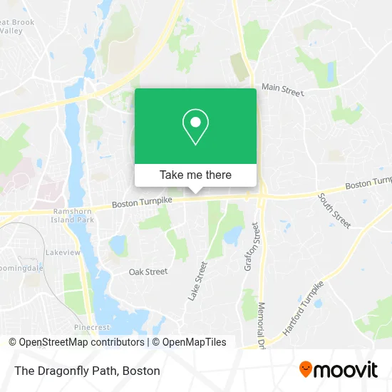
See The Dragonfly Path, Boston, on the map
Public Transit to The Dragonfly Path in Boston
Wondering how to get to The Dragonfly Path in Boston? Moovit helps you find the best way to get to The Dragonfly Path with step-by-step directions from the nearest public transit station.
Moovit provides free maps and live directions to help you navigate through your city. View schedules, routes, timetables, and find out how long does it take to get to The Dragonfly Path in real time.
Looking for the nearest stop or station to The Dragonfly Path? Check out this list of stops closest to your destination: Marketplace Shrewsbury.
Bus: 15, 16.
Want to see if there’s another route that gets you there at an earlier time? Moovit helps you find alternative routes or times. Get directions from and directions to The Dragonfly Path easily from the Moovit App or Website.
We make riding to The Dragonfly Path easy, which is why over 1.7 million users, including users in Boston, trust Moovit as the best app for public transit. You don’t need to download an individual bus app or train app, Moovit is your all-in-one transit app that helps you find the best bus time or train time available.
For information on prices of bus and train, costs and ride fares to The Dragonfly Path, please check the Moovit app.
Use the app to navigate to popular places including to the airport, hospital, stadium, grocery store, mall, coffee shop, school, college, and university.
The Dragonfly Path Address: 415 Boston Tpke street in Boston
- East Coast Pest Control,
- Collaborate Solutions,
- Central Communications Systems, Inc.,
- My Bodysage,
- Endlessflix Technology,
- Floor & Decor,
- Eml Express,
- Fast Computers,
- Saint Marys Assyrian Orthodox Church,
- Atlantic Cinematics,
- Law Offices of James W Cawley,
- Pmi Worcester,
- 175 Crescent St,
- All American Flag Company,
- Modern Manual Therapy of Shrewsbury,
- Framingham Assembly #47, Iorg,
- Pepperoni Express House of Pizza,
- Coldwell Banker Realty,
- Montessori Elementary School,
- Landry Mechanical
Places Near The Dragonfly Path (Boston)
- Prudential Center, Boston,
- Cheers, Boston,
- Boston Convention & Exhibition Center, Boston,
- Td Garden, Boston,
- Castle Island, Boston,
- Wang Theater, Boston,
- Boston Children's Hospital, Boston,
- Leader Bank Pavilion (Leader Bank Pavillion), Boston,
- Massachusetts General Hospital, Boston,
- Boston Medical Center, Boston,
- Seaport District, Boston,
- Faneuil Hall, Boston,
- House Of Blues, Boston,
- Museum Of Science, Boston,
- Quincy Market, Boston,
- Boston Common, Boston,
- Wilbur Theatre, Boston,
- Mgm Music Hall, Boston,
- Isabella Stewart Gardner Museum, Boston,
- North End, Boston
How to get to popular places in Boston with public transit
Get around Boston by public transit!
Traveling around Boston has never been so easy. See step by step directions as you travel to any attraction, street or major public transit station. View bus and train schedules, arrival times, service alerts and detailed routes on a map, so you know exactly how to get to anywhere in Boston.
When traveling to any destination around Boston use Moovit's Live Directions with Get Off Notifications to know exactly where and how far to walk, how long to wait for your line, and how many stops are left. Moovit will alert you when it's time to get off — no need to constantly re-check whether yours is the next stop.
Wondering how to use public transit in Boston or how to pay for public transit in Boston? Moovit public transit app can help you navigate your way with public transit easily, and at minimum cost. It includes public transit fees, ticket prices, and costs. Looking for a map of Boston public transit lines? Moovit public transit app shows all public transit maps in Boston with all Bus, Train, Subway and Ferry routes and stops on an interactive map.
Boston has 4 transit type(s), including: Bus, Train, Subway and Ferry, operated by several transit agencies, including MBTA, Southeastern Regional Transit Authority, MetroWest Regional Transit Authority, Rhode Island Public Transit Authority, WRTA, Lowell Regional Transit Authority, Merrimack Valley Transit, Montachusett Regional Transit Authority, Cape Cod Regional Transit Authority, Brockton Area Transit Authority, Martha's Vineyard Transit Authority, the WAVE - Nantucket Regional Transit Authority, GATRA, Cape Ann Transportation Authority and Massport